Israeli forces reportedly set up temporary checkpoint in al-Ajrafa, Quneitra; single-source report
What happened
A Telegram channel tied to the Syrian news outlet Syria Now, listed in the data as @AJSyriaNow, reported on 18 October 2026 that Israeli forces had set up a temporary checkpoint in al-Ajrafa village, central Quneitra countryside, and were searching passersby. The Arabic post does not state the number of personnel or how long the checkpoint would remain. It also reported that a six-vehicle Israeli force advanced into Razaniyah farm in southern Quneitra. No detentions, injuries or damage are mentioned, and the dataset lists no other outlet carrying the report.
Context and assessment
Quneitra is one of the most sensitive districts in southern Syria. It lies along the ceasefire line established after the 1973 war and the 1974 disengagement agreement, and Israel has held positions on the Syrian side of the Golan since 1967. After the fall of the Assad government in December 2024, Israeli forces reportedly expanded their presence in the buffer area, a development that has drawn repeated international concern. The related events in this cluster suggest a pattern of ground activity across the governorate and into neighboring Daraa. On 17 October, images showed earth berms on the Hadar-Tarnanga road. The next morning, a temporary checkpoint was reported on the Abidin-Jamla road in western Daraa, and a separate incursion into Jubata al-Khashab reportedly ended with two young men abducted and released the following day. Earlier on 17 October, drone reconnaissance was reported over Daraa countryside without any strike. The same day, an armed group called Saraya Nuza Kabail announced its formation in Quneitra, opposed to Israel. Taken together, these reports may indicate a shift toward static control points, route screening and population checks, though the single-source nature of most items limits how firmly that pattern can be stated.
Sources and confidence
All information in this event comes from one Telegram channel, @AJSyriaNow, which the data attributes to a Syria Now correspondent. No second channel, news agency or official statement in the dataset corroborates the checkpoint or the Razaniyah movement, and the source count is one. The confidence score of 7.6 reflects a specific, credible-looking report from a known regional outlet, tempered by the absence of independent confirmation and the lack of imagery. Confidence would rise with corroboration from a second independent outlet, geolocated photos or video of the checkpoint, or statements from residents or UNDOF. It would fall if the post were retracted or if imagery placed the checkpoint elsewhere.
Location
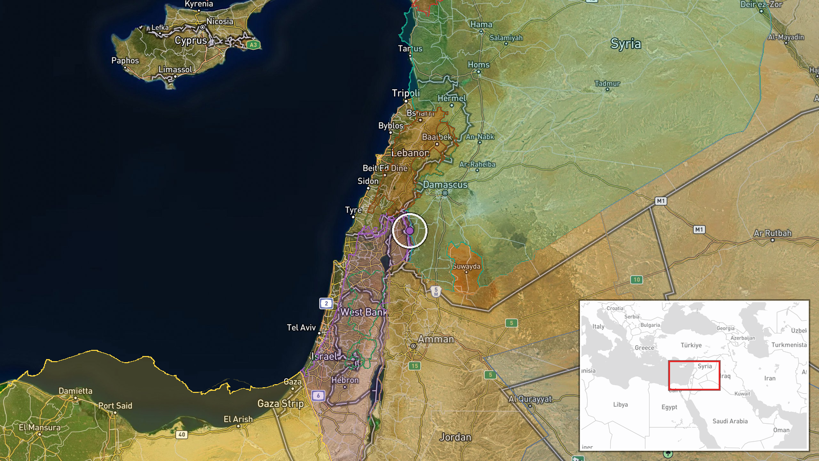
The point is set at settlement precision to al-Ajrafa village, with high location confidence, based on the place name given in the post. The coordinates, roughly 33.134 N and 35.878 E, place the village in the central countryside of Quneitra Governorate, within the agricultural zone east of the Golan ceasefire line. The Razaniyah farm in southern Quneitra has no separate coordinates in the record and is not mapped independently. Nearby features are largely open farmland and the volcanic uplands of the Golan, with the Mount Hermon range visible to the west on clear days.
Related events nearby
- Saraya Nuza Kabail, an armed group in southern Syria opposed to Israel, announced its formation under commande2026-10-17 19:40 UTC · Statement · Quneitra Governorate, Southern Syria
- Israeli forces abducted two young men during an incursion into Jubata al-Khashab, Quneitra countryside, and re2026-10-18 06:05 UTC · Security · Jubata al-Khashab, Quneitra Governorate, Syria
- Images show earth berms built by Israeli occupation forces on the Hadar-Tarnanga road in Quneitra countryside,2026-10-17 16:35 UTC · Deployment · Hadar - Tarnanga road, Quneitra Governorate, Syria
- Israeli forces set up a temporary checkpoint using three military vehicles on the Abidin-Jamla road in western2026-10-18 05:44 UTC · Security · Abidin-Jamla road, western Daraa countryside, Syri
- Intensive Israeli reconnaissance drone flights reported over Daraa countryside, southern Syria. No strike repo2026-10-17 15:37 UTC · Deployment · Daraa countryside, Daraa Governorate, Syria
▶ View this event on the live map

Intel Mapper aggregates open-source reports from monitored Telegram and X channels, geolocates them, cross-checks duplicates across sources and assigns a confidence score. Entries are updated as new confirmations arrive. Read how we verify events.