Israeli forces reportedly set up a temporary checkpoint on the Abidin-Jamla road in western Daraa
What happened
A post on the Telegram channel @AJSyriaNow, citing local sources, reports that Israeli forces set up a temporary checkpoint using three military vehicles on the Abidin-Jamla road in the western countryside of Daraa Governorate, southern Syria. The report was published on 18 October 2026 at 05:44 UTC. The original Arabic wording refers to the force as Israeli occupation forces and places the checkpoint on the road linking Abidin and Jamla. The post does not state how long the checkpoint remained in place, how many personnel were present, whether any people or vehicles were stopped or detained, or whether any incident followed. No other outlet in the dataset carries the report, so the details rest on one channel's account of local observation.
Context and assessment
Western Daraa and the adjacent Quneitra area lie close to the 1974 disengagement line on the Golan Heights, a zone that has been relatively quiet for decades under the 1974 arrangement. Since the fall of the former Syrian government in late 2024, Israeli forces have expanded their presence beyond the buffer zone, and reports of patrols, checkpoints and observation flights in the south have continued. The related events in this dataset fit that pattern. On 17 October, Israeli reconnaissance aircraft were reported over Nawa, and intensive drone flights were reported over the Daraa countryside without a strike. The same day, a ground patrol was reported advancing into farms west of Sidon al-Golan, and a temporary checkpoint was reported in al-Ajraf village in Quneitra. A new armed group opposed to Israel also announced its formation in Quneitra. Taken together, these reports suggest a sustained effort to monitor and control rural roads in the area. A small checkpoint on a rural link road may be intended to screen movement, observe the surrounding area or signal presence, but the single-source nature of the report means its scale and purpose cannot be established from the data alone.
Sources and confidence
The report comes from one Telegram channel, @AJSyriaNow, and no second outlet in the dataset covers the checkpoint. The confidence score of 7.6 reflects a credible source type and a specific, verifiable location, but it is held below the level of multi-source confirmation because no independent observation, photograph or official statement is attached. Confidence would rise if local media, a monitoring organization or residents corroborated the checkpoint, or if imagery showed vehicles at the stated road. It would fall if later reporting failed to find the checkpoint or if the claim changed in substance, such as the number of vehicles.
Location
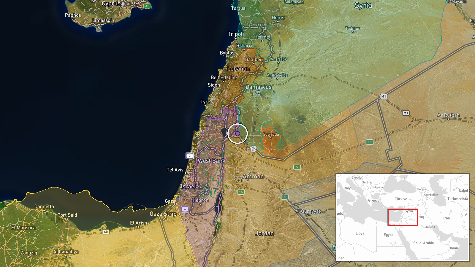
The location is coded at settlement precision, with high location confidence, placing the event on the Abidin-Jamla road at approximately 32.784 N, 35.871 E. This is a road-level point tied to the named settlements rather than an exact checkpoint position. The area is rural farmland and villages in western Daraa, close to the Golan Heights and the former disengagement zone. Jamla is a small town in the region, and the road is a local link between agricultural communities. The terrain is largely open and flat to gently rolling, which gives long sight lines along local roads.
Related events nearby
- Israeli reconnaissance aircraft reported flying over the city of Nawa in western Daraa countryside.2026-10-17 10:56 UTC · Combat Aircraft · Nawa, Daraa Governorate, Syria
- Intensive Israeli reconnaissance drone flights reported over Daraa countryside, southern Syria. No strike repo2026-10-17 15:37 UTC · Deployment · Daraa countryside, Daraa Governorate, Syria
- Saraya Nuza Kabail, an armed group in southern Syria opposed to Israel, announced its formation under commande2026-10-17 19:40 UTC · Statement · Quneitra Governorate, Southern Syria
- Israeli occupation force patrol advanced into Razzaniyeh and Abu Mudhara farms west of Sidon al-Golan in south2026-10-17 10:20 UTC · Security · Razzaniyeh Farm, South Quneitra, Syria
- Israeli occupation forces set up a temporary checkpoint in al-Ajraf village, Quneitra countryside, per local s2026-10-17 07:56 UTC · Security · Al-Ajraf, Quneitra Countryside, Syria
▶ View this event on the live map

Intel Mapper aggregates open-source reports from monitored Telegram and X channels, geolocates them, cross-checks duplicates across sources and assigns a confidence score. Entries are updated as new confirmations arrive. Read how we verify events.