Reported Israeli reconnaissance drone flights over Daraa countryside, southern Syria, no strike reported
What happened
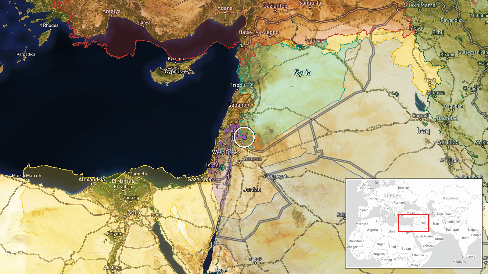
Syria Now correspondent, as relayed through a Telegram channel (@AJSyriaNow), reported intensive flights by Israeli reconnaissance drones over the Daraa countryside in southern Syria on 17 October 2026, at approximately 15:37 UTC. The original Arabic post describes the activity as 'intensive' flights of Israeli reconnaissance aircraft in the skies of Daraa's rural area, and does not specify altitude, number of aircraft, or duration. The report mentions no strike, impact, or casualties. The event is recorded as a deployment rather than an attack, reflecting the surveillance nature of the activity described. Coordinates are approximate and reflect the governorate's countryside rather than a specific settlement.
Context and assessment
Daraa and neighboring Quneitra sit along the Syrian side of the Golan frontier, an area where Israeli military activity has been recurrent since late 2024, when Israeli forces moved into the UN-monitored buffer zone and nearby positions. The related reports from the same day fit a broader pattern in the southwest. Earlier on 17 October, a reconnaissance aircraft was reportedly seen over Nawa in western Daraa countryside, and Israeli occupation forces were reported advancing into Razzaniyeh and Abu Mudhara farms west of Sidon al-Golan in southern Quneitra. A checkpoint in al-Ajraf village and a reported Israeli siege of the al-Mantara dam, where the reservoir is said to have reached dead level, were reported on the same and previous day. Taken together, the reports suggest sustained ground and aerial surveillance across a wide stretch of the Syrian southwest. Surveillance flights of this kind are typically used to monitor movement, track forces, and maintain situational awareness, and they can precede or accompany ground operations. The reports alone do not establish intent, and the sequence should be read as indicative rather than conclusive.
Sources and confidence
The report comes from one Telegram channel, @AJSyriaNow, which relayed a post attributed to a Syria Now correspondent. No second independent outlet has confirmed the drone flights in the available data, so the single-source status is the main limit on the score. The confidence score of 7.6 reflects a named correspondent attribution and a specific time, offset by the absence of corroboration and the general nature of the observation. Confidence would rise with independent observation from local residents, imagery, or wire-service confirmation, or with a second channel reporting matching flights. It would fall if subsequent reporting cannot verify the activity or if the attribution to Israeli aircraft is challenged.
Location
The location is recorded at the governorate level as the Daraa countryside, so the coordinates are approximate and do not identify a particular village or facility. The geo precision is listed as region and location confidence as low. Daraa Governorate lies in southern Syria, bordering Jordan to the south and the Golan Heights and Quneitra to the west and north. The surrounding terrain is largely flat to rolling agricultural land, with the Yarmouk basin and the Jordanian frontier to the south of the governorate.
Related events nearby
- Israeli reconnaissance aircraft reported flying over the city of Nawa in western Daraa countryside.2026-10-17 10:56 UTC · Combat Aircraft · Nawa, Daraa Governorate, Syria
- Israeli occupation force patrol advanced into Razzaniyeh and Abu Mudhara farms west of Sidon al-Golan in south2026-10-17 10:20 UTC · Security · Razzaniyeh Farm, South Quneitra, Syria
- Israeli occupation forces set up a temporary checkpoint in al-Ajraf village, Quneitra countryside, per local s2026-10-17 07:56 UTC · Security · Al-Ajraf, Quneitra Countryside, Syria
- Sweida governor urges dialogue with the Syrian government to halt bloodshed, guarantee rights, and address gri2026-10-17 11:16 UTC · Statement · As-Suwayda, Suwayda Governorate, Syria
- Images show earth berms built by Israeli occupation forces on the Hadar-Tarnanga road in Quneitra countryside,2026-10-17 16:35 UTC · Deployment · Hadar - Tarnanga road, Quneitra Governorate, Syria
▶ View this event on the live map

Intel Mapper aggregates open-source reports from monitored Telegram and X channels, geolocates them, cross-checks duplicates across sources and assigns a confidence score. Entries are updated as new confirmations arrive. Read how we verify events.