Israeli forces reportedly bulldoze land and uproot trees in Quneitra and Daraa countryside
What happened
A Telegram channel, @AJSyriaNow, reported that Israeli forces carried out incursions in the countryside of Quneitra and Daraa governorates in southern Syria since Saturday, 17 October 2026, including bulldozing land and uprooting trees. The Arabic-language post was framed as a roundup of the most prominent Israeli movements in the two areas and linked to a longer article for further reading. The report does not name a precise village, give a number of troops or vehicles, or mention casualties or clashes. The event is recorded at regional level for Quneitra countryside, and the timestamp reflects the posting time in UTC on 18 October 2026. Because the wording is a general summary, individual actions are not separately verified here.
Context and assessment
Quneitra and Daraa sit in southern Syria near the Golan Heights, an area where the 1974 disengagement arrangements long governed military deployments. Israeli forces have maintained a presence in and beyond the buffer zone, and this reporting suggests activity may have broadened beyond routine patrols. Land clearing and earth berms are the kind of works that often accompany fortified positions, observation posts or route control, though the data does not establish their purpose. The related reports fit a wider pattern: a temporary checkpoint on the Abidin-Jamla road in western Daraa, a checkpoint in al-Ajrafa where passersby were searched, earth berms on the Hadar-Tarnanga road, and the abduction and later release of two young men in Jubata al-Khashab. Separately, an armed group opposed to Israel, Saraya Nuza Kabail, announced its formation in Quneitra on 17 October. Taken together, these items may indicate efforts to secure access routes and monitor local movement, possibly in response to local armed opposition. Most of these indicators rest on single-channel reporting, so the operational reading remains tentative.
Sources and confidence
The item comes from one channel, Telegram account @AJSyriaNow, and no other outlet in the dataset has independently reported it. Several related events also draw on single reports, so the wider pattern gains weight only if they are later corroborated. The confidence score of 7.6 reflects a channel with a consistent local focus, offset by a single source, general summary wording without specifics, and no imagery or named locations beyond a region. Confidence would rise with geolocated photos or video of the bulldozing, named villages, or confirmation from local councils or independent observers. It would fall if later posts contradict the account or imagery shows the activity was older or unrelated.
Location
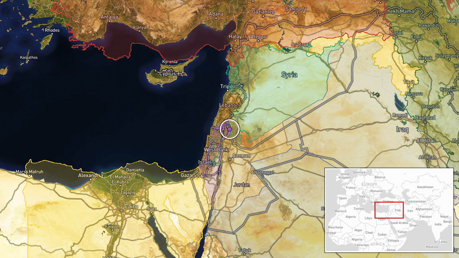
Coordinates are approximate and placed at the center of the Quneitra countryside rather than a specific settlement, because the source names only a governorate-level area. The location is recorded as region precision with low confidence. The point lies in southern Syria near the Golan Heights, in a mix of agricultural land, small villages and open ground. Daraa lies to the south, so the reported activity likely spans a broad area rather than a single site.
Related events nearby
- Saraya Nuza Kabail, an armed group in southern Syria opposed to Israel, announced its formation under commande2026-10-17 19:40 UTC · Statement · Quneitra Governorate, Southern Syria
- Israeli forces set up a temporary checkpoint in al-Ajrafa village, central Quneitra countryside, and are searc2026-10-18 12:36 UTC · Security · Al-Ajrafa, Quneitra Governorate, Syria
- Israeli forces abducted two young men during an incursion into Jubata al-Khashab, Quneitra countryside, and re2026-10-18 06:05 UTC · Security · Jubata al-Khashab, Quneitra Governorate, Syria
- Images show earth berms built by Israeli occupation forces on the Hadar-Tarnanga road in Quneitra countryside,2026-10-17 16:35 UTC · Deployment · Hadar - Tarnanga road, Quneitra Governorate, Syria
- Israeli forces set up a temporary checkpoint using three military vehicles on the Abidin-Jamla road in western2026-10-18 05:44 UTC · Security · Abidin-Jamla road, western Daraa countryside, Syri
▶ View this event on the live map

Intel Mapper aggregates open-source reports from monitored Telegram and X channels, geolocates them, cross-checks duplicates across sources and assigns a confidence score. Entries are updated as new confirmations arrive. Read how we verify events.