Reported Israeli overflights and ground incursions continue in southern Syria's Quneitra area
What happened
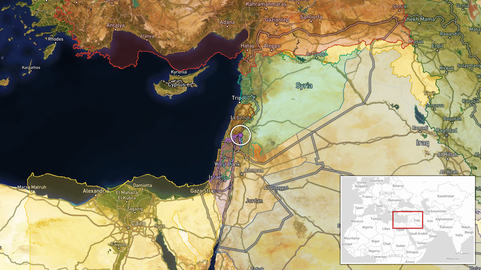
A single Telegram channel, @AJSyriaNow, reported on 18 October 2026 at 18:55 UTC that Israeli overflights had become intense and that Israeli ground incursions were continuing in southern Syria. The Arabic post did not name a village. It said further details would come from its correspondent and linked to a longer report. The wording describes an ongoing pattern rather than a single discrete strike or clash, and it reports no casualties, damage, or exchanges of fire. The Intel Mapper dataset classes the event as combat, but the source itself does not use that term. The location was assigned to a front-line area near Majdal Shams in Quneitra, based on the regional description rather than a named locality.
Context and assessment
The post fits a dense cluster of Israeli activity in Quneitra recorded on the same day. Earlier, Israeli forces reportedly abducted two young men during an incursion into Jubata al-Khashab and released them the following day. Later, two tanks advanced to the outskirts of al-Hurriya, where a temporary checkpoint was set up and passersby were searched. A checkpoint in al-Ajrafa, in central Quneitra countryside, also involved searches of passersby, and a separate six-vehicle Israeli formation was noted. AJSyria separately asked about dozens of Syrians reportedly abducted in southern Syria, though no specifics were given. Reports of bulldozing and uprooting trees across Quneitra and Daraa countryside since 17 October point to ground works alongside the movements. Quneitra borders the Israeli-occupied Golan Heights, and Israel has extended its presence into the former buffer zone since the collapse of the Assad government in December 2024. Taken together, the overflights, checkpoints, searches and detentions suggest area control, population screening and surveillance more than sustained combat. These are inferences from reporting, not confirmed intent, and the pattern could change quickly.
Sources and confidence
The event rests on one channel, Telegram @AJSyriaNow, with no independent confirmation in the dataset. The confidence score of 7.6 reflects the channel's close coverage of the area, the linked longer report, and several related entries from the same day that describe similar activity. It is held down by single-source status, the absence of a named locality, and the lack of verifiable detail about the overflights. Confidence would rise with corroboration from local residents, wire agencies, geolocated video or imagery, or the linked report if it names places and times. It would fall if the linked material does not substantiate the claims or if Israeli or Syrian official statements contradict them.
Location
The location is approximate. The coordinates were derived from the general reference to Majdal Shams and the Quneitra front line, and the precision is recorded only at region level with low confidence. The area lies on the southern edge of the Golan Heights, a hilly plateau near the 1974 ceasefire line. Mount Hermon rises to the north, and the UN-monitored buffer zone runs through the region. The terrain is open and largely agricultural, with villages and farmland separated by ridges and roads.
Related events nearby
- Israeli forces abducted two young men during an incursion into Jubata al-Khashab, Quneitra countryside, and re2026-10-18 06:05 UTC · Security · Jubata al-Khashab, Quneitra Governorate, Syria
- Israeli forces advanced with two tanks on the outskirts of al-Hurriya village in Quneitra countryside, set up 2026-10-18 15:26 UTC · Tank · Al-Hurriya, Quneitra, Syria
- AJSyria asks about the circumstances of Israeli forces abducting dozens of Syrians in southern Syria; a link p2026-10-18 15:16 UTC · Security · Al-Hurriya, Quneitra Governorate, Syria
- Israeli forces set up a temporary checkpoint in al-Ajrafa village, central Quneitra countryside, and are searc2026-10-18 12:36 UTC · Security · Al-Ajrafa, Quneitra Governorate, Syria
- Israeli forces conducted incursions, bulldozing and uprooting trees across the Quneitra and Daraa countryside 2026-10-18 14:11 UTC · Security · Quneitra Countryside, Quneitra Governorate, Syria
▶ View this event on the live map

Intel Mapper aggregates open-source reports from monitored Telegram and X channels, geolocates them, cross-checks duplicates across sources and assigns a confidence score. Entries are updated as new confirmations arrive. Read how we verify events.