Pistol shooting on Damascus airport road draws criticism and calls for accountability
What happened
A Telegram channel tracked as @AJSyriaNow reported on 21 October 2026, at 16:54 UTC, a pistol shooting on the road to Damascus International Airport. The Arabic-language post says the shooting has sparked criticism and public demands for accountability, but it does not give casualty figures, the identity of the shooter, or a motive. A linked item was cited for further reading and could not be checked from the summary alone. The wording is headline-style, so the reaction is described more clearly than the incident itself. No armed group or actor is named, and the event is filed under a general security category. The report should therefore be read as a single-channel account of a firearms incident on a major access road, not as a confirmed attack.
Context and assessment
Damascus International Airport lies on the southeastern approach to the Syrian capital, and its access road carries heavy traffic linking the city to air travel and official movements. A shooting there draws attention beyond its local scale, which may explain the strong public reaction the report describes. The incident also sits within a cluster of security reporting from the same two days, although most of it lies in the south. On 20 October, Syrian civil society groups called nationwide protests for 23 October against Israeli military operations in southern Syria. On 21 October, Israeli forces reportedly shelled the area east of Tal Ahmar in Quneitra with two artillery shells. A single-source report also claims a Suwayda National Guard drone struck an Internal Security Forces point in western Suwayda, while armed outlaw groups blocked government employees at the Umm al-Zeitoun checkpoint. The data does not link the Damascus shooting to any of these events. Operationally, the pattern suggests a fragmented security environment in which checkpoints, internal security units and armed local groups are under strain. The Damascus incident may be an isolated criminal or individual act, or it may indicate weak control on a sensitive corridor, but the available record cannot tell these apart.
Sources and confidence
The event rests on one Telegram channel, @AJSyriaNow, which posted a short Arabic-language item with a link to a longer piece. No second outlet is recorded, so cross-confirmation is absent and the source count is one. The confidence score of 7.6 reflects a specific location and a clear date, but it is held down by the single source, the missing casualty and actor details, and the headline-style wording. Confidence would rise with a second independent outlet, an official statement from Syrian authorities, or verifiable imagery of the road. It would fall if the linked article contradicts the post or no further reporting appears.
Location
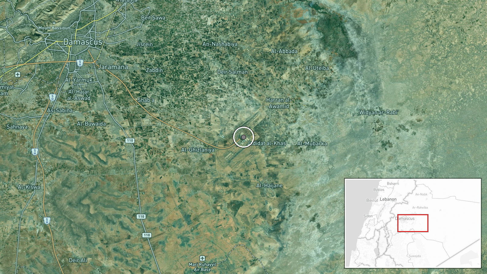
The location is a facility-level match to Damascus International Airport, with coordinates placed on the airport access road, and location confidence is recorded as high. The airport sits on the southeastern side of the Syrian capital, in a largely flat setting of suburbs, farmland and major highways. Its approach roads are the main land link between the city and the airfield, which makes the road a identifiable fixed point for mapping.
Related events nearby
- Syrian civil society groups call nationwide protests against Israeli military operations in southern Syria for2026-10-20 18:27 UTC · Statement · Damascus, Syria
- Israeli forces shelled the area east of Tal Ahmar in the southern Quneitra countryside with two artillery shel2026-10-21 05:28 UTC · Artillery · Tal Ahmar, Quneitra Governorate, Syria
- Suwayda National Guard reportedly struck an Internal Security Forces point in western Suwayda countryside with2026-10-20 21:30 UTC · UAS Strike · Western Suwayda countryside, Suwayda Governorate,
- Armed outlaw groups blocked Suwayda governorate employees from reaching their building in Al-Surra al-Soghra w2026-10-21 11:07 UTC · Security · Umm al-Zeitoun checkpoint, Al-Suwayda Governorate,
▶ View this event on the live map

Intel Mapper aggregates open-source reports from monitored Telegram and X channels, geolocates them, cross-checks duplicates across sources and assigns a confidence score. Entries are updated as new confirmations arrive. Read how we verify events.