Armed groups reportedly block Suwayda governorate staff at Umm al-Zeitoun checkpoint
What happened
Telegram channel @AJSyriaNow reports that armed groups, described in the quoted statement as outlaw groups, prevented employees of the Suwayda governorate from reaching their office building in the Al-Surra al-Soghra area of the northern Suwayda countryside. According to the report, the obstruction occurred while the staff were passing through the Umm al-Zeitoun checkpoint. The original Arabic text is attributed to the governorate's media directorate and describes an ongoing condition, saying the groups are blocking employees from accessing the building, rather than a single incident with a defined outcome. The report does not say how long the restriction lasted, whether anyone was detained or injured, or which group was responsible. The event is dated 21 October 2026, 11:07 UTC.
Context and assessment
Suwayda is a Druze-majority governorate in southern Syria, and its administration has been contested since the fall of the previous government in late 2024. Control of roads and checkpoints is therefore a central issue, and access to public buildings can serve as a practical signal of who holds local authority. The recent pattern in the data is one of overlapping actors. On 20 October, a report said Israeli forces airlifted weapons, equipment and possibly radar systems to a base on the Jabal al-Arab summit, while Druze authorities reportedly responded with their own position. The same day, the Suwayda National Guard reportedly struck an Internal Security Forces point in the western countryside with a munitions-laden drone, a single-source claim. Further east, in Quneitra, reports described Israeli artillery fire near Tal Ahmar, an occupation tank blocking a road in the governorate town, and a civilian detention during a patrol incursion. These events lie in different districts and are not confirmed to be connected. Taken together, they suggest a landscape of fragmented control, where public employees moving through checkpoints may become a point of pressure. Any operational reading should remain provisional until more reporting clarifies who controls the checkpoint and why access was restricted.
Sources and confidence
The event rests on a single Telegram channel, @AJSyriaNow, which is the only listed source, and the underlying statement is attributed to the governorate media directorate. No independent outlet, imagery, or second channel has been identified in the data. The confidence score of 7.6 reflects the specific location naming, the plausible attribution to an official governorate body, and the absence of any contradicting report, offset by the single-channel basis and the unidentified perpetrators. Confidence would rise with corroboration from another local outlet, a follow-up statement from Suwayda authorities, or video or photos of the checkpoint incident. It would fall if the directorate disputes the wording or if the post is traced to an older or reused statement.
Location
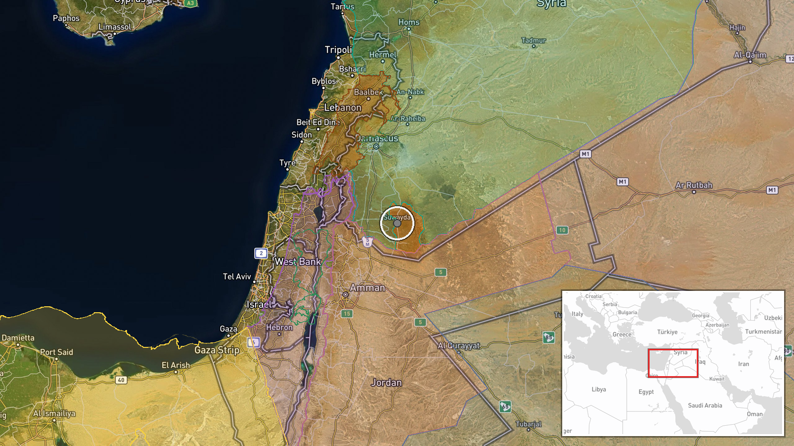
Location precision is settlement level. The coordinates correspond to the Umm al-Zeitoun checkpoint in Al-Suwayda Governorate, and the Arabic text names Al-Surra al-Soghra as the destination area in the northern countryside. The checkpoint's exact placement relative to that area is not specified. The setting is upland agricultural and semi-rural terrain on the southern Syrian plateau, with the Jabal al-Arab massif, the dominant mountain feature of the governorate, lying nearby to the west and northwest.
Related events nearby
- Israeli forces reportedly airlifted weapons, equipment and possibly radar systems by helicopter to Jabal al-Ar2026-10-20 12:43 UTC · Deployment · Jabal al-Arab summit, Sweida, Syria
- Suwayda National Guard reportedly struck an Internal Security Forces point in western Suwayda countryside with2026-10-20 21:30 UTC · UAS Strike · Western Suwayda countryside, Suwayda Governorate,
- Israeli forces shelled the area east of Tal Ahmar in the southern Quneitra countryside with two artillery shel2026-10-21 05:28 UTC · Artillery · Tal Ahmar, Quneitra Governorate, Syria
- Footage shows an Israeli occupation tank blocking the road in front of the old Quneitra Governorate building.2026-10-20 14:20 UTC · Tank · Quneitra, Quneitra Governorate, Syria
- Civilian recounts being detained by an Israeli occupation patrol during an incursion near a flower nursery in 2026-10-20 13:29 UTC · Security · Madinat al-Salam, Quneitra Countryside, Syria
▶ View this event on the live map

Intel Mapper aggregates open-source reports from monitored Telegram and X channels, geolocates them, cross-checks duplicates across sources and assigns a confidence score. Entries are updated as new confirmations arrive. Read how we verify events.