Israeli forces reportedly airlift equipment to Jabal al-Arab summit in Sweida to set up base
What happened
A single Telegram channel, @ClashReport, reported on 20 October 2026 that Israeli forces have begun moving military equipment to the Jabal al-Arab summit in Syria's Sweida province to establish a base, possibly including radar systems. The report, citing a local source relayed to Syria 360, says dozens of Israeli military helicopters have carried weapons, equipment and advanced devices to the area over the preceding 72 hours. The same account states that local Druze authorities have reportedly banned civilians from approaching or photographing the sites. The wording is hedged throughout: the radar element is described as possible, and the helicopter figures and photography ban are attributed to the source rather than independently observed.
Context and assessment
Jabal al-Arab, the highest massif in southern Syria, lies in Sweida Governorate, which is predominantly Druze and has been a focal point of sectarian tension since 2025. Its summit offers broad line-of-sight over the Hauran plain, the Daraa approaches and parts of the Damascus-Sweida road, which explains why elevated positions there carry strategic value for surveillance. The related events place this report within a wider pattern of activity in southern Syria. On 19 October, Daraa's governor-level official Laith al-Balous called Israeli violations against southern residents a red line. The same day, Israeli forces reportedly set up a temporary checkpoint at Al-Alam roundabout in the Quneitra countryside and detained a young man, and Israeli army flares were reported near the Jubata al-Khashab reserve. On 20 October, a farmer reported olive trees uprooted in Saida al-Hanut. Taken together, these reports suggest a sustained Israeli presence in the buffer zone and its approaches. If the Jabal al-Arab reports are accurate, a fixed installation there would indicate a longer-term posture, possibly intended for early warning or monitoring, rather than a short raid. Those inferences remain unconfirmed.
Sources and confidence
The report rests on one Telegram channel, @ClashReport, which relayed a local source's account through Syria 360. No second channel, wire service or imagery provider has corroborated the airlift, the radar claim or the photography ban in the data provided. The confidence score of 6.5 reflects a single-source report with a plausible geographic and strategic basis, a specific but unverified operational claim, and a source chain with one intermediary. Confidence would rise with independent corroboration, such as flight tracking of military helicopters over Sweida, commercial satellite imagery of the summit, statements from Druze or Syrian authorities, or Israeli official confirmation. It would fall if imagery showed no new construction or if the source's account proved inconsistent with local reporting.
Location
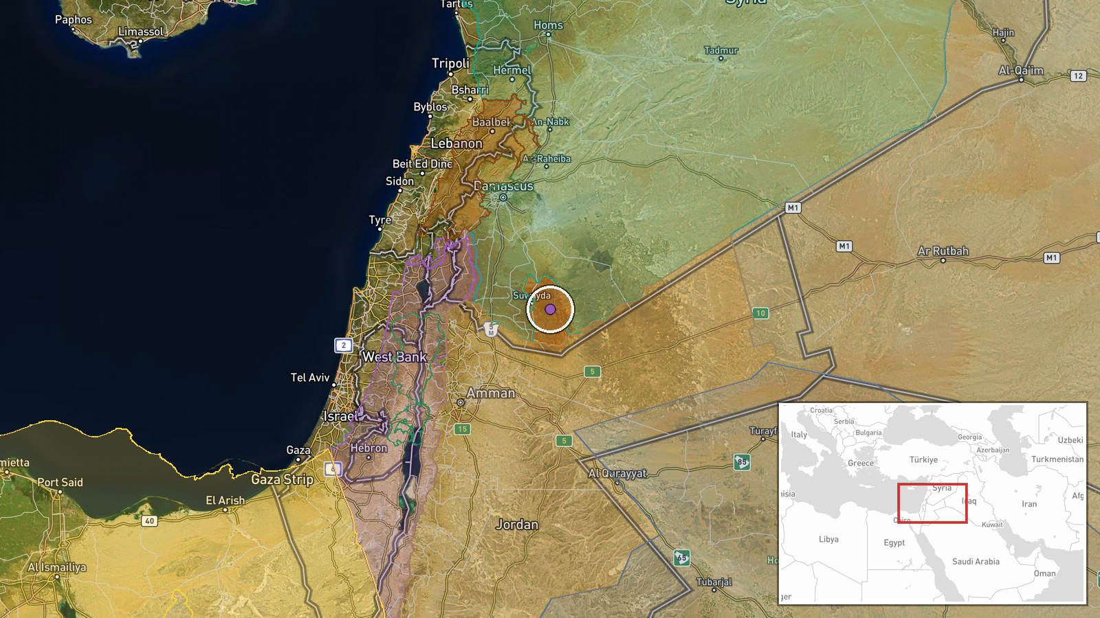
The location is given at settlement precision as the Jabal al-Arab summit in Sweida Province, with coordinates 32.667N, 36.733E, placing the point on the massif's high ground rather than a named facility. The summit is the highest point of the Jabal al-Arab range in southern Syria, a volcanic upland of basalt and limestone rising above the Hauran plain. Nearby features include the town of Sweida to the southeast and the Daraa plains to the southwest.
Related events nearby
- Laith al-Balous declares Israeli violations against southern Syrian residents a red line.2026-10-19 17:32 UTC · Statement · Daraa, Syria
- Per a farmer's account, Israeli occupation forces bulldozed and uprooted olive trees in his field in Saida al-2026-10-20 10:04 UTC · Report · Saida al-Hanut, Quneitra Governorate, Syria
- Israeli army fires illumination flares near Jubata al-Khashab reserve in northern Quneitra countryside, Syria.2026-10-19 20:48 UTC · Security · Jubata al-Khashab Nature Reserve, Quneitra Governo
- Civilian recounts being detained by an Israeli occupation patrol during an incursion near a flower nursery in 2026-10-20 13:29 UTC · Security · Madinat al-Salam, Quneitra Countryside, Syria
- Israeli forces set up a temporary checkpoint at Al-Alam roundabout in Quneitra countryside and detained a youn2026-10-19 18:59 UTC · Security · Al-Alam Roundabout, Quneitra Countryside, Syria
▶ View this event on the live map

Intel Mapper aggregates open-source reports from monitored Telegram and X channels, geolocates them, cross-checks duplicates across sources and assigns a confidence score. Entries are updated as new confirmations arrive. Read how we verify events.