Farmer says Israeli forces uprooted olive trees in Saida al-Hanut, Quneitra, before harvest
What happened
A report relayed by the Telegram channel @AJSyriaNow, citing a farmer's account, says Israeli occupation forces bulldozed and uprooted olive trees in his field in Saida al-Hanut village in the Quneitra countryside of southern Syria. The post was published on 20 October 2026 at 10:04 UTC, and it describes the clearing as happening before the farmer could harvest the crop. The original Arabic wording uses the phrase 'occupation forces' (قوات الاحتلال الإسرائيلي), a term Syrian outlets commonly use for Israeli troops operating in the Syrian Golan area. The account comes from the farmer as relayed in the channel post. The report does not give the size of the field, the number of trees affected, or the exact date of the clearing. No independent confirmation, imagery, or statement from the Israeli military was included in the material available at publication.
Context and assessment
Saida al-Hanut lies in the Quneitra countryside, the part of southern Syria that has been the focus of Israeli ground activity since the 1974 disengagement arrangement, and that activity expanded after the fall of the Assad government in December 2024, when Israeli forces moved into the UN buffer zone and surrounding areas. Agricultural land in this belt, including olive groves and orchards, is central to local livelihoods, so reports of damage to crops and trees carry weight beyond a single farm. The related events from the same 24-hour window point to a pattern of ground activity in the district. On 19 October, Israeli forces reportedly set up a temporary checkpoint at Al-Alam roundabout and detained a young man after he passed through it. That evening, Israeli army flares were fired near the Jubata al-Khashab nature reserve. On the morning of 20 October, two tanks reportedly advanced into Tal al-Hawa, west of Jubata al-Khashab. Taken together, these reports suggest a sustained presence in the area rather than a one-off incident. Clearing vegetation can, in principle, widen sightlines or open routes, but the report itself gives no stated purpose, and that interpretation remains unconfirmed. The Lebanon reports in the same window concern a separate front and are not evidence about Syria.
Sources and confidence
Only one source is listed: a single Telegram channel, @AJSyriaNow, relaying a farmer's account. No second outlet, video, photograph, or geolocated imagery was attached to the entry, and the entry has not been corrected. The confidence score of 7.8 reflects a specific location and a clear sourcing chain to a named channel, but it is held below the top of the scale because the core claim rests on one unverified first-person account. Confidence would rise with a second independent outlet, a named or visible farmer, photographs or video of the cleared field, or matching satellite imagery. It would fall if the farmer's account were disputed, if the field could not be located, or if the damage turned out to predate the period described.
Location
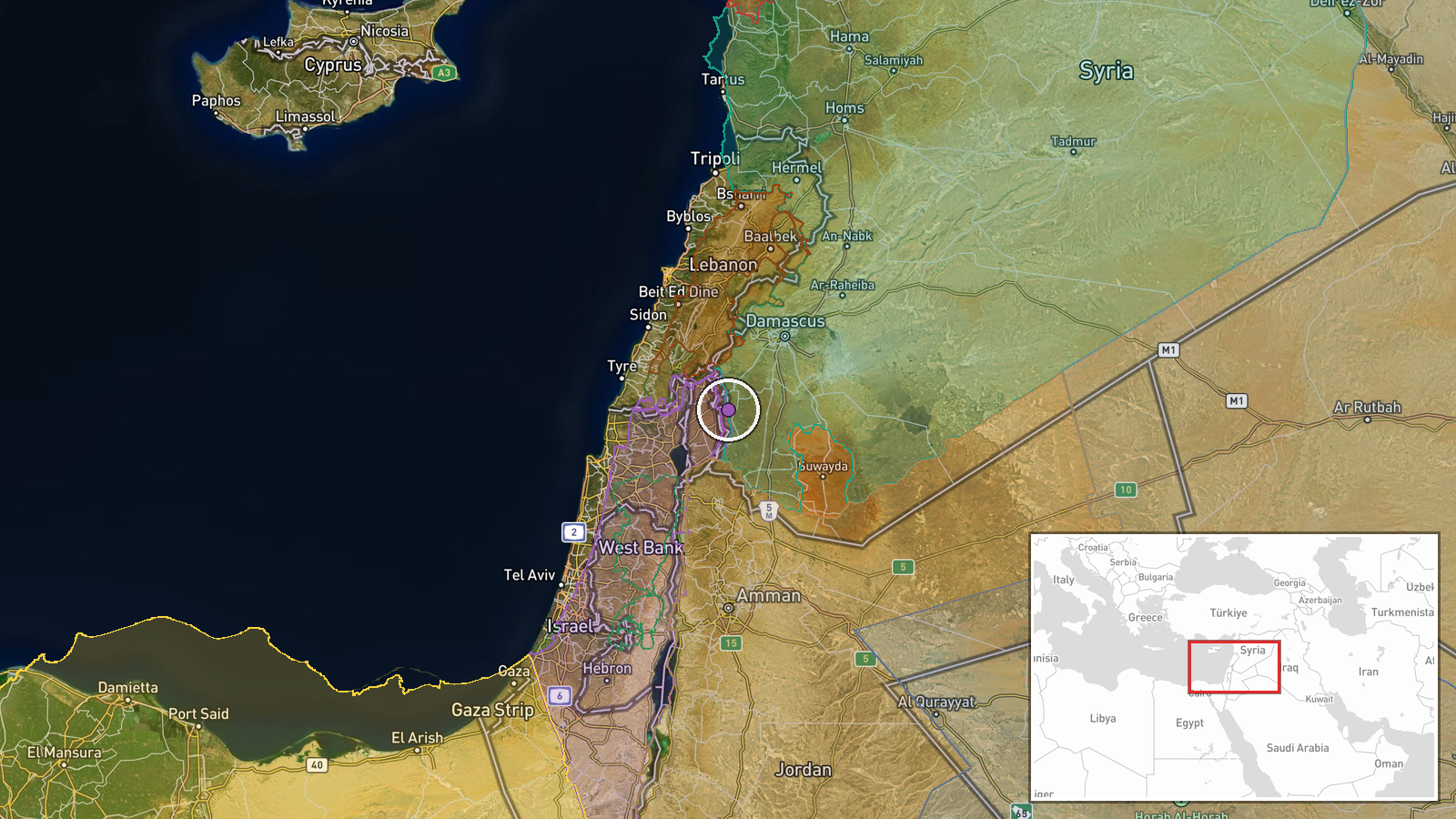
The location is recorded at settlement level, placing the point on the village of Saida al-Hanut in Quneitra Governorate, Syria, at approximately 33.09 N, 35.92 E. The location confidence is rated high because the report names the village directly, but the exact field is not identified. The village sits in the Quneitra countryside in hilly, largely agricultural terrain near the Golan ceasefire line. Jubata al-Khashab and Tal al-Hawa, which appear in related reports, are nearby reference points in the same district.
Related events nearby
- Israeli army fires illumination flares near Jubata al-Khashab reserve in northern Quneitra countryside, Syria.2026-10-19 20:48 UTC · Security · Jubata al-Khashab Nature Reserve, Quneitra Governo
- Israeli forces set up a temporary checkpoint at Al-Alam roundabout in Quneitra countryside and detained a youn2026-10-19 18:59 UTC · Security · Al-Alam Roundabout, Quneitra Countryside, Syria
- Israeli forces advanced with two tanks into Tal al-Hawa, west of Jubata al-Khashab in northern Quneitra countr2026-10-20 09:52 UTC · Tank · Tal al-Hawa, Jubata al-Khashab, Quneitra Governora
- Israeli military drone dropped bombs on a house in Lebanon; the munitions failed to detonate.2026-10-19 13:05 UTC · UAS Strike · Near Kfar Shouba, Nabatieh, Lebanon (front line, e
- IDF 91st Division says it has destroyed over 540 terror infrastructures in the security zone in southern Leban2026-10-20 09:24 UTC · Combat · Near Tebnine, Nabatieh, Lebanon (front line, estim
▶ View this event on the live map

Intel Mapper aggregates open-source reports from monitored Telegram and X channels, geolocates them, cross-checks duplicates across sources and assigns a confidence score. Entries are updated as new confirmations arrive. Read how we verify events.