Israeli army reportedly fires illumination flares near Jubata al-Khashab reserve, Quneitra, Syria
What happened
A single Telegram channel, @AJSyriaNow, reported on 19 October 2026 at about 20:48 UTC that the Israeli army fired illumination flares near the Jubata al-Khashab reserve in the northern countryside of Quneitra, southern Syria. The original Arabic post, credited to the channel's Syria correspondent, uses the phrase qanabil mudi'a, meaning illumination flares or light shells. It does not state whether anyone was harmed, whether the flares were fired from ground positions or aircraft, or why they were deployed. The report is brief and offers no imagery or secondary confirmation. Other reporting from the same afternoon describes Israeli movements across Quneitra and Rif Dimashq, but none of it explains the flares.
Context and assessment
Northern Quneitra lies on the Syrian side of the 1974 disengagement line, in an area Israel has occupied since 1967 and has further militarized since late 2024. The Jubata al-Khashab area sits near the southern edge of the Golan, so illumination flares there would plausibly be used to light terrain at night for observation or to track movement. The related events from 19 October show a day of multi-front activity. Israeli forces advanced into Burj al-Zaraa on the outskirts of Darbel in Mount Hermon at 07:54 UTC. A temporary checkpoint was set up at Al-Alam roundabout in the Quneitra countryside, where a young man was reportedly detained after passing through it. In Daraa, Laith al-Balous declared Israeli violations against southern residents a red line. Lebanese locations also saw drone-dropped munitions and airstrikes that day. Taken together, the flares fit a pattern of nighttime ground presence and population control rather than an isolated incident. Operationally, they may indicate night observation or the securing of positions, but a single unconfirmed report cannot establish intent, so this should be read as one data point in an active ground pattern.
Sources and confidence
Only one channel, Telegram @AJSyriaNow, appears in the data, with a source count of one and no cross-confirmation from another outlet, wire service, or local witness. The confidence score of 7.6 reflects a credible-sounding correspondent post about an event that is plausible given surrounding activity, but it is held down by single-source status and the absence of visual evidence or precise location detail. Confidence would rise if a second outlet, a local resident, or imagery showing flares over the reserve corroborated the report, or if the Israeli military commented. It would fall if the post were retracted or the flares were later attributed to another cause.
Location
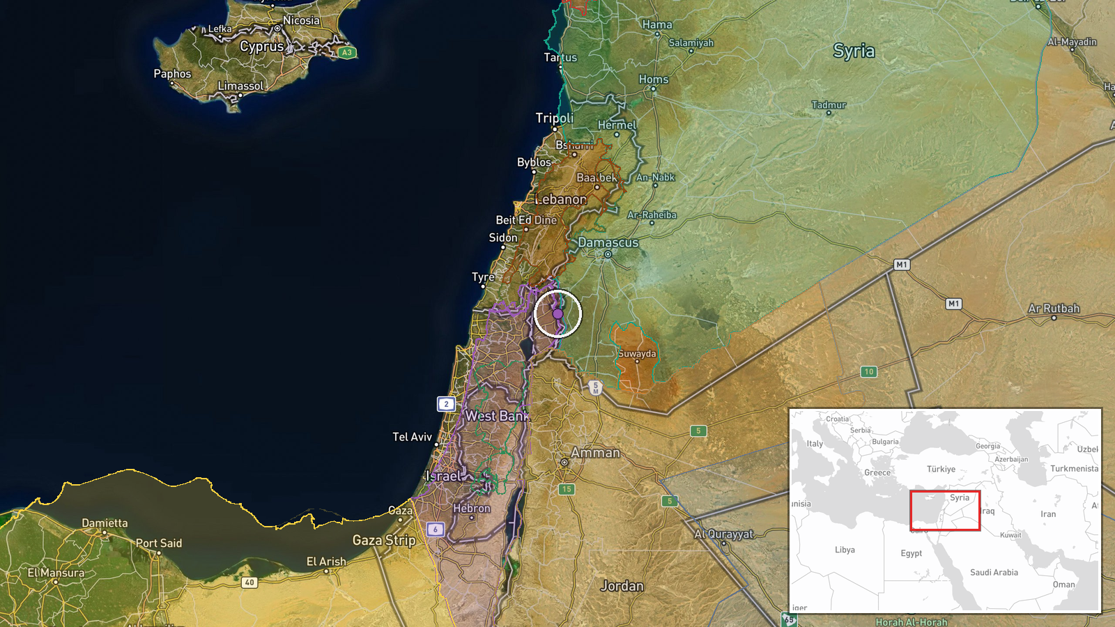
The location is recorded at settlement precision, so the coordinates (33.07 N, 35.86 E) mark the general Jubata al-Khashab reserve area rather than a point where flares were observed. The reserve lies in the northern Quneitra countryside of southwestern Syria, on the Golan plateau near the disengagement zone. Nearby features include Mount Hermon to the northwest and the open volcanic plateau of the Golan, terrain that offers wide sightlines and suits night observation and flare illumination.
Related events nearby
- Israeli forces set up a temporary checkpoint at Al-Alam roundabout in Quneitra countryside and detained a youn2026-10-19 18:59 UTC · Security · Al-Alam Roundabout, Quneitra Countryside, Syria
- Israeli forces advance into Burj al-Zaraa on the outskirts of Darbel in Mount Hermon, western Rif Dimashq.2026-10-19 07:54 UTC · Combat · Burj al-Zaraa, near Darbel, Rif Dimashq, Syria
- Israeli military drone dropped bombs on a house in Lebanon; the munitions failed to detonate.2026-10-19 13:05 UTC · UAS Strike · Near Kfar Shouba, Nabatieh, Lebanon (front line, e
- Explosions reported in Tebnine, southern Lebanon, following reports of Israeli Defense Forces (IDF) strikes. I2026-10-19 16:14 UTC · Airstrike · Tebnine, Lebanon
- Laith al-Balous declares Israeli violations against southern Syrian residents a red line.2026-10-19 17:32 UTC · Statement · Daraa, Syria
▶ View this event on the live map

Intel Mapper aggregates open-source reports from monitored Telegram and X channels, geolocates them, cross-checks duplicates across sources and assigns a confidence score. Entries are updated as new confirmations arrive. Read how we verify events.