Aerial footage reportedly shows SDF-built tunnels, trenches and berms around Ayn Issa, Raqqa
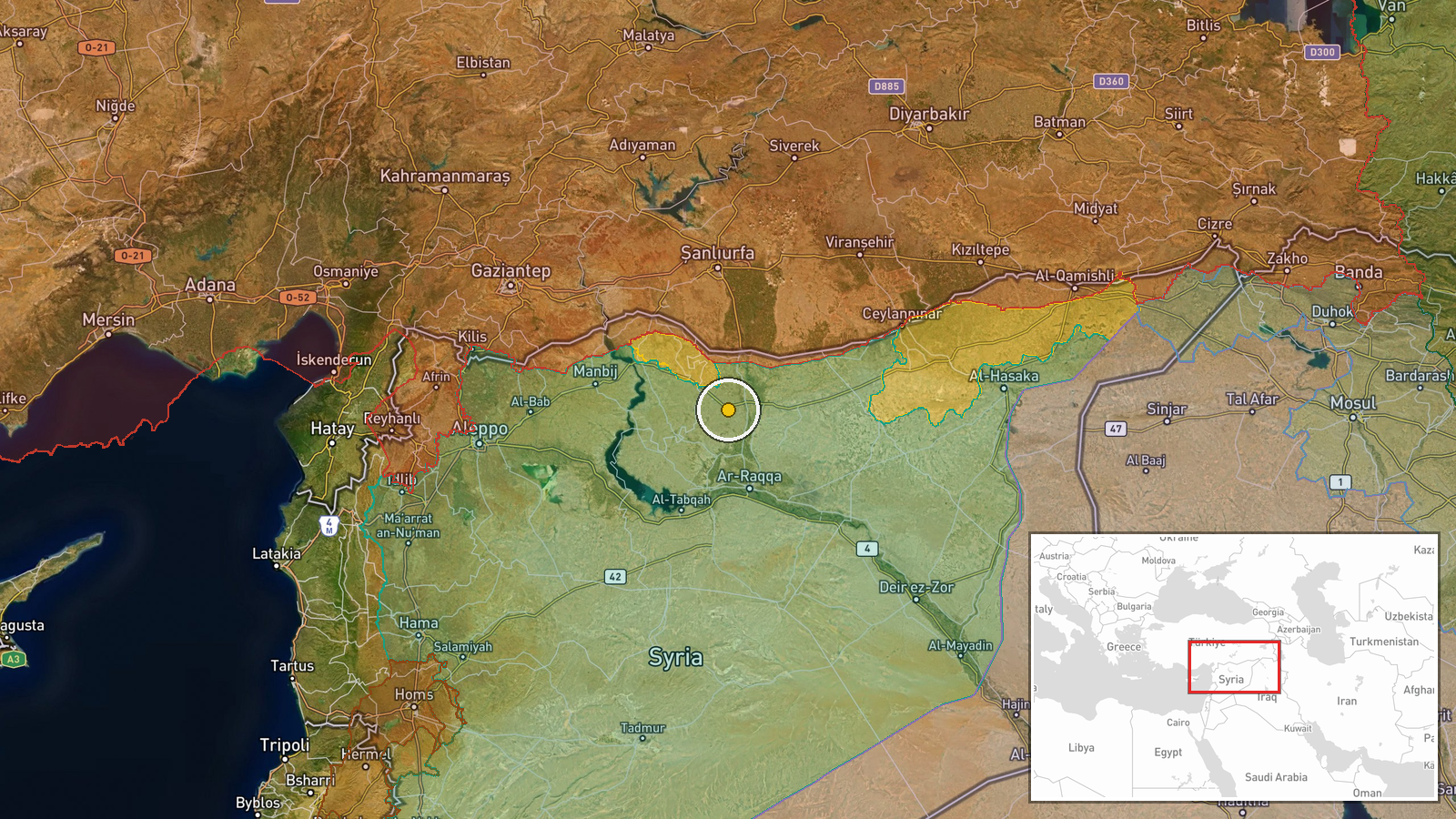
What happened
A report published on Telegram by the channel @AJSyriaNow, dated 22 October 2026 at about 06:08 UTC, describes aerial footage showing a network of tunnels, trenches and earthen berms in the countryside around the town of Ayn Issa in Raqqa Governorate, northern Syria. The Arabic-language original attributes the works to the Syrian Democratic Forces (SDF, known in the original as قسد), stating that they were left behind by the group. The summary characterizes the works as a fortification of the front line. The footage itself was not independently published in the report, and the post does not give a date for when the imagery was captured. No casualties, clashes or direct military action are mentioned in the report.
Context and assessment
Ayn Issa sits north of Raqqa city and has long been a contested point in northern Syria. Its position on routes linking Raqqa with the northern border area has made it a focus for the SDF, Turkish-backed armed factions, and, during the years of the ISIS insurgency, for the group itself. Earthen berms, trenches and tunnels are typical of static defensive positions meant to protect against vehicle movement and direct fire, and they usually signal that a front is expected to remain in place for some time rather than shift quickly. Two related events from the previous day point to a different local context. A Syrian military engineer team was reportedly hurt by a legacy regime-era landmine while clearing ordnance near Ain Issa, a reminder of the unexploded material that still litters former front lines. Separately, a family missing in Raqqa for nine years was reportedly identified through DNA analysis. Those reports do not confirm or contradict the fortification account, but they show that the area is being actively cleared and that its civilian and security situation is in transition. Operationally, the works may indicate that the actors involved are preparing for a prolonged standoff, though the footage alone cannot show who will hold the positions or why.
Sources and confidence
The report rests on a single Telegram channel, @AJSyriaNow, and no other outlet is recorded as having reported the imagery. The related events from 21 October come from different event types and do not corroborate the fortification claim. The confidence score of 7.8 reflects a specific location, an original Arabic-language text that names the place and actor, and a clear timestamp, offset by the lack of independent confirmation and the absence of verified footage. Confidence would rise if the imagery were geolocated and dated by other outlets or by local monitors, or if official statements from the SDF or Syrian authorities addressed the works. It would fall if the footage were shown to predate the current front or to have been recorded elsewhere.
Location
The location is recorded at settlement precision, with coordinates placed on the town of Ayn Issa rather than on the specific trench or tunnel site, which the report does not identify. Ayn Issa lies in the Raqqa countryside, in an open, largely agricultural landscape of the Euphrates basin, with the Balikh river valley and irrigated fields to the east and roads leading toward Raqqa city and the northern border region. The exact fortified sites are not known from the source.
Related events nearby
- Two Syrian military engineers were injured, one seriously, by a legacy regime-era landmine while clearing mine2026-10-21 10:13 UTC · Artillery · Ain Issa, Raqqa Governorate, Syria
- DNA analysis identified a family missing in Raqqa for nine years, reported as the first case of its kind in Sy2026-10-21 15:42 UTC · Report · Raqqa, Syria
▶ View this event on the live map

Intel Mapper aggregates open-source reports from monitored Telegram and X channels, geolocates them, cross-checks duplicates across sources and assigns a confidence score. Entries are updated as new confirmations arrive. Read how we verify events.