Israeli forces reportedly advance into western Zarzoura farm, Quneitra countryside, Syria
What happened
A report relayed by a Telegram channel, @AJSyriaNow, and attributed to the media office of Quneitra governorate, states that Israeli forces advanced into the western part of Zarzoura farm, which belongs to al-Rifeid town in the Quneitra countryside of southwestern Syria. The event is dated 23 October 2026 at 11:26 UTC. The original Arabic text is brief. It says Israeli occupation forces are advancing into the western side of the farm and gives no figures on troop numbers, vehicles, detentions, or casualties. The wording describes movement into the area rather than an armed clash, so the event is classified as a deployment. The report does not name a specific Israeli unit.
Context and assessment
Quneitra governorate sits along the 1974 disengagement line on the Golan Heights, and Israeli forces have operated in and beyond the UN-monitored buffer zone since late 2024, when the Assad government fell. Ground movements into villages and farmland in the province have been reported repeatedly since then. The related events in this data set fit that pattern. On 22 October, a patrol of six vehicles and 25 soldiers reportedly advanced into al-Hurriya village and conducted house-to-house searches. The Syrian Foreign Ministry separately condemned an Israeli incursion into Jamla in western Daraa, which it said killed a young man. On the same day, Israeli strikes in southern Lebanon were reported at Bani Hayyan and elsewhere along the border belt. Taken together, these reports suggest a sustained pattern of ground activity in the south of Syria at the same time as operations on the Lebanese front. A movement into a farm area may indicate reconnaissance, positioning, or searches of farmland and rural roads. Those are possibilities, not confirmed purposes, and a single short statement does not establish intent.
Sources and confidence
The event rests on one Telegram channel, @AJSyriaNow, which relays a statement attributed to the Quneitra media office. No second outlet, wire agency, or independent observer in the provided data reports this specific advance, so cross-confirmation is absent. The confidence score of 7.6 reflects a credible, attributed local source and a consistent regional pattern in the related events, but it is held below the high range because the claim is unverified and unaccompanied by detail. Confidence would rise with corroboration from local residents, Syrian government or UN observer statements, geolocated photos or video, or confirmation from a wire agency. It would fall if the Quneitra office corrected or withdrew the statement, or if local accounts denied any movement.
Location
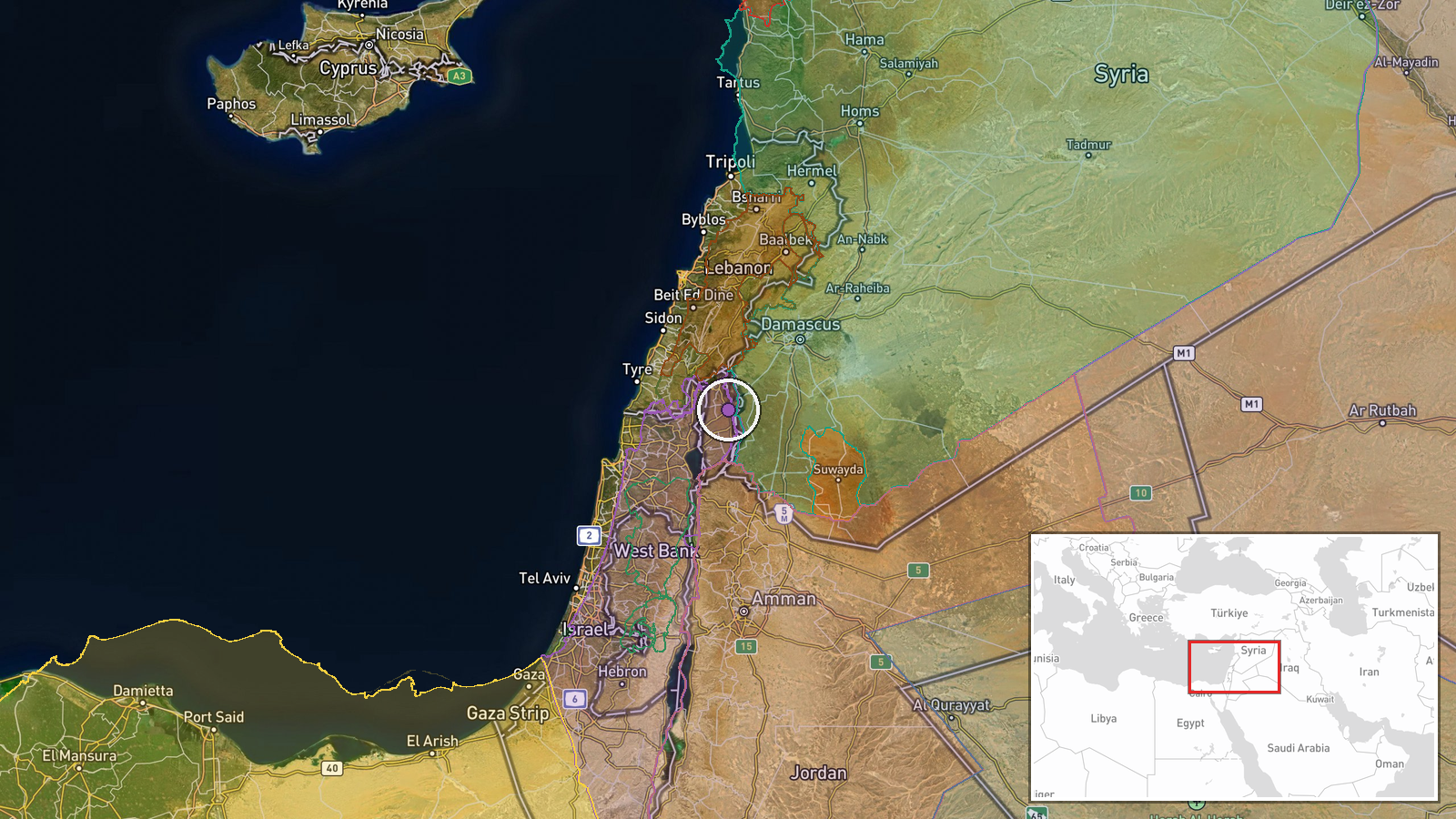
The coordinates, 33.113 N and 35.817 E, are set at settlement-level precision, which places the point at the farm associated with al-Rifeid rather than at a verified building or field boundary. The location confidence field is empty, so the exact footprint of the advance is unknown. The area lies in the Quneitra countryside, an agricultural landscape of farms, orchards, and open ground near the 1974 ceasefire line on the Golan Heights. It is close to the zone where Israeli and Syrian positions have been in contact since December 2024.
Related events nearby
- Israeli patrol of 6 vehicles and 25 soldiers advanced into al-Hurriya village in Quneitra countryside and cond2026-10-22 14:12 UTC · Security · Al-Hurriya village, Quneitra Governorate, Syria
- IDF struck alleged terror infrastructure in Bani Hayyan, southern Lebanon, per an X OSINT report. The weapon t2026-10-22 15:21 UTC · Airstrike · Bani Hayyan, South Lebanon, Lebanon
- Israel struck targets in south Lebanon; the report gives no location, casualty, or weapon details.2026-10-22 23:07 UTC · Airstrike · South Lebanon (border belt, representative point n
- Syrian FM al-Shaibani met King Abdullah II, conveying President al-Sharaa's greetings. Both sides pledged to a2026-10-22 12:34 UTC · Diplomacy · Damascus, Syria
- Syrian Foreign Ministry strongly condemns Israeli forces' incursion into Jamla, western Daraa, which killed a 2026-10-22 12:46 UTC · Statement · Damascus, Syria
▶ View this event on the live map

Intel Mapper aggregates open-source reports from monitored Telegram and X channels, geolocates them, cross-checks duplicates across sources and assigns a confidence score. Entries are updated as new confirmations arrive. Read how we verify events.