Israeli patrol reportedly searches homes in al-Hurriya village, Quneitra, Syria
What happened
A Telegram channel, @AJSyriaNow, reported on 22 October 2026 at 14:12 UTC that an Israeli patrol of six vehicles and 25 soldiers advanced into al-Hurriya village in the Quneitra countryside of southwestern Syria and carried out house-to-house searches. The original Arabic wording describes a patrol belonging to Israeli occupation forces that entered the village and conducted a campaign of home inspections. The report does not mention detentions, injuries or damage. Only this one channel has reported the incident so far, so the account has not yet been independently confirmed. The event is classed as a security incident with Israel listed as the actor.
Context and assessment
Quneitra and the adjacent Golan Heights lie within the area covered by the 1974 disengagement agreement, under which the United Nations Disengagement Observer Force, UNDOF, patrols a separation zone. Israel has held the Golan since 1967 and has expanded its military presence in the Syrian side of the zone since the collapse of the Assad government in December 2024. Several related reports from the same day point to sustained activity across the region. Earlier on 22 October, Israeli forces reportedly blocked a UNDOF patrol in Tarnaja, northern Quneitra, and advanced into Jamla in western Daraa, where a young man with disabilities was reportedly killed by gunfire. Low-altitude warplane flights were reported over Quneitra and western Rif Dimashq, though the operator and mission in the latter case remain unconfirmed. Operationally, house-to-house searches suggest a focus on checking the local population rather than simply holding ground, which may indicate security sweeps or intelligence gathering. The clustering of reports across several governorates could reflect a broader pattern of movement, but the individual reports rest on limited sourcing and should be read cautiously.
Sources and confidence
The event rests on a single channel, Telegram @AJSyriaNow, and no second outlet, official statement or imagery has been matched to it. The confidence score of 7.6 reflects the specificity of the report, including the stated unit size and village name, but single-channel sourcing keeps it below higher bands. Corroboration from other local outlets, UNDOF reporting, or geolocated video or satellite imagery would raise confidence. A denial, a failure to match the village name to the stated location, or a retraction would lower it.
Location
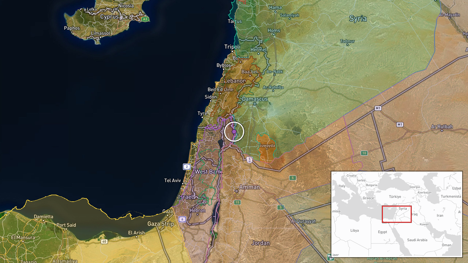
The point is placed at settlement precision using coordinates of 33.02 north and 35.87 east, which mark the village rather than a specific street or building. No separate location confidence value was recorded. Al-Hurriya lies in the Quneitra countryside of southwestern Syria, on the rolling terrain east of the Golan ceasefire line and within the zone monitored by UNDOF. Mount Hermon rises to the southwest of the governorate.
Related events nearby
- Israeli warplanes reported flying at low altitude over Quneitra Governorate skies, Syria, per X report.2026-10-22 08:02 UTC · Combat Aircraft · Quneitra, Syria
- Israeli occupation forces blocked a UNDOF patrol from crossing the road in Tarnaja village, northern Quneitra 2026-10-22 06:51 UTC · Security · Tarnaja, Quneitra, Syria
- Israeli occupation forces advanced into Jamla village in western Daraa countryside, killing a young man with d2026-10-22 05:15 UTC · Combat · Jamla, Daraa Governorate, Syria
- Israeli forces fired two artillery shells around Abdin village in western Daraa countryside.2026-10-21 18:09 UTC · Artillery · Abdin, Western Daraa countryside, Syria
- Circulating footage shows warplanes flying at low altitude over the western Rif Dimashq countryside; operator 2026-10-22 07:53 UTC · Combat Aircraft · Western Rif Dimashq countryside, Syria
▶ View this event on the live map

Intel Mapper aggregates open-source reports from monitored Telegram and X channels, geolocates them, cross-checks duplicates across sources and assigns a confidence score. Entries are updated as new confirmations arrive. Read how we verify events.