Israeli forces reportedly block UNDOF patrol on road in Tarnaja village, Quneitra
What happened
A Telegram channel, @AJSyriaNow, reported on 22 October 2026 at 06:51 UTC that Israeli occupation forces prevented a patrol from the United Nations Disengagement Observer Force (UNDOF) from crossing a road while it was passing through Tarnaja village in the northern countryside of Quneitra. The original Arabic post, attributed to a Syria Now correspondent, uses the term 'occupation forces' and says the patrol was stopped as it cut across the road, amid an ongoing Israeli presence in the village. The post does not report injuries, detentions, or gunfire, and it does not say how long the patrol was held or how it responded. The account currently rests on this single channel.
Context and assessment
Quneitra is among the most closely watched areas on the Syria-Israel frontier. The zone of separation monitored by UNDOF under the 1974 disengagement agreement has been a focus of tension since Israeli troops moved into parts of the buffer area after the collapse of the Assad government in December 2024, and UNDOF's freedom of movement there has been a recurring question. A patrol being stopped from crossing a road is therefore less a battlefield event than a test of access and of the UN mandate. Operationally, such incidents may indicate that Israeli units are controlling routes in or near their positions, possibly for force protection or to restrict movement near observation points, though the post gives no reason. Related reports from the same period point to wider activity in the south. A young man was reportedly killed by Israeli gunfire in Jamla, western Daraa, at 05:15 UTC on 22 October, and Israeli forces reportedly fired two artillery shells around Abdin in western Daraa the previous evening. Together these suggest sustained Israeli activity along the southern border zone, from fire into villages to restrictions on monitors. The other items, including a Damascus airport road shooting and a Suwayda checkpoint blockade, are in different parts of the country and are not clearly linked.
Sources and confidence
Only one channel has carried this report, so cross-confirmation is absent. The item is a short correspondent's field post with no cited photo or video in the data. The confidence score of 7.6 reflects a specific, plausible account from an outlet focused on Syria, with a named village, offset by single-source status and no independent corroboration from UNDOF, Israeli military statements, or local witnesses. Confidence would rise if UNDOF issued a statement, if other outlets reproduced the account with eyewitness detail, or if imagery showed the patrol at the site. It would fall if the UN or Israeli authorities denied the incident or if the channel revised its wording.
Location
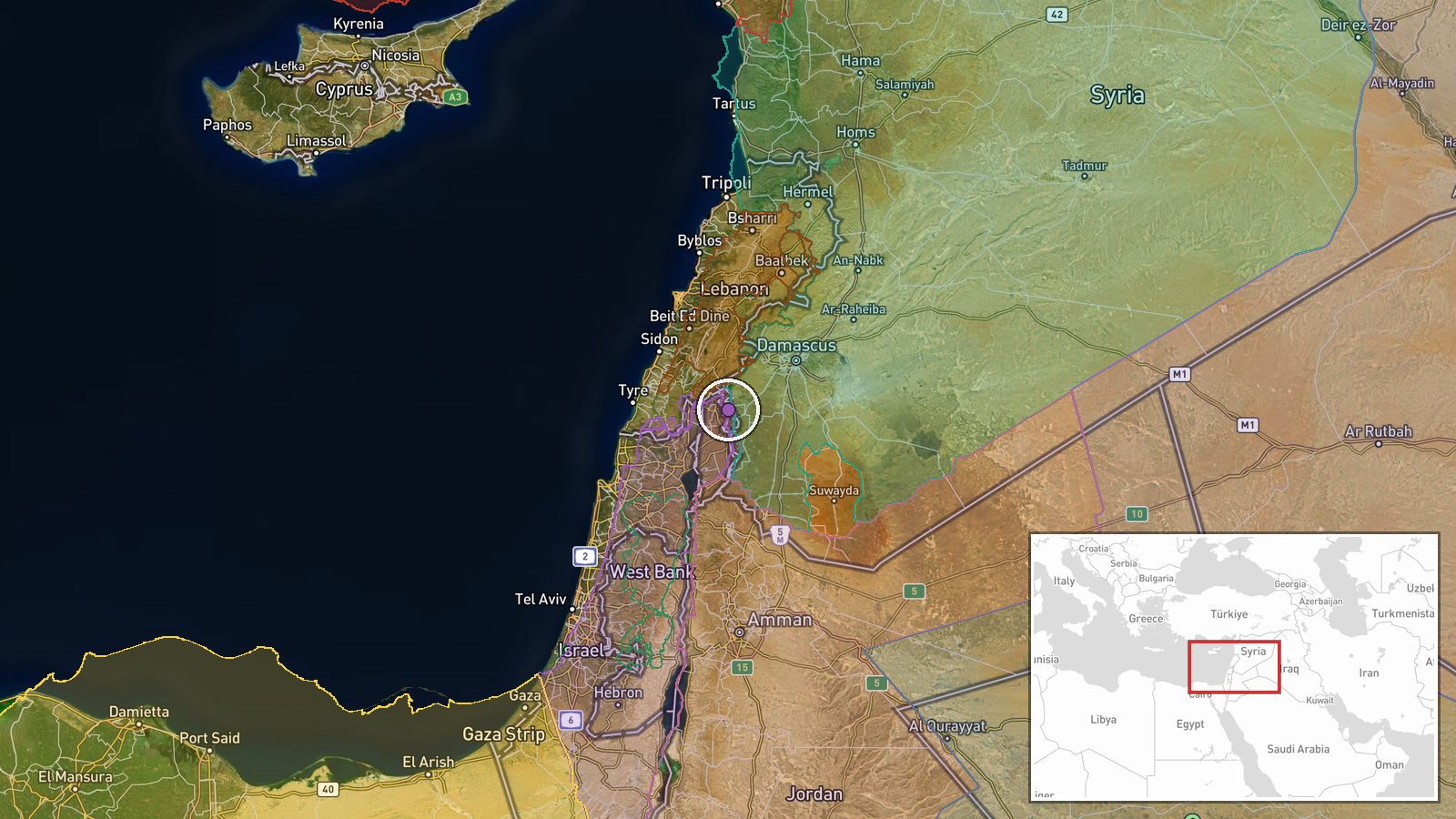
The location was resolved to Tarnaja village, a settlement in northern Quneitra countryside, at settlement-level precision with high location confidence, because the Arabic post names the village directly. The coordinates (33.233, 35.845) place it on the hilly, largely agricultural terrain of the Golan's southern edge near the disengagement line. The post names no specific road or checkpoint, so the exact site of the blockage is approximate within the village.
Related events nearby
- A young man with disabilities was killed by Israeli occupation gunfire in Jamla village, western Daraa country2026-10-22 05:15 UTC · Combat · Jamla, Daraa Governorate, Syria
- Israeli forces fired two artillery shells around Abdin village in western Daraa countryside.2026-10-21 18:09 UTC · Artillery · Abdin, Western Daraa countryside, Syria
- Pistol shooting on the Damascus airport road sparks criticism and public demands for accountability.2026-10-21 16:54 UTC · Security · Damascus International Airport road, Damascus, Syr
- Field footage from the Syrian Internal Security Forces and General Intelligence operation against an ISIS cell2026-10-22 05:41 UTC · Police Operation · Rankous, Rif Dimashq, Syria
- Armed outlaw groups blocked Suwayda governorate employees from reaching their building in Al-Surra al-Soghra w2026-10-21 11:07 UTC · Security · Umm al-Zeitoun checkpoint, Al-Suwayda Governorate,
▶ View this event on the live map

Intel Mapper aggregates open-source reports from monitored Telegram and X channels, geolocates them, cross-checks duplicates across sources and assigns a confidence score. Entries are updated as new confirmations arrive. Read how we verify events.