Source reports Israeli warplanes flying at low altitude over Quneitra Governorate, Syria
What happened
On 22 October 2026, a single channel on X, @ConflictTR, posted a breaking-news alert stating that Israeli warplanes were conducting low-altitude flights over the skies of Syria's Quneitra Governorate. The original post is in Turkish and uses the phrase 'savaş uçakları', meaning warplanes or combat aircraft. It gives no flight count, altitude, duration, aircraft type, or indication of any strike or munition use. The report is timestamped 08:02 UTC, and the event record includes no image or video. The event is classed as Combat Aircraft activity, with Israel recorded as the actor on the basis of the post's wording alone. The location is recorded at governorate level rather than at a specific village.
Context and assessment
Quneitra is one of the most sensitive districts in southern Syria. It borders the Israeli-occupied Golan Heights and contains the UN-supervised area of separation that UNDOF has monitored since 1974. Israeli forces expanded their presence into the buffer zone and nearby areas after the Assad government collapsed in late 2024, and the related events on this page reflect that ongoing footprint. Earlier on the same day, Israeli occupation forces reportedly blocked a UNDOF patrol from crossing a road in Tarnaja village in northern Quneitra. In neighbouring Daraa Governorate, forces advanced into Jamla village, where a young man was reportedly killed by gunfire, and artillery shells were fired around Abdin the previous evening. A separate, unconfirmed clip of low-altitude warplanes over western Rif Dimashq was also circulating, with its operator and mission not established. Taken together, these reports suggest a sustained, multi-domain presence in the south. Low-altitude overflights are commonly used for reconnaissance and to project presence, but without corroboration the report cannot establish intent. The claim should be treated as unverified until imagery, flight tracking, or a second independent source emerges.
Sources and confidence
The report rests on one channel, the X account @ConflictTR, which is the only listed source. No second outlet, wire service, official statement from Israel or Syria, or imagery has been linked to it in the record. The event carries a confidence score of 6.3, reflecting single-source status, while location confidence is rated high at governorate level. The score would rise with flight-tracking data, geolocated video, or confirmation from a wire agency or UN observers. It would fall if the account is found to recycle older footage or if the post is later withdrawn or corrected.
Location
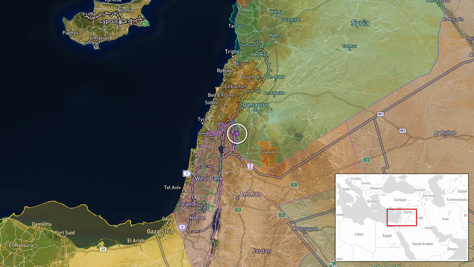
The location was assigned at region level. The coordinates given, approximately 33.09 N and 35.92 E, fall within Quneitra Governorate rather than at a named settlement or facility, because the post names only the province. Quneitra lies in southwestern Syria, bordering Israel and Jordan, with the Golan Heights to the west. The UNDOF buffer zone runs through the governorate, and the Yarmouk River area lies to the south.
Related events nearby
- Israeli occupation forces blocked a UNDOF patrol from crossing the road in Tarnaja village, northern Quneitra 2026-10-22 06:51 UTC · Security · Tarnaja, Quneitra, Syria
- Israeli occupation forces advanced into Jamla village in western Daraa countryside, killing a young man with d2026-10-22 05:15 UTC · Combat · Jamla, Daraa Governorate, Syria
- Israeli forces fired two artillery shells around Abdin village in western Daraa countryside.2026-10-21 18:09 UTC · Artillery · Abdin, Western Daraa countryside, Syria
- Circulating footage shows warplanes flying at low altitude over the western Rif Dimashq countryside; operator 2026-10-22 07:53 UTC · Combat Aircraft · Western Rif Dimashq countryside, Syria
- Pistol shooting on the Damascus airport road sparks criticism and public demands for accountability.2026-10-21 16:54 UTC · Security · Damascus International Airport road, Damascus, Syr
▶ View this event on the live map

Intel Mapper aggregates open-source reports from monitored Telegram and X channels, geolocates them, cross-checks duplicates across sources and assigns a confidence score. Entries are updated as new confirmations arrive. Read how we verify events.