IRGC claims third supertanker struck in Strait of Hormuz within two days
What happened
Iran's Islamic Revolutionary Guard Corps claimed on October 12 that it struck a third supertanker in the Strait of Hormuz, allegedly setting the vessel on fire. According to the IRGC statement, the tanker had disabled its navigation system and ignored warnings while attempting to transit the strategic waterway. The claim was reported via Telegram and X channels, though independent verification of the incident remains unclear.
Context and assessment
The Strait of Hormuz, through which roughly one-fifth of global oil passes, has been a flashpoint for maritime incidents in recent months. This claim follows reports of at least two other tanker incidents in the same area within the preceding day, suggesting a pattern of escalating maritime tension. Rising fuel prices have drawn political attention in the United States, with officials attributing cost increases partly to unresolved Strait of Hormuz security concerns. The repeated claims of supertanker strikes may reflect Iranian efforts to assert control over navigation in the waterway or could indicate deliberate escalation amid broader regional pressures.
Sources and confidence
The IRGC claim was reported by Telegram channel @ClashReport and X account @Osint613, representing two independent sources. The low confidence score (7.9) reflects the absence of corroborating maritime tracking data, shipping company statements, or Western military confirmation. Raising confidence would require independent vessel tracking confirmation or statements from affected shipping companies. The claim's specificity and timing alongside reported earlier incidents provide modest support.
Location
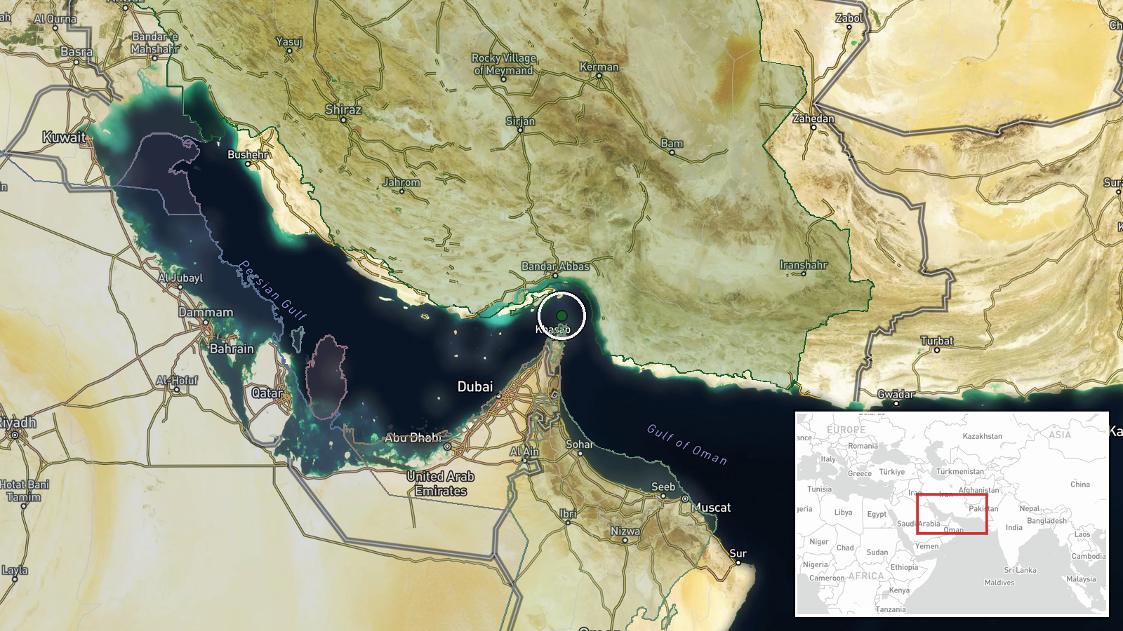
The Strait of Hormuz is a 54-kilometer-wide maritime chokepoint between Iran and Oman at the entrance to the Persian Gulf. The incident location is reported at regional precision only (latitude 26.55, longitude 56.4), reflecting uncertainty about the tanker's exact position within the busy shipping lanes where multiple vessels transit daily.
Related events nearby
- U.S. House Speaker Mike Johnson attributes rising fuel prices to unresolved Strait of Hormuz tensions rather t2026-10-12 11:40 UTC · Diplomacy · Strait of Hormuz, Persian Gulf
- IRGC Navy reports third rogue supertanker struck naval mine in unauthorized Strait of Hormuz route, causing en2026-10-11 17:48 UTC · Report · Strait of Hormuz, Persian Gulf
▶ View this event on the live map

Intel Mapper aggregates open-source reports from monitored Telegram and X channels, geolocates them, cross-checks duplicates across sources and assigns a confidence score. Entries are updated as new confirmations arrive. Read how we verify events.