Reuters probe reportedly counts 135 strikes on 84 Gulf infrastructure sites since Feb 28
What happened
A report attributed to a Reuters investigation, relayed through a single Telegram channel (@ClashReport), states that Iran and its proxies carried out at least 135 precision strikes on 84 infrastructure sites across the Gulf since February 28. The reported targets include oil, gas, electricity and transportation facilities. The report says the attacks caused billions of dollars in damage, disrupted global energy supplies, and helped Iran withstand U.S. military pressure. It further states that Gulf governments frequently downplayed the damage, often blaming falling debris from intercepted missiles and drones. The event is logged at a regional level rather than at any single site, with a record timestamp of October 15, 2026, 23:52 UTC.
Context and assessment
The Gulf's oil, gas, power and transport networks are central to global energy markets, and even short disruptions there tend to ripple into prices and shipping routes. That makes a claimed campaign against dozens of such sites significant regardless of how it is ultimately verified. The record places this report alongside a same-day entry describing an Iranian Revolutionary Guards naval strike against a vessel in the Persian Gulf near the Basra Basin, though no casualty figures or vessel identification were provided. If both entries prove accurate, they would point to a maritime dimension to the wider pattern, with attacks extending from coastal and offshore infrastructure to shipping. A separate entry recording Qatar's Interior Minister visiting Damascus for talks with the Syrian government is not directly linked to the strikes, but it shows Gulf states continuing regional diplomacy while the infrastructure damage is being contested. Operationally, a claimed count of this size would suggest sustained use of long-range drones and missiles, with the precision label implying targeting of specific installations rather than area fire. Such a characterization is hard to confirm from one channel, and the downplaying by Gulf governments, if accurate, would complicate independent assessment of damage.
Sources and confidence
Only one channel is recorded: Telegram (@ClashReport), with a source count of one. The summary and original text cite a Reuters investigation, but no Reuters item is listed as a separate source, so the attribution is secondhand and unverified within this record. The confidence score of 7.1 reflects a single-channel report with no cross-confirmation, offset by the specificity of the aggregate figures. Confidence would rise with a direct link to the published Reuters investigation or independent confirmation of individual strikes through satellite imagery, operator statements, or insurance and energy-market data. It would fall if the original investigation cannot be located or if the figures cannot be traced to documented incidents.
Location
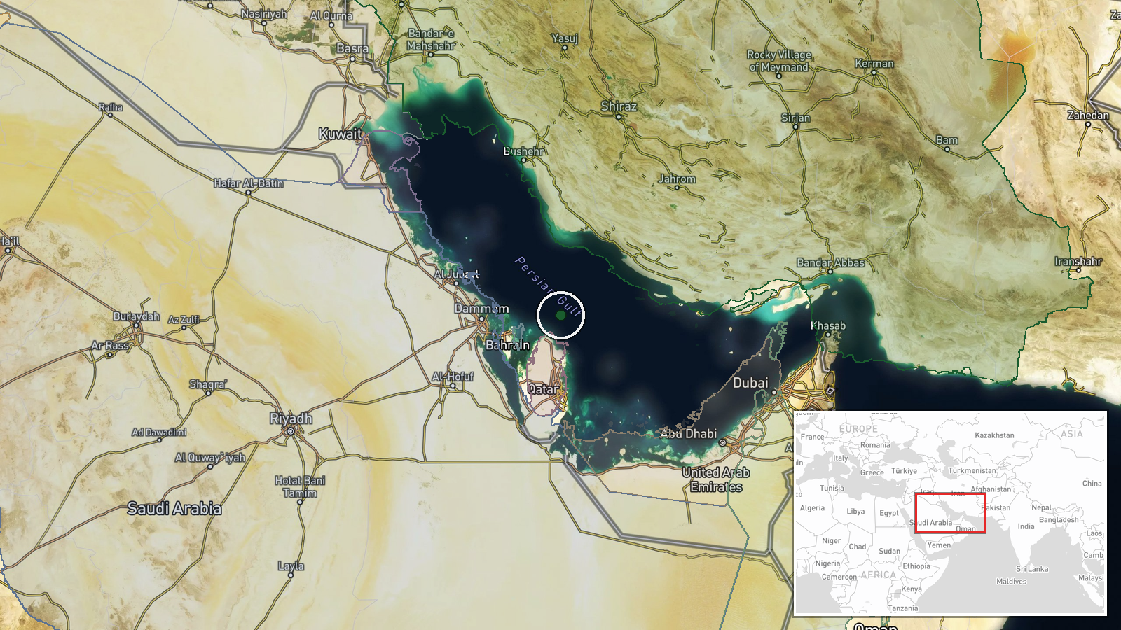
The coordinates (26.5N, 51.5E) are a general point in the central Persian Gulf, not a specific facility, and the location confidence is recorded as low. The record covers a broad region rather than individual sites, so the point marker should be read as representative only. The area is largely offshore and coastal, lying between Iran's southern shoreline and the states of Qatar, Bahrain, and the UAE. Many of the energy and port facilities referenced in such reports are located on the Gulf coastline, and the Strait of Hormuz lies to the southeast.
Related events nearby
- Iranian Revolutionary Guards (IRGC) conducted a naval strike against a vessel in the Persian Gulf (Basra Basin2026-10-15 08:28 UTC · Naval · Persian Gulf (Basra Basin), Iran-Iraq waters
- Qatar's Interior Minister arrives in Damascus for bilateral talks with Syrian counterpart, marking diplomatic 2026-10-15 08:52 UTC · Diplomacy · Doha, Qatar
▶ View this event on the live map

Intel Mapper aggregates open-source reports from monitored Telegram and X channels, geolocates them, cross-checks duplicates across sources and assigns a confidence score. Entries are updated as new confirmations arrive. Read how we verify events.