Iranian LPG tankers reportedly leave Gulf of Oman despite US naval blockade
What happened
A report carried on the Telegram channel @ClashReport states that at least eight Iranian liquefied petroleum gas tankers, carrying an estimated 4.1 million barrels, have left the Gulf of Oman since mid-July despite a U.S. naval blockade. The post says most of the shipments are heading toward Malaysia, with likely onward delivery to China. The event is dated 16 October 2026 at 14:02 UTC and is geotagged to the broader Gulf of Oman rather than a specific port or vessel position. The original text attributes the figures to Reuters, but the only channel recorded in the sourcing is the Telegram account, so the attribution has not been matched to a Reuters item in the data. The report does not give individual vessel names, departure ports, or the basis for the delivery estimate.
Context and assessment
The Gulf of Oman is the approach to the Strait of Hormuz, a chokepoint for much of the region's seaborne energy, so movements here draw attention quickly when sanctions or naval pressure are in play. If confirmed, the reported shipments would suggest Iranian LPG is still leaving the area despite the U.S. naval blockade, which bears on how effective maritime restrictions are in practice. A related report from the same day describes another tanker burning in the Gulf of Oman. The Iranian Navy reportedly said that vessel had switched off tracking and entered a prohibited area east of Hormuz, but the cause of the fire is unconfirmed and no link to the LPG shipments is established. Together the items may point to vessels operating with reduced transparency in a contested corridor, though the data does not show a connection. A Japan Joint Staff item in the same feed concerns surveillance counts and should not be read as corroboration. The reported routing toward Malaysia may, if verified, indicate transshipment through intermediaries that complicates tracing the cargo's final destination.
Sources and confidence
The event rests on a single Telegram channel, @ClashReport, which is the only source recorded in the data. The original text credits Reuters, but no Reuters item is listed as a source, so cross-confirmation is currently absent. The confidence score of 7.1 reflects a single-channel report with specific figures and a plausible commercial context, offset by the lack of named vessels, ports, or independent confirmation. Confidence would rise with a Reuters item or shipping-tracking data matching the tankers, and would fall if the attribution cannot be traced or the figures are disputed.
Location
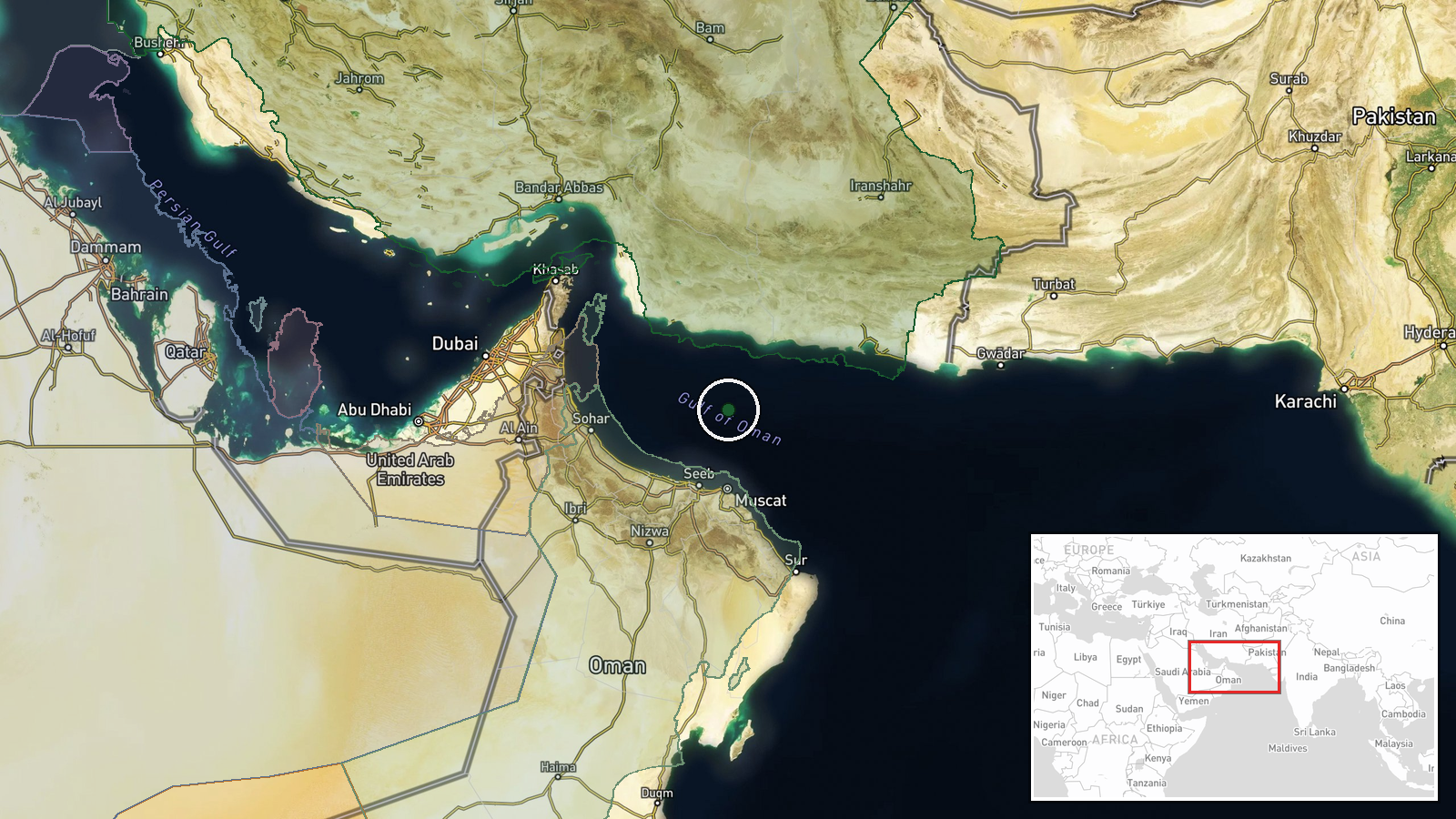
The location is recorded at region level only. Coordinates of 24.6 N, 58.6 E sit in open water in the Gulf of Oman, not at a port or vessel position, and location confidence is rated low. The Gulf lies between the Iranian coast to the north and the Omani coast to the south, linking the Strait of Hormuz with the Arabian Sea. The reports do not name any specific nearby ports, anchorages, or loading terminals.
Related events nearby
- Another tanker is burning in the Gulf of Oman. Iranian Navy says it had turned off tracking and entered a proh2026-10-16 11:00 UTC · Report · Gulf of Oman
- Japan's Joint Staff reports September Middle East intelligence-gathering: surface unit confirmed 12 vessels, a2026-10-16 06:13 UTC · Report · Gulf of Oman, Middle East waters
▶ View this event on the live map

Intel Mapper aggregates open-source reports from monitored Telegram and X channels, geolocates them, cross-checks duplicates across sources and assigns a confidence score. Entries are updated as new confirmations arrive. Read how we verify events.