Japan's Joint Staff reports September Middle East intelligence-gathering vessel tallies on X
What happened
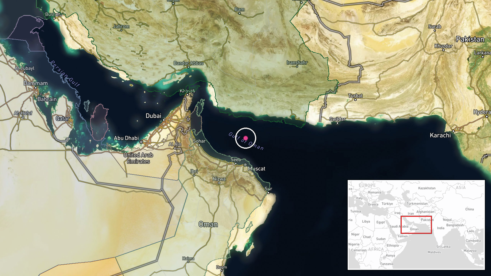
Japan's Joint Staff, the operational headquarters of the Japan Self-Defense Forces, posted on X that during September its units carried out intelligence-gathering in the Middle East. The post says the surface unit confirmed 12 vessels and the air squadron confirmed 823 vessels, figures the entry carries as reported. The Japanese wording gives monthly totals only, without individual incidents, vessel types, flags or positions. The entry was logged on 16 October 2026 at 06:13 UTC, so the timestamp reflects publication rather than the dates of observation. The attached location is a broad area, Gulf of Oman and Middle East waters, rather than a specific point.
Context and assessment
The Gulf of Oman sits at the approach to the Strait of Hormuz, one of the world's most important oil transit chokepoints, which is why maritime activity there draws close attention from navies and shipping operators alike. Japan depends heavily on Middle East crude, so its government has long maintained interest in the safety of commercial traffic through these waters, and its forces have in the past been tasked with information gathering in the region. A related entry from the previous day reports a second oil tanker catching fire in the Gulf of Oman near the strait, and Iran's Navy reportedly claimed that the vessel had disabled its tracking systems while entering a restricted area. That is a single-side claim and does not establish cause. Read together, the two entries suggest a period in which vessel movements in this corridor are closely watched by several parties. The Japanese post does not explain whether the counted vessels relate to commercial traffic, naval observation, or a wider surveillance effort. Operationally, a tally of this kind may indicate sustained monitoring of shipping, but the wording offers no detail on methods or targets, so any firmer interpretation would be speculative.
Sources and confidence
This entry rests on one channel, the official X account of the Japan Joint Staff, which is a primary government source for its own activity. No independent outlet or second government statement was identified in the data, so cross-confirmation is absent. The confidence score of 6.1 reflects a credible official origin offset by single sourcing, a monthly aggregate with no supporting detail, and an approximate location. Confidence would rise if the figures were corroborated by a Japanese government document, press briefing, or defense ministry release that explains the methodology. It would fall if the account were corrected or if the numbers were contradicted by other reporting.
Location
The location is a region-level assignment rather than a determined point, and location confidence is recorded as low. The coordinates, roughly 24.6 N and 58.6 E, fall in the Gulf of Oman offshore from Oman's northern coast, near the Strait of Hormuz to the northwest. The Gulf of Oman is a deep arm of the Arabian Sea linking the Strait of Hormuz with the open ocean. Its shipping lanes run close to Omani and Iranian coastal waters.
Related events nearby
- Another tanker is burning in the Gulf of Oman. Iranian Navy says it had turned off tracking and entered a proh2026-10-16 11:00 UTC · Report · Gulf of Oman
- Second oil tanker caught fire in Gulf of Oman near Strait of Hormuz. Iran's Navy claimed the vessel had disabl2026-10-15 12:55 UTC · Report · Gulf of Oman, Eastern Strait of Hormuz
▶ View this event on the live map

Intel Mapper aggregates open-source reports from monitored Telegram and X channels, geolocates them, cross-checks duplicates across sources and assigns a confidence score. Entries are updated as new confirmations arrive. Read how we verify events.