Iran reports oil tanker fire in Gulf of Oman; claims vessel disabled tracking systems
What happened
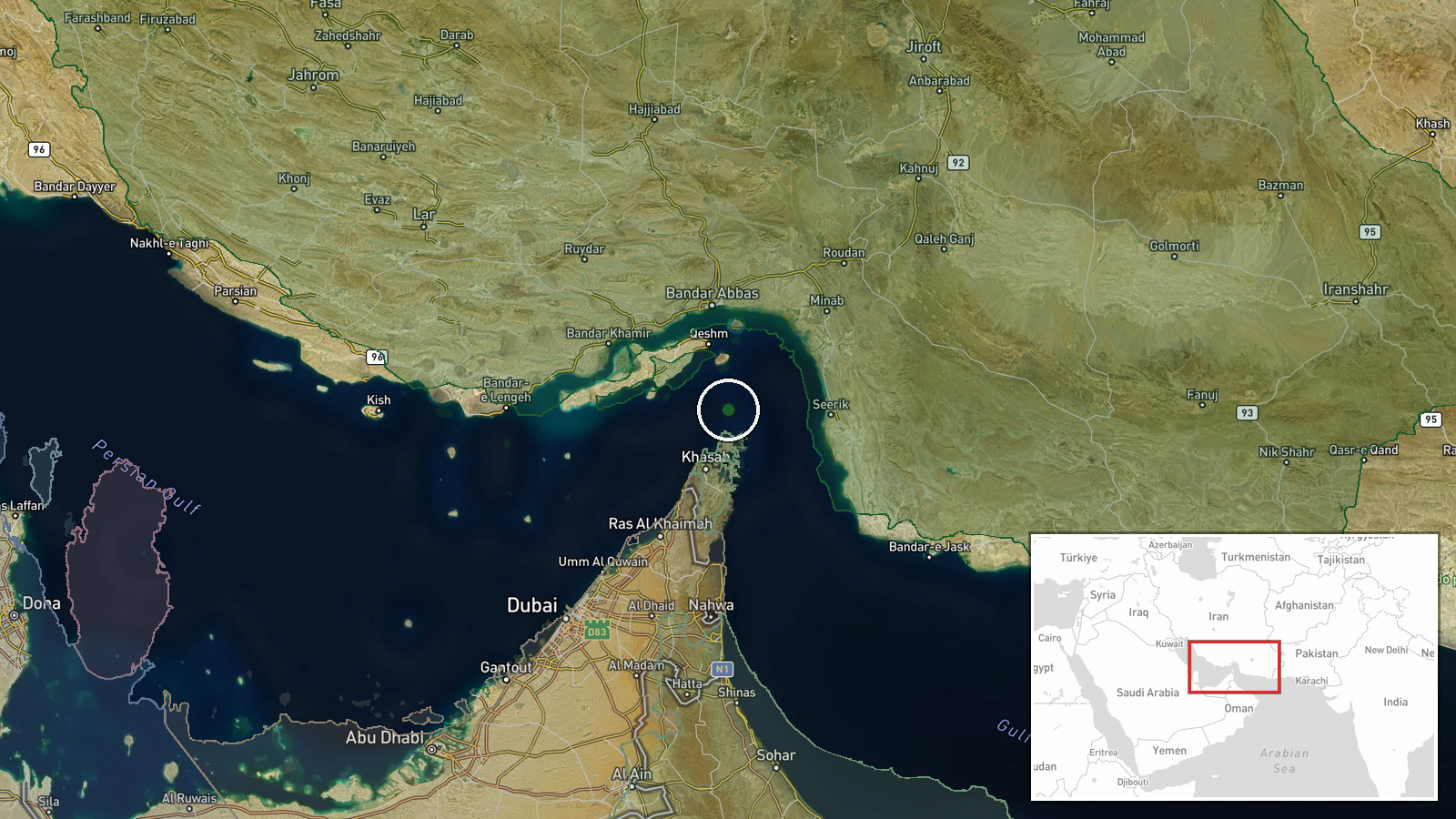
Iran's Navy announced that an oil tanker caught fire in the Gulf of Oman near the Strait of Hormuz on October 15. According to Iranian statements, the vessel had switched off its tracking systems while attempting to enter what Tehran described as a restricted zone without authorization. Iran's Navy reasserted that it maintains control over the strategic waterway. The incident was reported by two open-source channels, though independent confirmation of the vessel's identity and damage status remains limited.
Context and assessment
The Gulf of Oman and Strait of Hormuz remain a flashpoint for regional tensions. This fire represents the second reported maritime incident in the area within days, following an Iranian naval attack on merchant vessels on October 14 and a U.S. operation against an Iranian-affiliated dhow on October 6. Iran has historically used maritime incidents to assert sovereignty over the chokepoint through which roughly one-third of global seaborne oil passes. The timing and Iranian framing—emphasizing unauthorized entry and disabled tracking—may reflect efforts to control the narrative around escalating maritime activity and justify Iranian naval operations in contested waters.
Sources and confidence
Two sources reported the incident: Telegram channel @ClashReport and X account @Osint613. Cross-confirmation between these channels provides moderate corroboration. Confidence of 7.9 reflects the limited source count and reliance on official Iranian statements rather than independent maritime monitoring or third-party vessel tracking data. Confirmation would be raised by AIS tracking data, shipping company statements, or satellite imagery. It would be lowered by contradicting reports from U.S. Navy or regional maritime authorities.
Location
The incident was located by geographic coordinates in the Gulf of Oman east of the Strait of Hormuz (26.55°N, 56.4°E), with region-level precision. The area lies in international and contested waters between Oman's coast to the south and Iran's coastline to the north, approximately 200 kilometers southeast of the Strait of Hormuz's narrowest point. This region is a major shipping corridor and area of recurring Iranian naval activity.
Related events nearby
- U.S. forces destroyed an Iranian-affiliated dhow conducting surveillance and targeting operations against U.S.2026-10-14 19:44 UTC · Naval · Gulf of Oman
- Iranian naval attack in Strait of Hormuz results in ship damage/sinking. Reports indicate one or more merchant2026-10-14 16:31 UTC · Naval · Strait of Hormuz, Persian Gulf
▶ View this event on the live map

Intel Mapper aggregates open-source reports from monitored Telegram and X channels, geolocates them, cross-checks duplicates across sources and assigns a confidence score. Entries are updated as new confirmations arrive. Read how we verify events.