Two Emirati cargo ships sunk near Strait of Hormuz as Iranian attacks surge
What happened
Two Emirati-flagged cargo vessels have sunk near the Strait of Hormuz, according to the Wall Street Journal. The incident occurs amid a marked escalation in Iranian attacks on maritime traffic in the Persian Gulf. Since early October, approximately 24 vessels have been struck by Iranian forces, exceeding the total number of attacks recorded throughout September. The Strait of Hormuz, a critical chokepoint for global oil trade, has become increasingly contested.
Context and assessment
The Strait of Hormuz, through which roughly one-third of globally traded oil passes, has been a focal point of U.S.–Iran tensions and regional proxy conflict. Recent related events confirm at least two merchant vessel losses, including the GFS Pride container ship, sunk after being struck by a projectile. CENTCOM reported that 19 million barrels of crude transited the strait under U.S. escort on October 14 alone, underscoring the critical importance of the waterway and the operational constraints now in place. The acceleration in Iranian attacks—from September's baseline to 24 vessels in early October—may reflect Iranian responses to U.S. military activity or broader regional escalation. The deliberate targeting of commercial shipping suggests an attempt to disrupt regional commerce and signal resolve.
Sources and confidence
Reports originate from the Wall Street Journal, corroborated by multiple open-source channels including Telegram (@ClashReport) and X accounts (@ConflictTR, @Osint613). Three independent sources confirm the broader attack pattern. Confidence of 8.5 reflects high-confidence corroboration of the attack surge and vessel losses, though the exact mechanism of each sinking (mine, projectile, drone) varies across related reports. Additional satellite imagery confirmation of at least one loss raises confidence; independent verification of the two-ship figure would strengthen the assessment.
Location
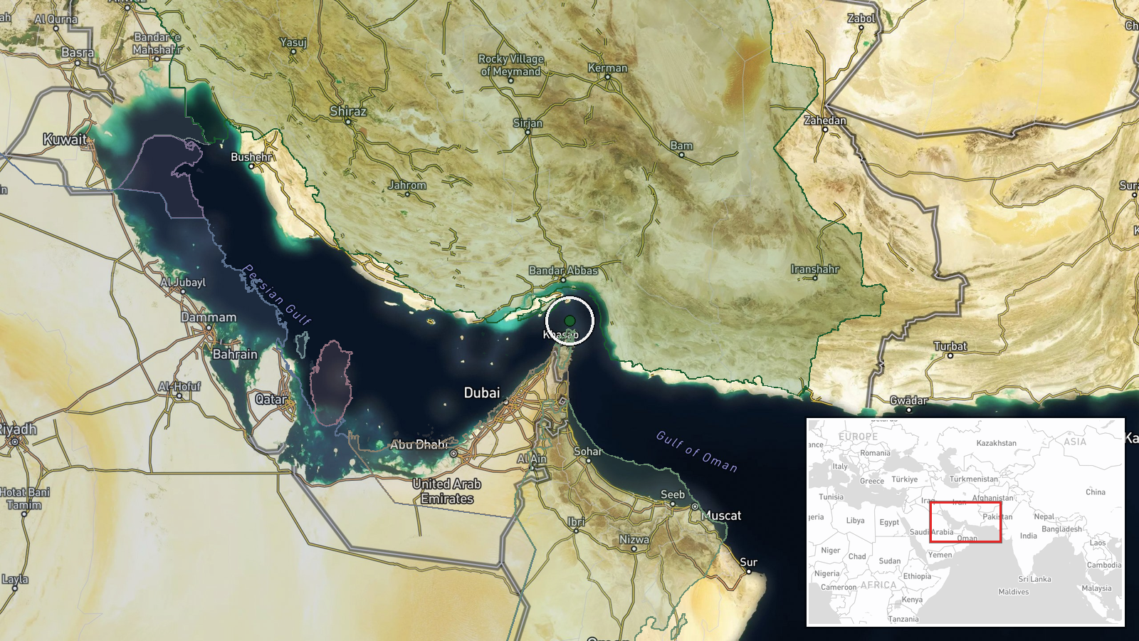
The Strait of Hormuz, located at approximately 26.55°N, 56.4°E, is the narrow waterway separating Iran to the north from Oman and the United Arab Emirates to the south. The strait connects the Persian Gulf to the Gulf of Oman and the Arabian Sea. Geographic precision is regional owing to the wide operational area; specific coordinates refer to the general chokepoint rather than pinpointed impact sites. The waterway is heavily trafficked and subject to Iranian coastal surveillance and control.
Related events nearby
- CENTCOM reports 19+ million barrels of crude passed through Strait of Hormuz under U.S. escort on Monday; Iran2026-10-14 12:09 UTC · Naval · Strait of Hormuz, Iran-Oman
- Unidentified projectile struck a tanker transiting the Strait of Hormuz. UK Maritime Trade Operations confirme2026-10-13 19:11 UTC · Report · Strait of Hormuz, Persian Gulf
- UAE-flagged container ship GFS PRIDE identified as vessel that struck mine in southern Strait of Hormuz corrid2026-10-14 09:19 UTC · Naval · Southern Strait of Hormuz (approx.) — GFS PRIDE si
- U.S. drone strike wounded three Iranian fishermen at sea off Sirik, Iran. Report confirms earlier unverified a2026-10-14 07:38 UTC · UAS Strike · Off Sirik, Hormuzgan Province, Iran
▶ View this event on the live map

Intel Mapper aggregates open-source reports from monitored Telegram and X channels, geolocates them, cross-checks duplicates across sources and assigns a confidence score. Entries are updated as new confirmations arrive. Read how we verify events.