U.S. drone strike wounds three Iranian fishermen off Sirik coast
What happened
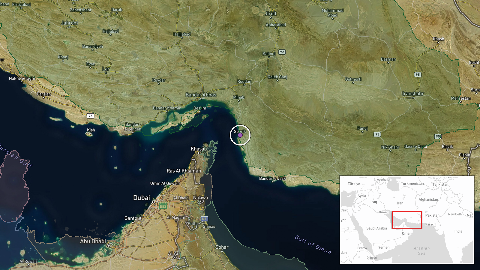
A U.S. unmanned aerial vehicle struck a fishing vessel off Sirik, Hormuzgan Province, Iran on October 14, reportedly wounding three Iranian fishermen. The incident was first reported unverified by open-source accounts and subsequently confirmed by multiple X channels citing the same source material. The strike occurred in waters near Sirik Island in the northern Persian Gulf.
Context and assessment
The strike occurs amid escalating maritime tensions in the Strait of Hormuz region. Within the previous 24 hours, reports documented an unidentified projectile striking a tanker transiting the strait, Iranian Revolutionary Guards releasing footage of a burning oil tanker following an Iranian strike, and a U.S. Navy VHF warning to an unidentified vessel. Iran's simultaneous deployment of civilian observers across the strait to gather targeting intelligence for the Revolutionary Guards suggests a coordinated effort to enhance situational awareness and potentially prepare retaliatory options. The targeting of a civilian fishing vessel—if confirmed—represents a significant escalation in direct attacks on Iranian personnel in contested waters.
Sources and confidence
Reports from X accounts @ConflictTR and @Osint613, both citing the same Turkish-language source (SONDAKIKA). No independent confirmation from U.S. military or Iranian official channels. Confidence of 7.4 reflects corroboration across two channels but reliance on social media sourcing and absence of direct statement from involved parties. Verification of casualty count and vessel damage would strengthen confidence; contrary statements from U.S. or Iranian authorities would lower it.
Location
Off Sirik Island, Hormuzgan Province, northern Persian Gulf, approximately 150 kilometers southeast of Bandar Abbas. Sirik lies in strategically important waters near major shipping lanes transiting the Strait of Hormuz. The location was determined by toponymic reference in the source; geo-precision is regional rather than specific coordinates.
Related events nearby
- Unidentified projectile struck a tanker transiting the Strait of Hormuz. UK Maritime Trade Operations confirme2026-10-13 19:11 UTC · Report · Strait of Hormuz, Persian Gulf
- IRGC Navy released footage showing an oil tanker burning in the eastern Strait of Hormuz after Iranian strike.2026-10-13 14:36 UTC · Report · East of Strait of Hormuz, Persian Gulf
- U.S. Navy issued a warning to an unidentified vessel on VHF Ch-16 in the Strait of Hormuz, demanding it revers2026-10-13 12:54 UTC · Naval · Strait of Hormuz, Persian Gulf
▶ View this event on the live map

Intel Mapper aggregates open-source reports from monitored Telegram and X channels, geolocates them, cross-checks duplicates across sources and assigns a confidence score. Entries are updated as new confirmations arrive. Read how we verify events.