U.S. Navy Issues Warning to Unidentified Vessel in Strait of Hormuz
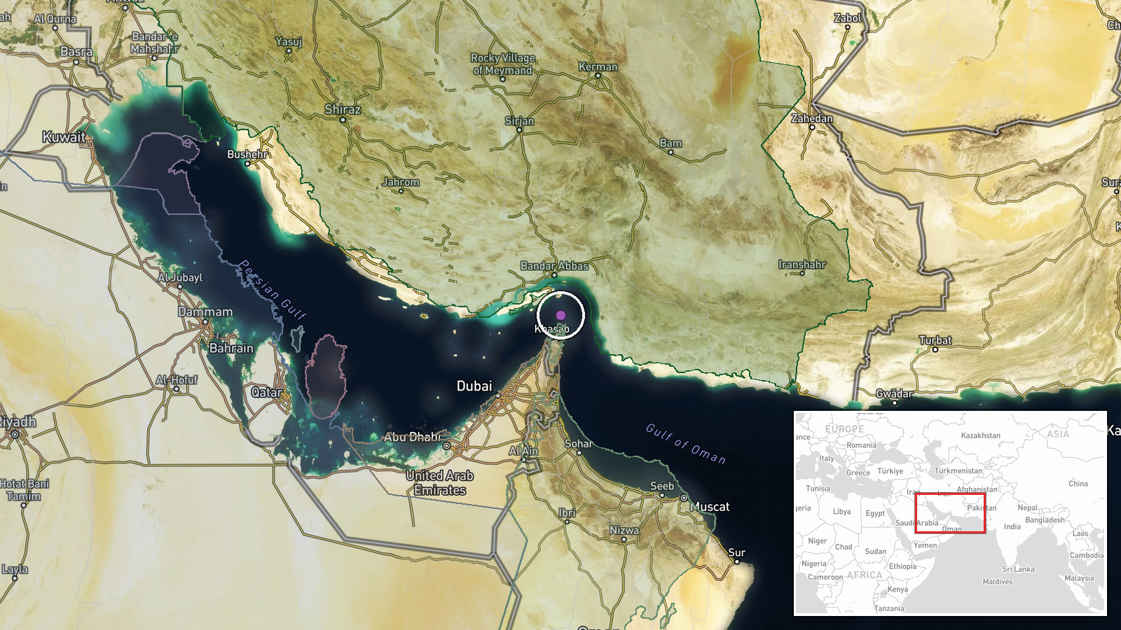
What happened
The U.S. Navy reportedly issued a VHF radio warning on Channel 16 to an unidentified vessel transiting the Strait of Hormuz on October 13, demanding it reverse course or face military action. The incident was logged by an AIS monitoring account. The event represents a routine naval interdiction operation in one of the world's most critical maritime chokepoints, though the identity of the vessel and the specific reason for the warning remain unclear from available reporting.
Context and assessment
The warning occurs amid a significant surge in maritime incidents in the Strait of Hormuz. Within the preceding 24 hours, at least five merchant vessels—predominantly tankers—were struck by unidentified munitions while transiting the waterway, prompting alerts from the UK Maritime Trade Operations center. These attacks have been linked to ongoing Houthi maritime operations in the region. U.S. naval presence in the strait is routinely elevated to enforce freedom of navigation and respond to threats against commercial shipping. The timing of this interdiction suggests heightened U.S. Navy activity coinciding with the escalation of strikes against shipping, though whether the warning relates directly to those incidents or represents independent enforcement operations remains unclear.
Sources and confidence
Single-source report from X account @Osint613, citing live AIS tracking data. No cross-confirmation from official U.S. Navy statements, regional maritime authorities, or secondary OSINT channels. Low confidence reflects single-source reporting, lack of official corroboration, and inherent limitations of AIS-derived incidents. Confidence would increase with statements from U.S. Central Command, UKMTO advisories referencing the incident, or reporting from maritime news services.
Location
The Strait of Hormuz, a 54-nautical-mile waterway separating Iran and Oman, connecting the Persian Gulf to the Gulf of Oman and Arabian Sea. Coordinates place the report in the central strait region. Precision is limited to regional level; the exact position and direction of the unidentified vessel are not specified. The area is the world's primary chokepoint for crude oil transit.
Related events nearby
- Four additional tankers struck by unidentified munitions in the Strait of Hormuz. Attack origin and responsibl2026-10-12 19:35 UTC · Cargo Ship · Strait of Hormuz, Persian Gulf
- Crude oil tanker struck by unknown projectile during outbound transit through Strait of Hormuz. UKMTO advisory2026-10-12 18:30 UTC · Cargo Ship · Strait of Hormuz, Persian Gulf
- Outbound tanker struck by unknown projectile in Strait of Hormuz. All crew safe. UKMTO issued warning; vessels2026-10-12 15:34 UTC · Cargo Ship · Strait of Hormuz, Persian Gulf
▶ View this event on the live map

Intel Mapper aggregates open-source reports from monitored Telegram and X channels, geolocates them, cross-checks duplicates across sources and assigns a confidence score. Entries are updated as new confirmations arrive. Read how we verify events.