Four tankers hit by unknown munitions in Strait of Hormuz
What happened
Four additional tanker vessels were reportedly struck by munitions of unknown origin in the Strait of Hormuz on 12 October 2026, according to a report circulated on social media. The report provides no details on the time of impact, the vessels involved, damage sustained, or casualties. This incident follows two earlier strikes on tankers in the same waterway the same day, suggesting a pattern of attacks within hours. The source of the munitions and the identity of the responsible actor remain unconfirmed.
Context and assessment
The Strait of Hormuz is a critical chokepoint through which roughly one-third of global seaborne oil passes, making it strategically significant for international energy markets and geopolitics. The concentration of four reported strikes on tankers within a single day, following earlier incidents the same morning and afternoon, indicates a sustained period of maritime targeting in the waterway. Such clustering may suggest coordination or escalation, though the lack of attribution complicates assessment. Previous months have seen recurring attacks on commercial shipping in the Persian Gulf attributed to various actors, including Houthi militants, raising questions about whether this pattern represents a deliberate campaign or isolated incidents. The identity and intent of the attacker remain central to understanding whether this constitutes a strategic threat to regional stability or commercial navigation.
Sources and confidence
A single social media account (@ConflictTR on X) reported the incident; no cross-confirmation from maritime authorities, shipping industry monitors, or news agencies has been identified. The source does not cite UKMTO advisories, crew communications, or vessel owners, weakening independent verification. The confidence score of 5.4 reflects this single-source limitation. Confirmation from the UK Maritime Trade Operations centre, shipping company statements, or secondary reporting would substantially raise confidence. Lower reporting velocity or contradictory details would reduce it.
Location
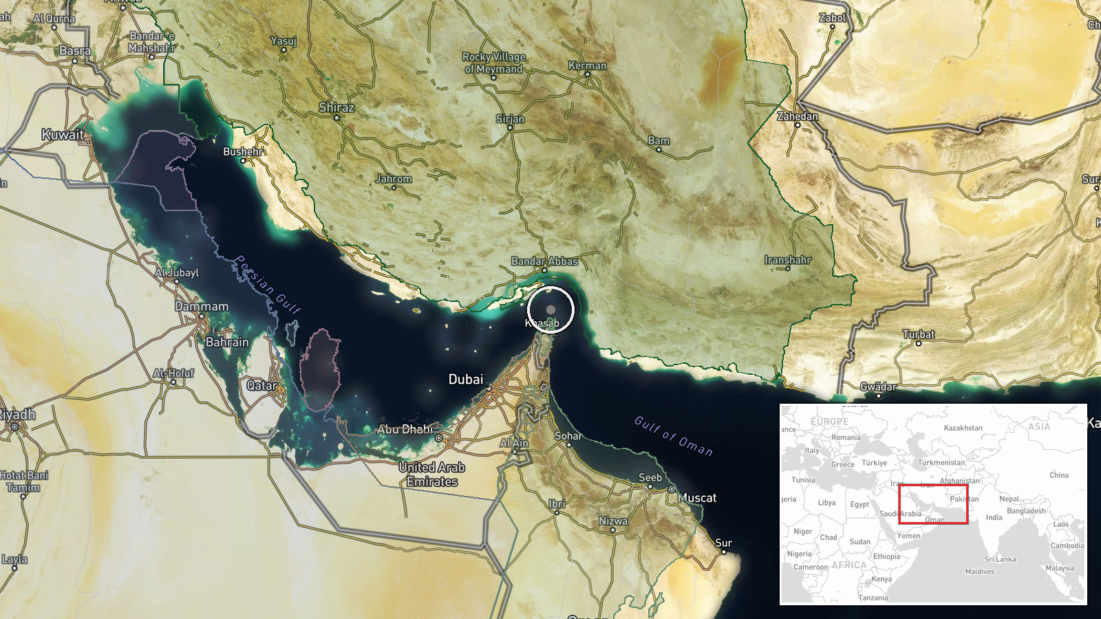
The Strait of Hormuz, located between Iran and Oman at approximately 26.5°N, 56.4°E, connects the Persian Gulf to the Gulf of Oman and Arabian Sea. The incident was reported at regional precision only, with no specific vessel position or waterway segment identified. The narrow corridor—roughly 33 nautical miles wide at its narrowest point—is heavily trafficked and hemmed by Iranian territorial waters to the north.
Related events nearby
- Crude oil tanker struck by unknown projectile during outbound transit through Strait of Hormuz. UKMTO advisory2026-10-12 18:30 UTC · Cargo Ship · Strait of Hormuz, Persian Gulf
- Outbound tanker struck by unknown projectile in Strait of Hormuz. All crew safe. UKMTO issued warning; vessels2026-10-12 15:34 UTC · Cargo Ship · Strait of Hormuz, Persian Gulf
▶ View this event on the live map

Intel Mapper aggregates open-source reports from monitored Telegram and X channels, geolocates them, cross-checks duplicates across sources and assigns a confidence score. Entries are updated as new confirmations arrive. Read how we verify events.