Tanker struck by projectile in Strait of Hormuz; crew safe
What happened
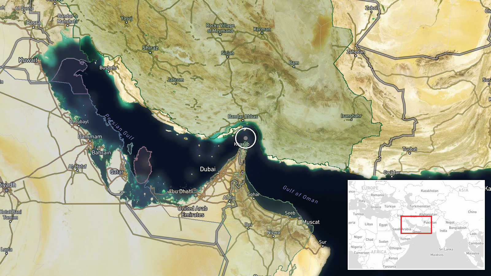
A products tanker transiting outbound through the Strait of Hormuz was struck by an unknown projectile on 12 October 2026. The United Kingdom Maritime Trade Operations (UKMTO) reported the incident. No casualties were reported among the crew. The origin of the projectile remains unconfirmed. The vessel was reportedly advised to transit with caution, and a broader warning was issued to shipping in the waterway.
Context and assessment
The Strait of Hormuz remains a critical chokepoint for global energy trade, with roughly one-third of seaborne oil passing through its narrow waters. The incident occurs amid an established pattern of maritime attacks in the Persian Gulf region, with multiple vessel strikes reported over recent weeks. The unconfirmed projectile origin underscores the operational challenge of attribution in these waters. While the immediate cause is unclear, such incidents have been associated with regional tensions and non-state maritime activity, though confirmation would be required to determine responsibility and intent.
Sources and confidence
Reported by UKMTO via social media (@Osint613). Currently derived from a single source channel with no independent cross-confirmation. Confidence is low (6.0/10) due to limited sourcing and lack of vessel identification details. Additional confirmation from shipping industry statements, vessel operators, or corroborating maritime authorities would strengthen confidence. Clarity on projectile type and origin would be needed to raise confidence substantially.
Location
Strait of Hormuz, Persian Gulf. Coordinates place the incident at regional level precision (26.55°N, 56.4°E), reflecting the waterway's extent rather than a pinpointed strike location. The strait lies between Oman and Iran, spanning approximately 54 nautical miles at its narrowest point. Outbound transit typically routes through designated shipping lanes subject to international maritime law.
Related events nearby
- Four additional tankers struck by unidentified munitions in the Strait of Hormuz. Attack origin and responsibl2026-10-12 19:35 UTC · Cargo Ship · Strait of Hormuz, Persian Gulf
- Outbound tanker struck by unknown projectile in Strait of Hormuz. All crew safe. UKMTO issued warning; vessels2026-10-12 15:34 UTC · Cargo Ship · Strait of Hormuz, Persian Gulf
▶ View this event on the live map

Intel Mapper aggregates open-source reports from monitored Telegram and X channels, geolocates them, cross-checks duplicates across sources and assigns a confidence score. Entries are updated as new confirmations arrive. Read how we verify events.