Oil tanker catches fire east of Strait of Hormuz; Iran claims strike on violating vessel
What happened
Iran's Navy released footage on October 13 showing a burning oil tanker in waters east of the Strait of Hormuz, according to Iranian state news agency IRNA. The Iranian account describes the vessel as a 'violating oil tanker,' though neither the ship's identity nor its flag state has been confirmed. The IRGC Navy characterized the incident as resulting from Iranian action, but independent verification of the attack origin remains absent.
Context and assessment
The eastern Strait of Hormuz has experienced multiple maritime incidents over October 12–13, with at least five tankers struck by projectiles of undetermined origin. Iran's claim follows a U.S. Navy VHF warning to an unidentified vessel demanding it reverse course. Iran has historically claimed responsibility for actions in the Strait when framing them as enforcement of maritime rules. The pattern of incidents—rapid escalation, unclear attribution, and involvement of multiple vessels—suggests either heightened regional tension, naval signaling between actors, or maritime security instability. Iran's public claim of targeting a 'violating' vessel may reflect an attempt to establish a justification narrative amid broader Strait tensions.
Sources and confidence
Report sourced to IRGC Navy via IRNA and amplified on X (@Osint613). Single-channel reporting from Iranian state media only; no independent maritime confirmation, vessel identification, or cross-source corroboration available. Confidence score of 6.8 reflects the source's direct institutional authority balanced against lack of third-party verification, satellite imagery, or affected crew statements. Confirmation would require ship tracking data, UKMTO incident report, or international maritime authority statement.
Location
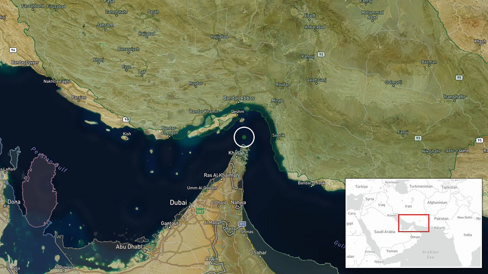
The incident location is geolocated to the eastern Strait of Hormuz at approximately 26.55°N, 56.4°E, representing a regional precision level rather than precise coordinates. The Strait of Hormuz is the world's primary oil export chokepoint between Iran and Oman, with the eastern waters falling within Iran's claimed territorial waters. Nearby features include Iranian coastal installations and major shipping lanes used by international tanker traffic.
Related events nearby
- U.S. Navy issued a warning to an unidentified vessel on VHF Ch-16 in the Strait of Hormuz, demanding it revers2026-10-13 12:54 UTC · Naval · Strait of Hormuz, Persian Gulf
- Four additional tankers struck by unidentified munitions in the Strait of Hormuz. Attack origin and responsibl2026-10-12 19:35 UTC · Cargo Ship · Strait of Hormuz, Persian Gulf
- Crude oil tanker struck by unknown projectile during outbound transit through Strait of Hormuz. UKMTO advisory2026-10-12 18:30 UTC · Cargo Ship · Strait of Hormuz, Persian Gulf
▶ View this event on the live map

Intel Mapper aggregates open-source reports from monitored Telegram and X channels, geolocates them, cross-checks duplicates across sources and assigns a confidence score. Entries are updated as new confirmations arrive. Read how we verify events.