Iran reportedly strikes container vessel in Strait of Hormuz
What happened
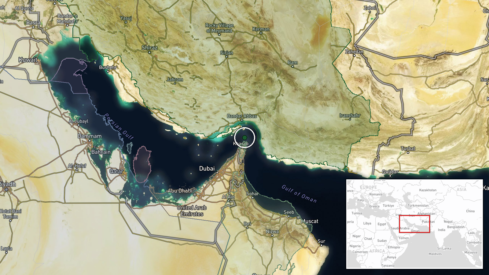
Iran reportedly attacked a container vessel transiting the Strait of Hormuz on October 14, according to a report from conflict monitoring channel @ConflictTR on X. The specific nature of the strike and extent of damage remain unclear from available reporting. The incident occurred in the strategic waterway separating Iran and Oman, a critical chokepoint for global maritime trade. Limited operational details have been released, with the report identifying only the vessel type and location.
Context and assessment
The Strait of Hormuz handles roughly one-third of seaborne traded oil globally, making maritime incidents there significant for energy markets and regional stability. This reported strike follows a pattern of escalating incidents in the waterway over preceding days, including an October 13 tanker strike confirmed by UK Maritime Trade Operations and footage released by Iran's Islamic Revolutionary Guard Corps Navy showing a burning oil tanker. A separate October 14 U.S. drone strike near Sirik, Iran, that reportedly wounded three Iranian fishermen suggests heightened military activity in the region. The sequence of events indicates mounting tensions and tit-for-tat operations between Iranian and Western naval forces in this confined passage.
Sources and confidence
Single source via X channel @ConflictTR; no cross-confirmation from maritime authorities or naval sources noted. Confidence score of 5.5 reflects limited information and sole-source reporting. Related incident reports from UK Maritime Trade Operations and IRGC Navy footage provide circumstantial corroboration of regional activity but not direct confirmation of this specific strike. Higher confidence would require verification from independent maritime tracking, vessel operators, or official statements.
Location
The Strait of Hormuz, the waterway between Iran and Oman connecting the Persian Gulf to the Gulf of Oman. Coordinates indicate the central shipping channel area. Geographic precision is regional only; exact location of struck vessel unspecified. The strait is approximately 21 nautical miles wide at its narrowest point and carries dense maritime traffic on established transit lanes.
Related events nearby
- Iran's IRGC Navy reports container ship struck naval mine in Strait of Hormuz via unauthorized route. Three sa2026-10-14 09:39 UTC · Naval · Strait of Hormuz, Iran-Oman
- Iranian IRGC Navy reported a container ship with 2,500+ containers struck a naval mine while transiting the St2026-10-14 09:19 UTC · Report · Strait of Hormuz
- Unidentified projectile struck a tanker transiting the Strait of Hormuz. UK Maritime Trade Operations confirme2026-10-13 19:11 UTC · Report · Strait of Hormuz, Persian Gulf
- IRGC Navy released footage showing an oil tanker burning in the eastern Strait of Hormuz after Iranian strike.2026-10-13 14:36 UTC · Report · East of Strait of Hormuz, Persian Gulf
- U.S. Navy issued a warning to an unidentified vessel on VHF Ch-16 in the Strait of Hormuz, demanding it revers2026-10-13 12:54 UTC · Naval · Strait of Hormuz, Persian Gulf
▶ View this event on the live map

Intel Mapper aggregates open-source reports from monitored Telegram and X channels, geolocates them, cross-checks duplicates across sources and assigns a confidence score. Entries are updated as new confirmations arrive. Read how we verify events.