Iran reports container ship struck mine, sank in Strait of Hormuz
What happened
Iran's Islamic Revolutionary Guard Corps Navy said a container vessel carrying over 2,500 containers struck a naval mine while transiting the Strait of Hormuz through an unauthorized route on Wednesday morning. According to the IRGC account, the ship caught fire following the mine strike and subsequently sank south of the strait. The report was disseminated via Telegram and circulated on social media.
Context and assessment
The Strait of Hormuz remains one of the world's most strategically sensitive maritime chokepoints, with roughly one-third of global seaborne oil trade passing through its narrow waters. This incident follows a pattern of escalating maritime disruptions in the region over the preceding 24 hours, including reports of a tanker struck by an unidentified projectile on October 13th and IRGC Navy footage showing an oil tanker ablaze in the eastern strait. The claimed mine strike, if confirmed, would represent a deliberate effort to obstruct shipping in contested waters and signals heightened tensions affecting commercial navigation. Such incidents typically trigger international maritime warnings and may reflect broader regional instability or deliberate interdiction strategies.
Sources and confidence
Reported by IRGC Navy via Telegram (@ClashReport) and cross-posted on X (@Osint613). Confidence score of 7.9 reflects dual-source confirmation and official Iranian claim, though mine strike accounts lack independent maritime verification. Score would increase with vessel identification, insurers' loss reports, or satellite imagery. It would decrease if maritime authorities contradict the Iranian account or if the vessel's status proves unverified.
Location
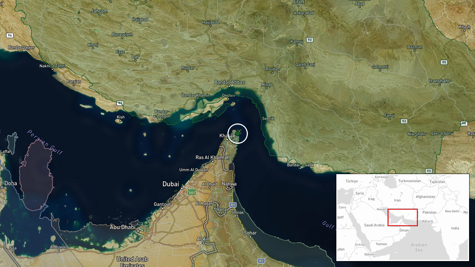
Strait of Hormuz, positioned at approximately 26.3°N, 56.46°E. The waterway separates Iran to the north from Oman and the United Arab Emirates to the south, forming the critical gateway between the Persian Gulf and Gulf of Oman. The report specifies the vessel sank south of the strait, placing the incident in the immediate approaches to international waters.
Related events nearby
- Iran's IRGC Navy reports container ship struck naval mine in Strait of Hormuz via unauthorized route. Three sa2026-10-14 09:39 UTC · Naval · Strait of Hormuz, Iran-Oman
- Iran reportedly struck a container vessel in the Strait of Hormuz. Limited details available; classification b2026-10-14 09:19 UTC · Naval · Strait of Hormuz, Iran-Oman
- Unidentified projectile struck a tanker transiting the Strait of Hormuz. UK Maritime Trade Operations confirme2026-10-13 19:11 UTC · Report · Strait of Hormuz, Persian Gulf
- U.S. Navy issued a warning to an unidentified vessel on VHF Ch-16 in the Strait of Hormuz, demanding it revers2026-10-13 12:54 UTC · Naval · Strait of Hormuz, Persian Gulf
- IRGC Navy released footage showing an oil tanker burning in the eastern Strait of Hormuz after Iranian strike.2026-10-13 14:36 UTC · Report · East of Strait of Hormuz, Persian Gulf
▶ View this event on the live map

Intel Mapper aggregates open-source reports from monitored Telegram and X channels, geolocates them, cross-checks duplicates across sources and assigns a confidence score. Entries are updated as new confirmations arrive. Read how we verify events.