IRGC claims two oil tankers disabled by mines in southern Strait of Hormuz
What happened
The Islamic Revolutionary Guard Corps (IRGC) claims that two oil tankers were set on fire and brought to a halt after striking naval mines it had planted in the southern Strait of Hormuz. The report was logged on 20 October 2026 at 09:48 UTC and is attributed to a Telegram channel, @ClashReport, and an X account, @Osint613. The original wording describes the vessels as having struck mines planted by the IRGC, and the event is classified as an explosion. No independent confirmation of the tankers' identities, the extent of damage, any casualties, or the cause of the fires has been published in the data available to this desk. The account therefore remains an unverified claim attributed to the IRGC rather than an established fact, and it is recorded here as the IRGC's assertion.
Context and assessment
The southern Strait of Hormuz is one of the world's most important oil chokepoints, a narrow passage linking the Persian Gulf with the Gulf of Oman and the wider Indian Ocean. Any incident there draws attention from shipping insurers, energy markets and naval forces well beyond the immediate area. The event sits within a cluster of activity reported over the previous two days. Roughly three hours earlier, at 06:08 UTC on 20 October, the IRGC claimed to have shot down a U.S. MQ-9 drone over the same waterway using a new air defense system, described as the 54th U.S. drone downed; that claim is also unverified. A separate report from 19 October, citing an intelligence assessment, said Iranian officials planned to keep oil prices elevated through attacks on shipping in and around the Strait. That assessment describes a stated motive rather than an observed action and should be read as such. Taken together, the reports suggest a pattern of claimed maritime and air incidents concentrated in one waterway, though the data does not establish coordination or confirm any single claim. Naval mines are a low-cost area-denial tool, so their reported use would point to an intent to deter or disrupt traffic rather than a targeted strike on a specific vessel. The claims are best monitored for corroboration from shipping data and maritime security agencies.
Sources and confidence
The report was carried by two channels: Telegram (@ClashReport) and X (@Osint613). Both are single-channel accounts, and the data does not show independent reporting from wire services, shipping authorities or government statements confirming the tankers, the fires or the mine strikes. The confidence score of 7.6 reflects two-source attribution and a claim that is specific but uncorroborated, with no first-hand observation identified. Confidence would rise with vessel tracking data showing disabled tankers, statements from flag states or operators, or maritime security advisories. It would fall if the vessels cannot be identified or if the claim is traced to a recycled earlier incident.
Location
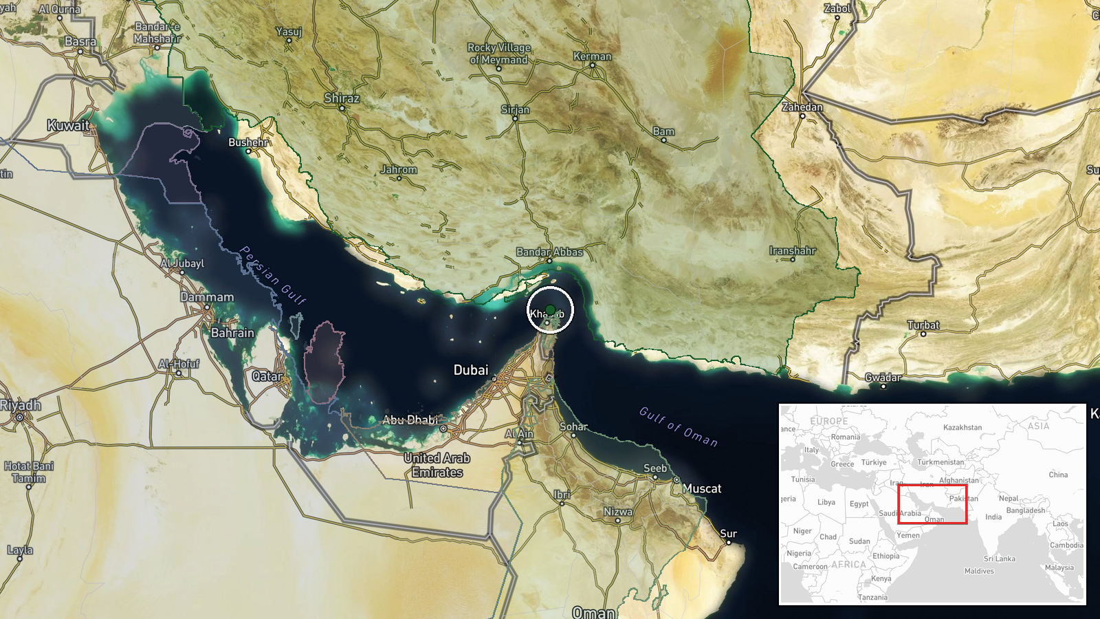
The location is recorded at region level rather than as a precise point, and location confidence is rated low. The coordinates, 26.4 N and 56.3 E, sit in the southern part of the Strait of Hormuz, a narrow waterway between the Iranian coast and Oman's Musandam Peninsula. Shipping lanes run through busy, relatively shallow waters, and the area lies on the approaches to the Gulf of Oman. No specific port, facility or settlement is named in the data.
Related events nearby
- IRGC claims it shot down a U.S. MQ-9 drone over the Strait of Hormuz using a new air defense system; claimed a2026-10-20 06:08 UTC · Drone Shootdown · Strait of Hormuz, Persian Gulf
- Intelligence assessment says Iranian officials plan to keep oil prices high through attacks on shipping in and2026-10-19 11:39 UTC · Report · Tehran, Iran
▶ View this event on the live map

Intel Mapper aggregates open-source reports from monitored Telegram and X channels, geolocates them, cross-checks duplicates across sources and assigns a confidence score. Entries are updated as new confirmations arrive. Read how we verify events.