Israel-backed Druze militia launches heaviest assault in months on Syrian forces near Sweida
What happened
An Israel-aligned Druze militia launched overnight attacks against Syrian government positions near Sweida, reportedly the heaviest such assault in recent months, with clashes continuing into Tuesday morning. Damascus accused Israel of backing the breakaway force. The escalation occurred as simultaneous Israeli military incursions were reported across southern Syria, and heavy clashes erupted on Sweida city's western outskirts, with power infrastructure damaged during the fighting.
Context and assessment
Sweida's strategic location in southwestern Syria, near the Israeli-occupied Golan Heights, has made it a recurring flashpoint. The Druze-majority governorate has experienced periodic tensions between local militias and central Syrian authorities since the civil war's evolution. This assault represents the most significant militia action in months and coincides with broader Israeli military activity across Daraa and Quneitra governorates on the same date, suggesting potential coordination or a broader operational push in southern Syria. The pattern indicates sustained pressure on Damascus's control over the southern border region and the role of non-state actors in fragmenting Syrian state authority.
Sources and confidence
Reported by Telegram channel ClashReport as primary source, with confidence score of 7.0 reflecting single-source reporting. Related events from the same date—including power outages in Sweida city, clashes on western outskirts, Israeli incursions in Daraa and Quneitra, and detention reports near Al-Rafid—provide corroborating context of coordinated activity. Confirmation from additional independent sources or Syrian state media would strengthen confidence; clarification of Israeli involvement claims would lower uncertainty.
Location
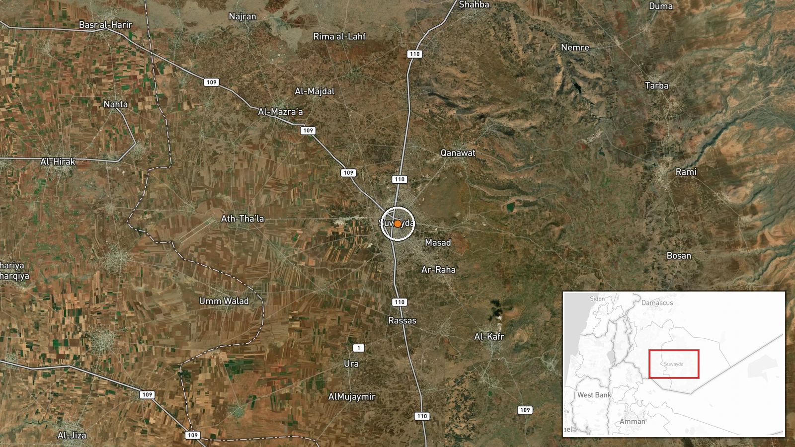
Sweida city and surrounding area in Sweida Governorate, southwestern Syria. Located approximately 40 kilometers south of Damascus and roughly 15 kilometers north of the Israeli-occupied Golan Heights. The governorate is bordered by Daraa to the north and west, making it part of Syria's critical southern border zone. Precise coordinates indicate the city center area where clashes and infrastructure damage were concentrated.
Related events nearby
- Sweida Electricity Company reports power outage affecting large sections of Sweida city and Shahba region due 2026-09-01 06:09 UTC · Security · Sweida City, Sweida Governorate, Syria
- Heavy clashes erupted on Sweida's western outskirts as Israel-backed Druze National Guard forces attacked HTS 2026-09-01 06:57 UTC · Combat · Sweida City western outskirts, Sweida Governorate,
- Israel conducted simultaneous military incursions in the Daraa and Quneitra governorates in southern Syria, ex2026-09-01 06:59 UTC · Combat · Daraa, Daraa Governorate, Syria
- Israeli occupation forces detained a shepherd during infiltration west of Al-Rafid village in southern Quneitr2026-09-01 08:10 UTC · Security · Al-Rafid, Quneitra Governorate, Syria
- Syrian Foreign Minister Asaad al-Shaybani announced direct commercial flights between Damascus and Copenhagen 2026-09-01 09:21 UTC · Diplomacy · Damascus, Syria
▶ View this event on the live map
Intel Mapper aggregates open-source reports from monitored Telegram and X channels, geolocates them, cross-checks duplicates across sources and assigns a confidence score. Entries are updated as new confirmations arrive. Read how we verify events.