Iran escalates anti-shipping campaign in Strait of Hormuz with weekly drone and missile strikes
What happened
Iran has sustained near-daily attacks on commercial shipping in the Strait of Hormuz since early August, reportedly launching approximately 30 drone attacks and 10 anti-ship missile strikes per week according to confidential data cited by The New York Times. At least four commercial vessels were struck in the ten days preceding the report, while British Navy monitoring documented at least 13 ships hit by projectiles or debris since September 10. The attacks continue despite reported recovery in Middle East oil exports.
Context and assessment
The Strait of Hormuz remains one of the world's most critical chokepoints, with roughly one-third of seaborne traded oil passing through its narrow waters. Iranian attacks on merchant shipping in this corridor have intensified notably since early August, correlating with broader regional tensions. Recent incidents on October 1 involving strikes on Liberian-flagged tankers and a fire-causing hit on a tanker reinforce an operational pattern of targeting commercial traffic regardless of flag state. The sustained weekly tempo—if sustained as reported—suggests either an organized campaign response to external pressures or a shift in Iranian naval doctrine toward commerce disruption. The attacks risk further destabilizing regional maritime trade and raising shipping insurance costs.
Sources and confidence
Reporting sourced primarily to confidential data shared with The New York Times and a single Telegram channel. British Navy Maritime Trade Operations provided independent confirmation of at least 13 strike incidents since September 10. The confidence score of 7.0 reflects reliance on single-source attribution for the weekly attack figures; cross-confirmation from additional official or independent maritime monitors would strengthen confidence. Official statements from Iranian or regional naval authorities would raise certainty; visual evidence of attack origins would lower ambiguity.
Location
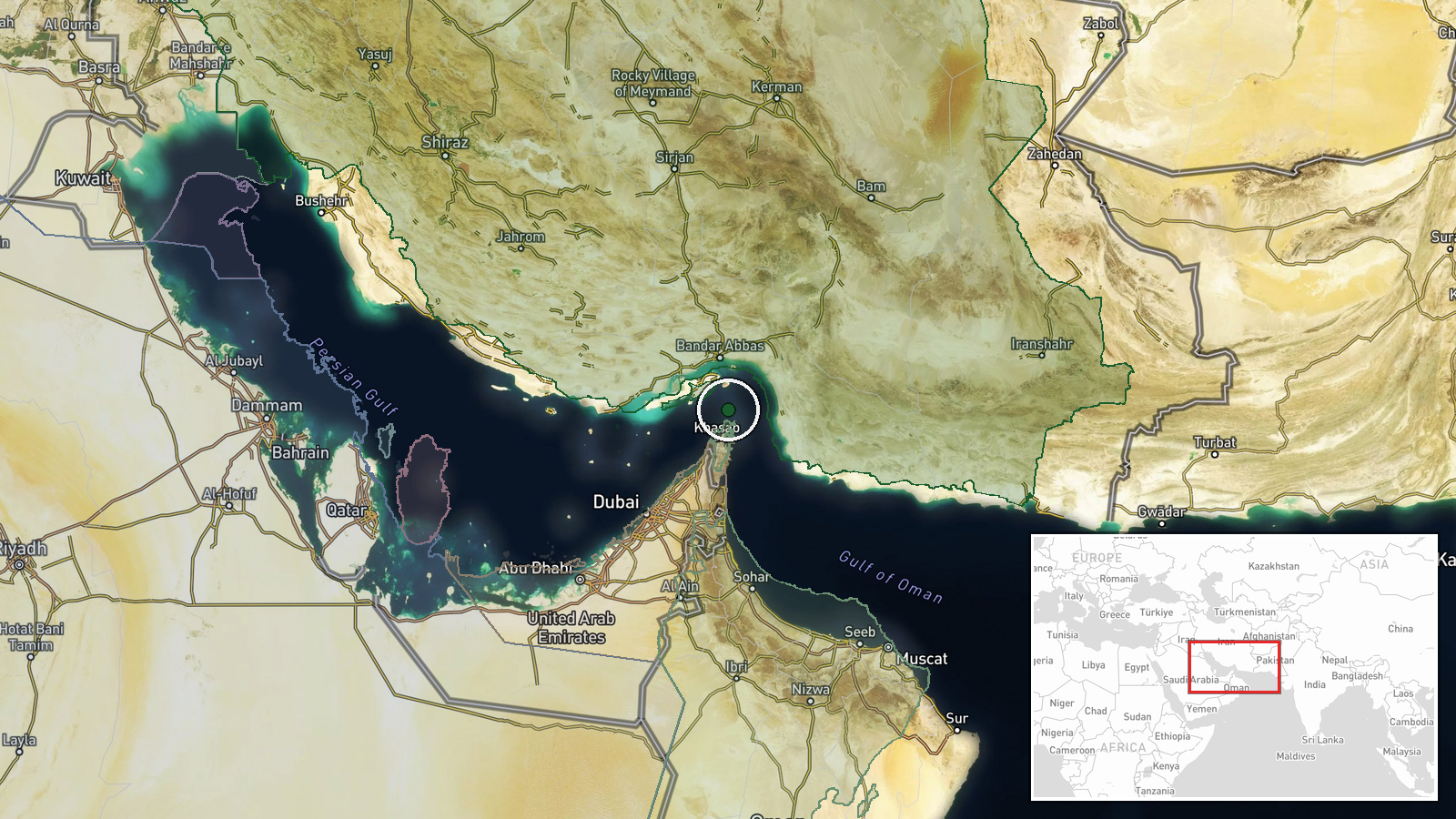
The Strait of Hormuz lies between Iran's southern coast and the Musandam Peninsula of Oman, forming the primary maritime gateway between the Persian Gulf and the Gulf of Oman. The waterway is approximately 21 miles wide at its narrowest point. Recent confirmed strikes have involved vessels in the central and northern transit lanes, typical routes for commercial traffic moving between Gulf oil terminals and international markets.
Related events nearby
- UK Maritime Trade Operations reported a tanker struck in the Strait of Hormuz, causing fire. Attribution and p2026-10-01 20:11 UTC · Ballistic Missile · Strait of Hormuz, Persian Gulf
- Three Liberian-flagged oil tankers (Al Ruwais, Mersin Prosperity, Sinbad) struck by unknown projectiles while 2026-10-01 12:26 UTC · Naval · Strait of Hormuz, Persian Gulf
▶ View this event on the live map
Intel Mapper aggregates open-source reports from monitored Telegram and X channels, geolocates them, cross-checks duplicates across sources and assigns a confidence score. Entries are updated as new confirmations arrive. Read how we verify events.