Tanker reports multiple explosions 60 nm south of Al Mukha in Red Sea
What happened
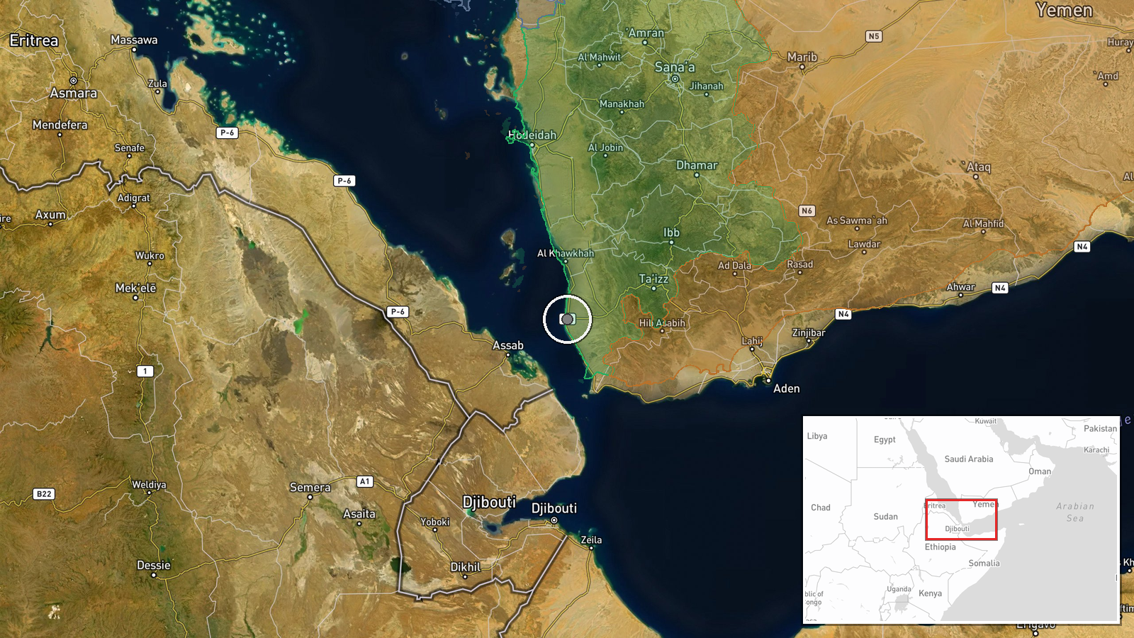
A tanker operating in the Red Sea reported multiple explosions in close proximity to the vessel approximately 60 nautical miles south of Al Mukha, Yemen, on 4 October 2026 at 19:03 UTC. The United Kingdom Maritime Trade Operations (UKMTO) relayed the report. The crew was reported safe with no environmental impact from the incident. The source of the explosions was not identified in the maritime notification.
Context and assessment
The Red Sea remains contested waters amid escalating Houthi (Ansar Allah) operations. On the same day, Houthi forces advanced near Taiz in southwestern Yemen and cut routes to Aden port, while seizing infrastructure in Ta'izz Governorate in a series of ground offensives. Maritime incidents in this corridor have been attributed to multiple actors, though recent patterns reflect Houthi capability and stated targeting of vessels. The incident occurs as the group consolidates territorial control in Yemen's west, potentially signaling expanded operational scope beyond land warfare.
Sources and confidence
Two Telegram channels—ClashReport and warmonitors—reported the incident via UKMTO notification. Source count of two and cross-channel confirmation provide moderate assurance, though both appear to cite the same maritime authority statement. Confidence score of 7.0 reflects the official UKMTO channel and crew safety confirmation. Identification of the actor and attack origin would substantially raise confidence; visual confirmation or additional maritime reports would strengthen assessment.
Location
The coordinates (13.32°N, 43.26°E) place the incident approximately 60 nautical miles south of Al Mukha in southwestern Yemen's coastal zone. Al Mukha is a historic Red Sea port in Taiz Governorate. The location represents open Red Sea waters in a strategically significant shipping lane linking the Bab el-Mandeb Strait to Indian Ocean routes.
Related events nearby
- Houthi forces advance near Taiz in southwestern Yemen and cut the route between Taiz city and Aden port. Saudi2026-10-04 16:40 UTC · Combat · Taiz, Yemen
- Houthi (Ansar Allah) forces expanded control (~92 km²) in the Ta'izz Governorate area per updated conflict con2026-10-04 05:55 UTC · Combat · Ta'izz Governorate
- Houthi (Ansar Allah) forces expanded control (~161 km²) in the Ta'izz Governorate area per updated conflict co2026-10-04 17:58 UTC · Combat · Ta'izz Governorate
- Houthi forces seized the residence of Yemeni Parliament Speaker Sultan al-Barakani in Al-Hawban, south of Taiz2026-10-04 12:27 UTC · Combat · Al-Hawban, Ta'izz Governorate, Yemen
▶ View this event on the live map
Intel Mapper aggregates open-source reports from monitored Telegram and X channels, geolocates them, cross-checks duplicates across sources and assigns a confidence score. Entries are updated as new confirmations arrive. Read how we verify events.