Ukraine strikes Russian fuel depot in Belgorod Oblast overnight
What happened
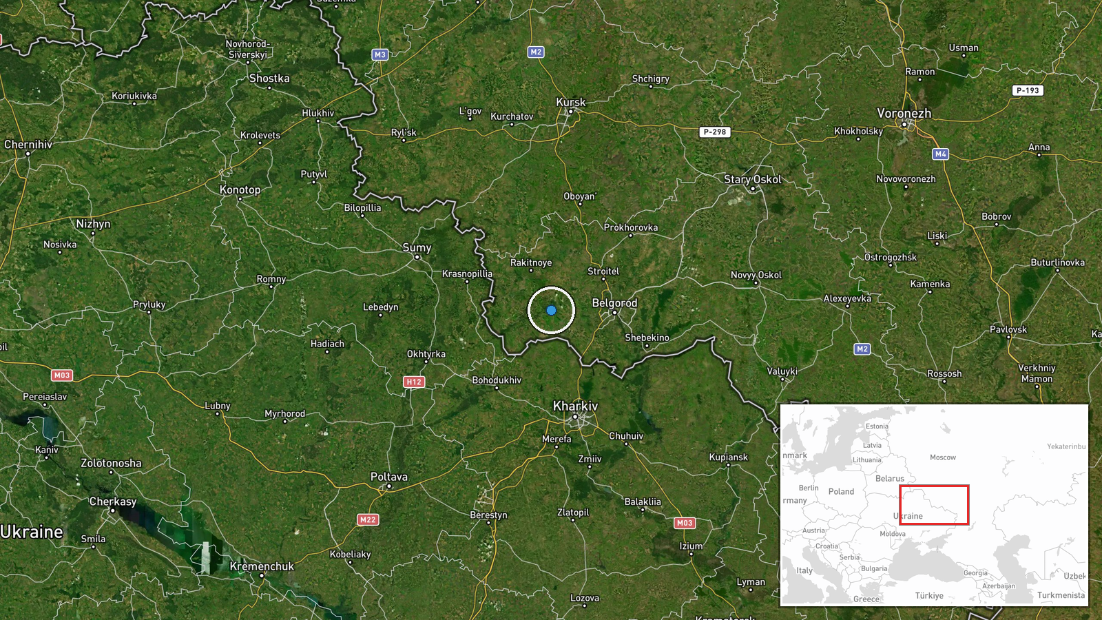
Ukrainian unmanned aerial systems struck a Russian fuel and lubricants depot in Borisivka, Belgorod Oblast during the night of 31 August to 1 September 2026, reportedly destroying enemy logistical supplies. The strike was confirmed by Ukraine's General Staff via Telegram. Borisivka lies approximately 40 kilometres north of the Ukrainian border in Russia's southwestern Belgorod region.
Context and assessment
The strike on Borisivka's fuel depot reflects Ukraine's sustained campaign against Russian rear-area logistics, critical to sustaining operations along the eastern front. This follows a UAS strike on 31 August against a Russian military communications node in nearby Zimovne, suggesting coordinated pressure on Russian command and supply infrastructure in Belgorod Oblast. Fuel depots are high-value targets; their destruction degrades Russian mechanised mobility and air operations. The pattern of strikes on communications and logistics nodes indicates Ukrainian forces are targeting command-and-control effectiveness alongside operational sustainment, potentially indicating preparation for localised initiatives or disruption of Russian coordination capacity.
Sources and confidence
Reported solely by Ukraine's General Staff via official Telegram channel. No independent verification or secondary source confirmation available. Confidence of 8.0 reflects official Ukrainian sourcing and high location precision, though single-source reporting limits corroboration. Confirmation from Russian sources, damage assessments, or third-party monitors would increase confidence; contradictory reports from Moscow would lower it.
Location
Borisivka is a settlement in Belgorod Oblast, located at coordinates 50.61°N, 36.01°E, approximately 40 kilometres north of the Ukrainian border. The settlement sits in flat agricultural terrain typical of southwestern Russia's borderlands. Precision is rated high based on settlement-level geolocation.
Related events nearby
- Ukrainian forces destroyed a Russian military communications node in Zimovne, Belgorod Oblast, Russia. Strike 2026-08-31 09:11 UTC · UAS Strike · Zimovne, Belgorod Oblast, Russia
▶ View this event on the live map
Intel Mapper aggregates open-source reports from monitored Telegram and X channels, geolocates them, cross-checks duplicates across sources and assigns a confidence score. Entries are updated as new confirmations arrive. Read how we verify events.