Ukraine strikes drone storage facility in Russian-held Donetsk city
What happened
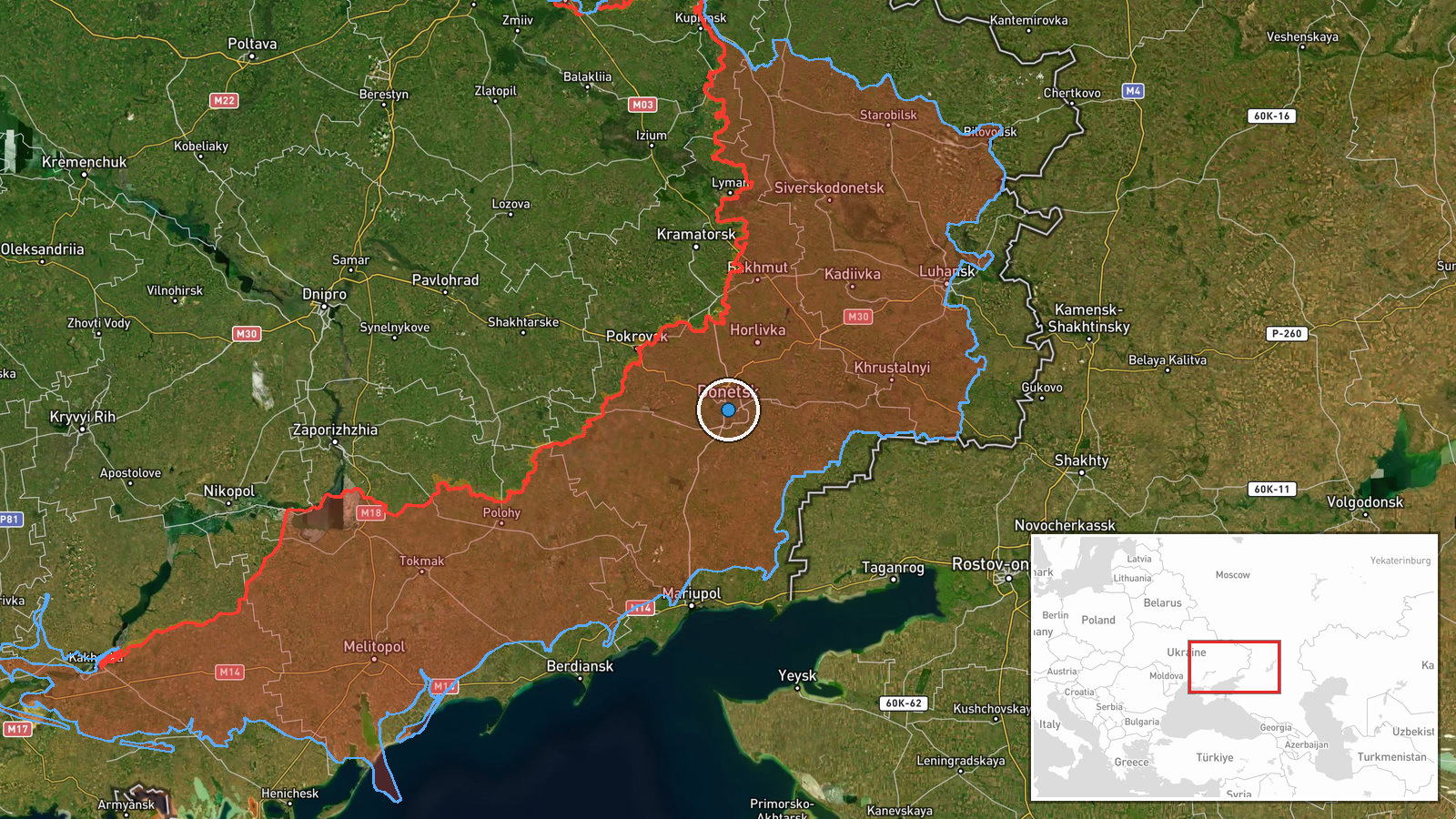
Ukrainian forces reportedly struck a facility in Donetsk city used by Russian forces for storing, preparing, and launching attack unmanned aerial systems, according to the General Staff of the Armed Forces of Ukraine. The strike occurred on 16 September 2026 at approximately 09:24 UTC. The facility's exact location within the city was not specified beyond the settlement-level designation.
Context and assessment
The strike fits an established Ukrainian campaign targeting Russian drone infrastructure, which has intensified as Moscow has deployed thousands of kamikaze drones daily. A similar facility in nearby Horlivka was struck the previous day. Russian forces conducted 106 airstrikes and deployed over 7,100 kamikaze drones on 16 September alone, underlining the operational significance of such supply nodes. Degrading these preparation and launch sites may hamper Russia's ability to sustain the volume of drone operations that have characterized recent months of the conflict. The targeting of Donetsk city, a Russian-held administrative center in eastern Ukraine, reflects Ukraine's strategy of striking deep into occupied territory.
Sources and confidence
Report sourced solely from Telegram channel of the Ukrainian General Staff (@GeneralStaffZSU). No independent cross-confirmation from other channels is recorded. Confidence score of 8.0 reflects the official status of the source and alignment with documented Ukrainian targeting patterns, but single-source reports carry inherent limitations. Corroboration from Russian military sources or geolocated imagery would strengthen confidence.
Location
Donetsk city, located at the administrative and industrial center of Donetsk Oblast in eastern Ukraine, currently under Russian control. Coordinates 48.0°N, 37.8°E indicate settlement-level precision. The city lies approximately 110 kilometers from the nearest Ukrainian-held territory and is a major Russian logistics and command hub.
Related events nearby
- Ukrainian forces destroyed a storage, preparation, and launch site for attack drones in the Donetsk city distr2026-09-15 10:05 UTC · UAS Strike · Horlivka, Donetsk Oblast, Russia-controlled
- Ukrainian special forces (SBS) released footage confirming the elimination of Russian Major General Anton Grun2026-09-16 08:39 UTC · Security · Bakhmut, Donetsk Oblast, Ukraine
- Ukrainian General Staff reports 278 combat engagements on day 1666 of the war. Russia conducted 106 airstrikes2026-09-16 05:05 UTC · Statement · Ukraine (Nationwide)
- Russian forces conducted 219 engagements across Ukraine on 15 September 2026. Attacks included 68 airstrikes, 2026-09-15 19:03 UTC · Combat · Eastern Ukraine, Ukraine
- Ukrainian forces struck an enemy ammunition depot in Dovzhansky, Luhansk Oblast. Facility reportedly contained2026-09-16 09:25 UTC · UAS Strike · Dovzhansky, Luhansk Oblast, Ukraine
▶ View this event on the live map
Intel Mapper aggregates open-source reports from monitored Telegram and X channels, geolocates them, cross-checks duplicates across sources and assigns a confidence score. Entries are updated as new confirmations arrive. Read how we verify events.