Ukrainian forces strike Russian telecoms hub in Makiivka, Donetsk
What happened
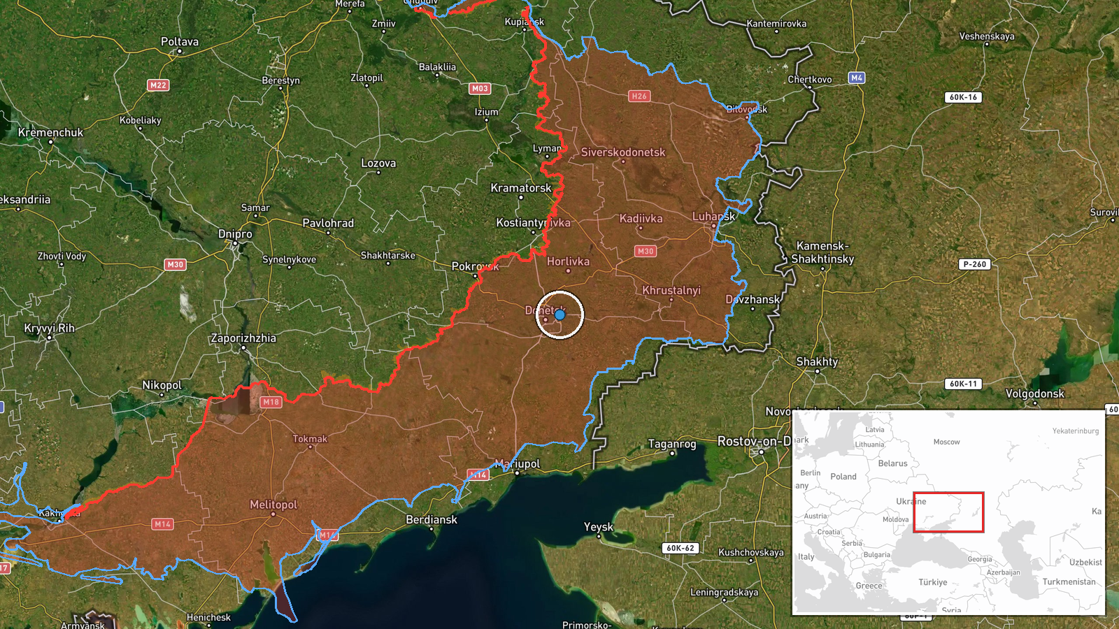
Ukraine's Defence Forces reportedly conducted an unmanned aerial system (UAS) strike against a Russian telecommunications facility in Makiivka, Donetsk Oblast, on October 5–6, 2026, according to the General Staff of the Armed Forces of Ukraine. The operation targeted critical communications infrastructure used by Russian forces in the region. No details on damage assessment or subsequent operational impact were provided in the initial report.
Context and assessment
Makiivka lies in Russian-controlled territory in central Donetsk Oblast, approximately 40 kilometers southwest of Donetsk city. Targeting enemy communications infrastructure reflects a sustained Ukrainian strategy to degrade Russian command-and-control capabilities across occupied sectors. The strike occurred amid a broader pattern of Ukrainian UAS operations, including a concurrent strike on Russian troop concentrations in the Sokologirsk area of Luhansk Oblast the same day. Disrupting telecommunications hubs can impede coordination of Russian forces across multiple sectors, though the durability of such effects depends on redundancy in Russian networks and repair timelines.
Sources and confidence
Report sourced solely from Telegram channel @GeneralStaffZSU, the official account of Ukraine's Defence Forces General Staff. Single-source reporting accounts for the confidence score of 8.0. Cross-confirmation from independent military monitors or Russian statements would strengthen confidence. The location precision is high based on stated coordinates in Makiivka.
Location
Makiivka, a city in central Donetsk Oblast, coordinates 48.04782°N, 37.92576°E. The facility's exact position within or near the city is indicated at regional precision level. Makiivka lies in Russian-controlled territory, roughly 40 kilometers southwest of Donetsk city and near the Donets River.
Related events nearby
- Ukrainian Defence Forces conducted a UAS strike on Russian troop concentrations in the Sokologirsk area, Luhan2026-10-06 09:24 UTC · UAS Strike · Sievierodonetsk, Luhansk Oblast, Ukraine
- Ukrainian air monitoring: Russian strategic bomber circling over Tsentralnyi; 2 Russian strategic bombers (Tu-2026-10-06 05:38 UTC · Combat Aircraft · Tsentralnyi, Ukraine
▶ View this event on the live map
Intel Mapper aggregates open-source reports from monitored Telegram and X channels, geolocates them, cross-checks duplicates across sources and assigns a confidence score. Entries are updated as new confirmations arrive. Read how we verify events.