Ukraine strikes Russian drone storage and launch facility in Donetsk
What happened
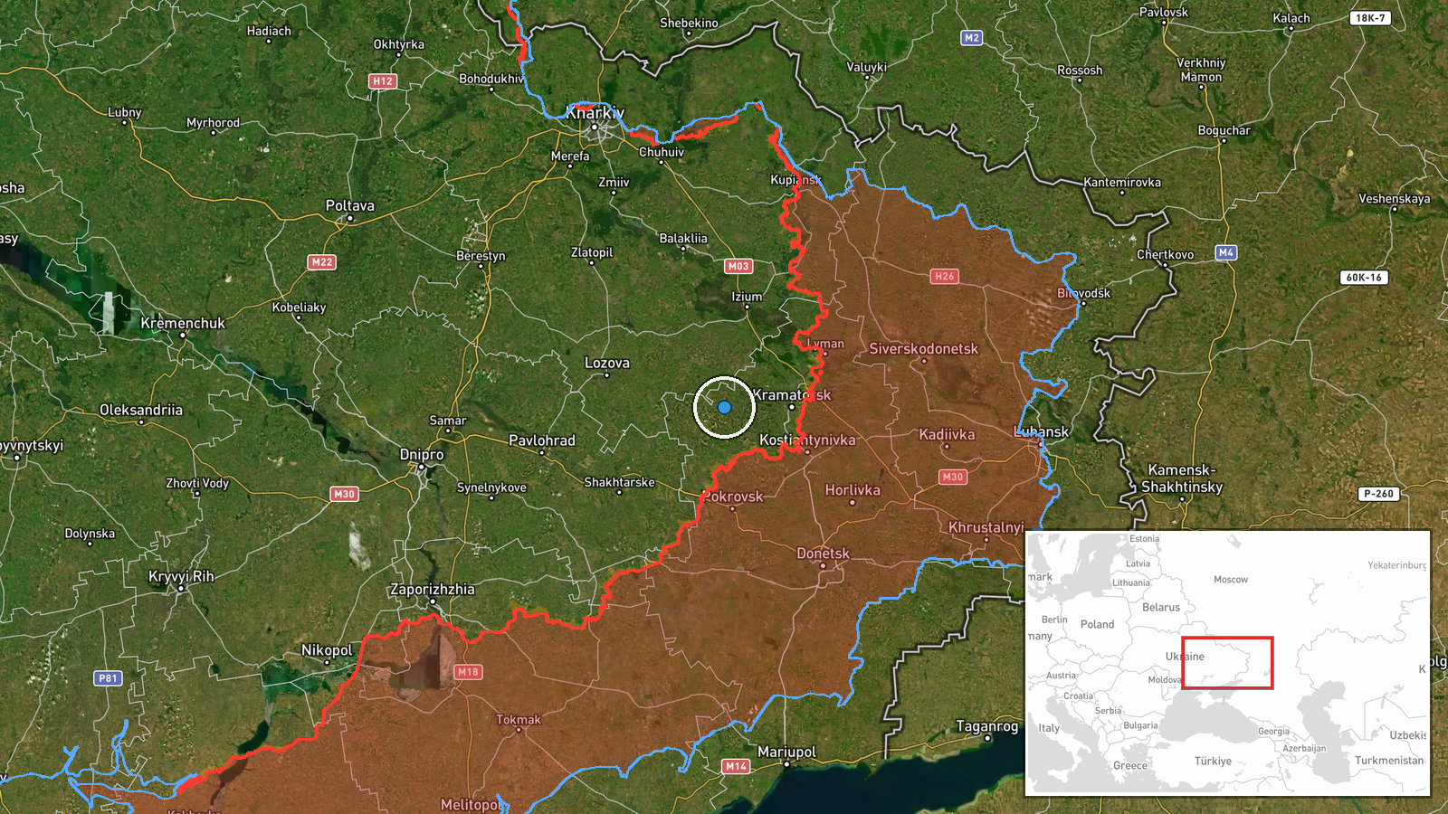
Ukrainian forces conducted a strike against a Russian facility in the Ocheretyne area of Donetsk Oblast on October 8, reportedly targeting a site used for storing, preparing, and launching attack unmanned aerial systems. The General Staff of the Armed Forces of Ukraine announced the operation, characterizing it as part of a systematic campaign to degrade Russia's capacity to conduct strikes against Ukrainian civilian infrastructure. The strike came hours after a Russian ballistic missile attack on a civilian bus in Kramatorsk that killed 33 people.
Context and assessment
Drone strikes on Ukrainian civilian infrastructure have intensified throughout the conflict, making Russian UAS facilities operationally significant targets. Ukraine has increasingly prioritized degrading Russia's strike capability through strikes on logistics and preparation sites rather than engaging systems in flight. The Ocheretyne area in central Donetsk has seen sustained Ukrainian operations; Ukrainian forces also reported striking a Russian command post in the same area on the same day. These strikes may indicate Ukrainian efforts to disrupt Russian operational tempo ahead of wider winter offensive activity or to exact attrition costs on Russian air assets.
Sources and confidence
Single source: Telegram channel of Ukraine's General Staff (@GeneralStaffZSU). No independent cross-confirmation available. Confidence score of 8.0 reflects official Ukrainian military channel status, consistent operational reporting pattern, and geographic specificity, but is tempered by lack of third-party verification or visual evidence in the provided data.
Location
Ocheretyne settlement, central Donetsk Oblast, eastern Ukraine. Located approximately 15 kilometers northwest of Donetsk city in an area of mixed forest and open terrain. Coordinates determined at regional precision level. The facility's specific position within the settlement or nearby area is not pinpointed in available data.
Related events nearby
- Ukrainian forces struck a Russian enemy command post (CP) in the Ocheretyne area, Donetsk Oblast. The operatio2026-10-08 13:09 UTC · Report · Ocheretyne, Donetsk Oblast, Ukraine
- Russian ballistic missile strike on a civilian bus in Kramatorsk killed 33 people and wounded 18. Fire erupted2026-10-08 10:30 UTC · Ballistic Missile · Bilenkе, Donetsk Oblast, Ukraine
- Ukrainian General Staff reports record casualty rates: Azov forces eliminated 1,000+ Russian personnel (702 KI2026-10-08 08:34 UTC · Report · Ukraine (Azov sector)
- Ukrainian General Staff operational update: 185 combat clashes across all fronts on Oct 7. Russia conducted 1 2026-10-07 19:24 UTC · Report · Ukraine (Eastern Front)
- Ukrainian forces report significant tactical disruption of Russian operations in the Lyman sector, causing wid2026-10-07 16:00 UTC · Combat · Lyman, Donetsk Oblast, Ukraine
▶ View this event on the live map
Intel Mapper aggregates open-source reports from monitored Telegram and X channels, geolocates them, cross-checks duplicates across sources and assigns a confidence score. Entries are updated as new confirmations arrive. Read how we verify events.