Ukraine's General Staff reports 8,784 kamikaze drones and 217 glide bombs in 24 hours
What happened
Ukraine's General Staff reported on Telegram that Russian forces carried out, over the previous 24 hours, one missile strike, 63 airstrikes, and 217 guided glide bombs. The statement also said Russia used 8,784 kamikaze drones and conducted 2,607 shellings of settlements and Ukrainian positions. The post was published on 20 October 2026 at 04:07 UTC and names no single location; the attacks are presented as a nationwide aggregate across the front and Ukrainian territory. These are the General Staff's own tallies and have not been independently verified. The original Ukrainian wording refers to strikes on settlements and positions of Ukrainian forces without naming specific targets, casualties, or damage.
Context and assessment
The figures matter less for any one place than for the scale they imply. The 8,784 drone count is far larger than the 269 Shahed-type drones cited in the overnight attack of 19 October, which also included Iskander-M, S-400 and Iskander-K missiles, suggesting the tally includes drones used across the whole front and not only long-range launches. The same day's related reports describe more than 10 energy facilities damaged in an overnight attack, and a separate report from 18 October gives a 90.28 percent interception rate for 463 strike drones, meaning roughly 45 drones got through on that day. Taken together, the pattern points to sustained pressure on both frontline positions and rear infrastructure. The 217 guided glide bombs and 63 airstrikes are typically associated with support of ground operations near the front, though the report does not say so directly. A reported drone tracked near Irdyn in Cherkasy Oblast, heading west, indicates that long-range drone activity extends well into central Ukraine. Operationally, such high daily volumes may be intended to saturate air defenses and sustain attrition, but that interpretation remains a hedged inference rather than something the source states.
Sources and confidence
The report rests on a single Telegram channel, the official General Staff account, and no second source in the data corroborates this specific tally. Official military statistics from Ukraine have a consistent daily cadence and are generally treated as a useful but partisan record, which supports a fairly high confidence score of 8.0. The score is held below the maximum because the figures are aggregate, unlocated, and unverified by independent monitors. Related events from 18 and 19 October share the same broad picture but come from separate reports and do not confirm these exact totals. Confidence would rise with corroboration from the Ukrainian Air Force, independent open-source monitors, or wire agencies that cite the same numbers, and would fall if the figures were revised or contradicted.
Location
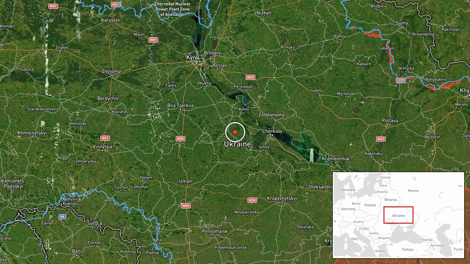
This event has region-level precision and no specific settlement or facility is named. The coordinates, 49.487 N and 31.272 E, are a placeholder point in central Ukraine that represents the country as a whole rather than a strike site. The setting is the broad central Ukrainian plain, with the Dnipro River system lying to the east of the point. The Cherkasy Oblast location referenced in a related drone report is in the same general area but is not the subject of this event.
Related events nearby
- Ukrainian military conscription officers reportedly dragged a man across a vehicle's hood during a mobilizatio2026-10-19 09:19 UTC · Security · Ukraine
- Zelensky says over 10 energy facilities were damaged in a Russian overnight attack; Ukrainian power outages re2026-10-19 08:32 UTC · Combat · Ukraine
- Overnight Russian attack: Iskander-M/S-400 ballistic and Iskander-K cruise missiles plus 269 Shahed-type drone2026-10-19 06:08 UTC · Ballistic Missile · Ukraine
- Ukrainian air monitoring: one Russian jet-powered Shahed (Geran-3) drone tracked near Irdyn, Cherkasy Oblast, 2026-10-19 17:29 UTC · Drone Transit · Irdyn, Ukraine
- Ukrainian air defense downed 418 of 463 Russian strike drones (Shahed, Parodiya, Gerbera, Banderol, Italmas) o2026-10-19 15:02 UTC · Air Defense · Ukraine (location not reported)
▶ View this event on the live map

Intel Mapper aggregates open-source reports from monitored Telegram and X channels, geolocates them, cross-checks duplicates across sources and assigns a confidence score. Entries are updated as new confirmations arrive. Read how we verify events.