Russian Geran-3 jet drone tracked near Irdyn in Cherkasy Oblast, heading west
What happened
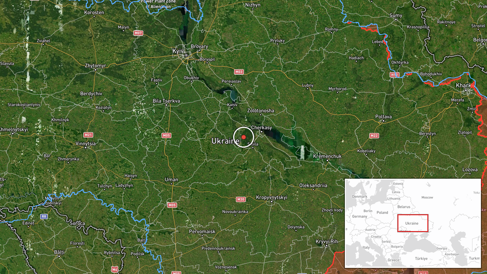
Ukrainian air monitoring reported through the Telegram channel @kpszsu that a single Russian jet-powered Shahed, identified as a Geran-3, was tracked in the Irdyn area of Cherkasy Oblast in central Ukraine, flying on a western heading. The alert was posted at 17:29 UTC on October 19, 2026. The original Ukrainian wording describes a jet-powered UAV ('Реактивний БпЛА') near Irdyn on a western course. The report is a brief tracking notice. It does not describe any impact, damage, casualties, or intended target. The event is classified as a drone transit, meaning it records movement through the area rather than a confirmed strike on a specific site. The available details are limited to a settlement-level position and a direction of travel.
Context and assessment
Irdyn lies within Cherkasy Oblast, a central Ukrainian region on the right bank of the Dnipro, which sits along the flight paths that Russian long-range drones have used to cross from the east and north toward western Ukraine. The related events show a sequence over the same oblast on October 19. Early that morning, at 07:26, two or more Geran-3 drones were reported passing through heading west. At 15:54 a single Geran-3 was reported passing and heading northwest, and at 16:00 another was reported moving from Poltava Oblast toward Cherkasy Oblast. The Irdyn sighting at 17:29 fits that pattern of repeated transits across the same corridor. The day before, on October 18, Ukrainian air defense reportedly downed 418 of 463 Russian strike drones, a 90.28 percent interception rate, and separate preliminary reporting described Banderol mini cruise missiles without a stated location. Taken together, the sequence suggests that drones were moving through central Ukraine along multiple routes during a single day. It does not on its own indicate that Cherkasy Oblast or Irdyn was the destination. Repeated transits can reflect routing toward targets farther west, or drones being tracked as they change course.
Sources and confidence
The report comes from a single Telegram channel, @kpszsu, which carries Ukrainian air monitoring updates. No second independent channel, official statement, or media outlet is listed as reporting the same track. The score of 8.0 reflects that the channel is an official-style air monitoring source with a consistent record of tracking notices, and that the location is precise at the settlement level. It is held below the maximum because the event is not cross-confirmed and the notice gives no impact or follow-up information. Confidence would rise if other monitoring channels or regional military administrations corroborated the track, or if later reporting confirmed the drone's path. It would fall if the track were revised, retracted, or attributed to a different aircraft.
Location
The location was taken from the settlement name Irdyn given in the monitoring post, so the coordinates reflect a settlement-level point rather than an exact site. Its high location confidence reflects a named community, although the precise position of the drone at the time of the notice is not recorded. Cherkasy Oblast is mainly flat to gently rolling terrain of the Dnipro basin, with farmland, forest belts, and river valleys. The Dnipro is the dominant waterway in the broader region. Notable features nearby are chiefly agricultural land and rural road and rail links, and the area sits between Poltava Oblast to the east and the western parts of central Ukraine.
Related events nearby
- Ukrainian air defense downed 418 of 463 Russian strike drones (Shahed, Parodiya, Gerbera, Banderol, Italmas) o2026-10-19 15:02 UTC · Air Defense · Ukraine (location not reported)
- Ukrainian air monitoring preliminary reconnaissance on Russian Banderol mini cruise missiles; no specific loca2026-10-18 19:45 UTC · Cruise Missile · Ukraine (location not reported)
- Ukrainian air monitoring: 1 Russian jet-powered Shahed (Geran-3) drone from Poltava Oblast toward Cherkasy Obl2026-10-19 16:00 UTC · Drone Transit · Cherkasy Oblast, Ukraine
- Ukrainian air monitoring: 1 Russian jet-powered Shahed (Geran-3) drone passing Cherkasy Oblast, heading northw2026-10-19 15:54 UTC · Drone Transit · Cherkasy Oblast, Ukraine
- Ukrainian air monitoring: 2+ Russian jet-powered Shahed (Geran-3) drones passing Cherkasy Oblast, heading west2026-10-19 07:26 UTC · Drone Transit · Cherkasy Oblast, Ukraine
▶ View this event on the live map

Intel Mapper aggregates open-source reports from monitored Telegram and X channels, geolocates them, cross-checks duplicates across sources and assigns a confidence score. Entries are updated as new confirmations arrive. Read how we verify events.