Ukraine reports one Russian assault near Mykolaivka repelled; no assaults on Kramatorsk axis
What happened
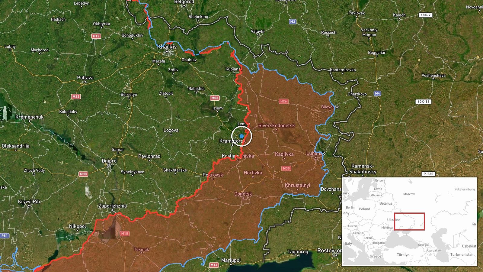
On 21 October 2026, at 19:04 UTC, Ukraine's General Staff reported through its Telegram channel that Ukrainian forces on the Sloviansk axis in Donetsk Oblast had stopped one Russian attempt to advance toward Mykolaivka, a settlement in the oblast. The Ukrainian-language statement also said that on the Kramatorsk axis the enemy conducted no assault actions. The report comes from a single channel and is a Ukrainian military claim, so the account of a repelled assault has not been independently confirmed. The text gives no casualty figures, equipment losses, attacker numbers, or engagement timing beyond the publication time. The event is classified as combat, with Ukraine listed as the actor.
Context and assessment
Mykolaivka sits on the approaches to the Sloviansk and Kramatorsk area, the largest urban cluster still under Ukrainian control in northern Donetsk Oblast, so reported pressure there carries weight beyond the village itself. The same General Staff feed carried several related reports on the same day. It described six Russian assault attempts on the Kostiantynivka axis, all repelled, and separately counted 37 attacks on that axis with pressure toward Novopavlivka, Novoselivka and Dobropillia. It also reported 19 attacks on the Pokrovsk direction, with assaults near Sofiivka, Dobropillia and Bilytske. A single-source report described a National Guard unit, 2nd Corps Khartiia, reportedly infiltrating Russian positions near Kostiantynivka. Taken together, the pattern suggests Russian forces applying pressure along several axes at once rather than concentrating on a single breakthrough. The absence of assaults on the Kramatorsk axis may indicate a shift in emphasis, or it may reflect what the General Staff chose to report. Those readings cannot be separated from one day of data.
Sources and confidence
The event rests on one Telegram channel, the official General Staff account (@GeneralStaffZSU), giving a source count of one and a confidence score of 8.0. The channel has institutional standing, and its related reports are internally consistent, but it is a belligerent's own claim and it does not provide corroborating footage, maps or casualty details. No independent geolocated imagery, Russian defence ministry statement or local witness account is attached. Confidence would rise with geolocated video or satellite imagery of the engagement, a Russian statement acknowledging fighting near Mykolaivka, or independent frontline analysis. It would fall if other reporting described different front-line conditions or contradicted the claim of a repelled assault.
Location
The event is placed at Mykolaivka in Donetsk Oblast at settlement-level precision, with coordinates of 48.8619 N, 37.7683 E and normal location confidence. Several settlements share the name across Ukraine, so the oblast and the Sloviansk axis reference are what tie this one to the report. The surrounding terrain is largely open steppe and farmland cut by river valleys and small water bodies in the wider Sloviansk area. Those features shape movement and defensive positions in the district.
Related events nearby
- Ukrainian General Staff reports six Russian assault attempts on the Kostiantynivka axis near Kostiantynivka an2026-10-21 19:05 UTC · Combat · Kostiantynivka, Donetsk, Ukraine
- Ukraine's 2nd Corps Khartiia (National Guard) reportedly infiltrated Russian positions through underground pip2026-10-21 09:04 UTC · Combat · Near Kostyantynivka, Donetsk, Ukraine (front line,
- Ukrainian air monitoring: 1 Russian guided glide bomb (KAB) heading toward Donetsk Oblast.2026-10-21 18:56 UTC · Airstrike · Donetsk Oblast, Ukraine
- Ukrainian General Staff reports 37 Russian attacks on the Kostiantynivka axis, with offensive pressure toward 2026-10-21 05:05 UTC · Combat · Dobropillia, Donetsk, Ukraine
- Ukrainian General Staff reports 19 Russian attacks on the Pokrovsk direction, with assaults near Sofiivka, Dob2026-10-21 19:05 UTC · Combat · Dobropillia, Donetsk Oblast, Ukraine
▶ View this event on the live map

Intel Mapper aggregates open-source reports from monitored Telegram and X channels, geolocates them, cross-checks duplicates across sources and assigns a confidence score. Entries are updated as new confirmations arrive. Read how we verify events.