Sudan air defense reportedly downs unidentified drone near Bakuri, Blue Nile State
What happened
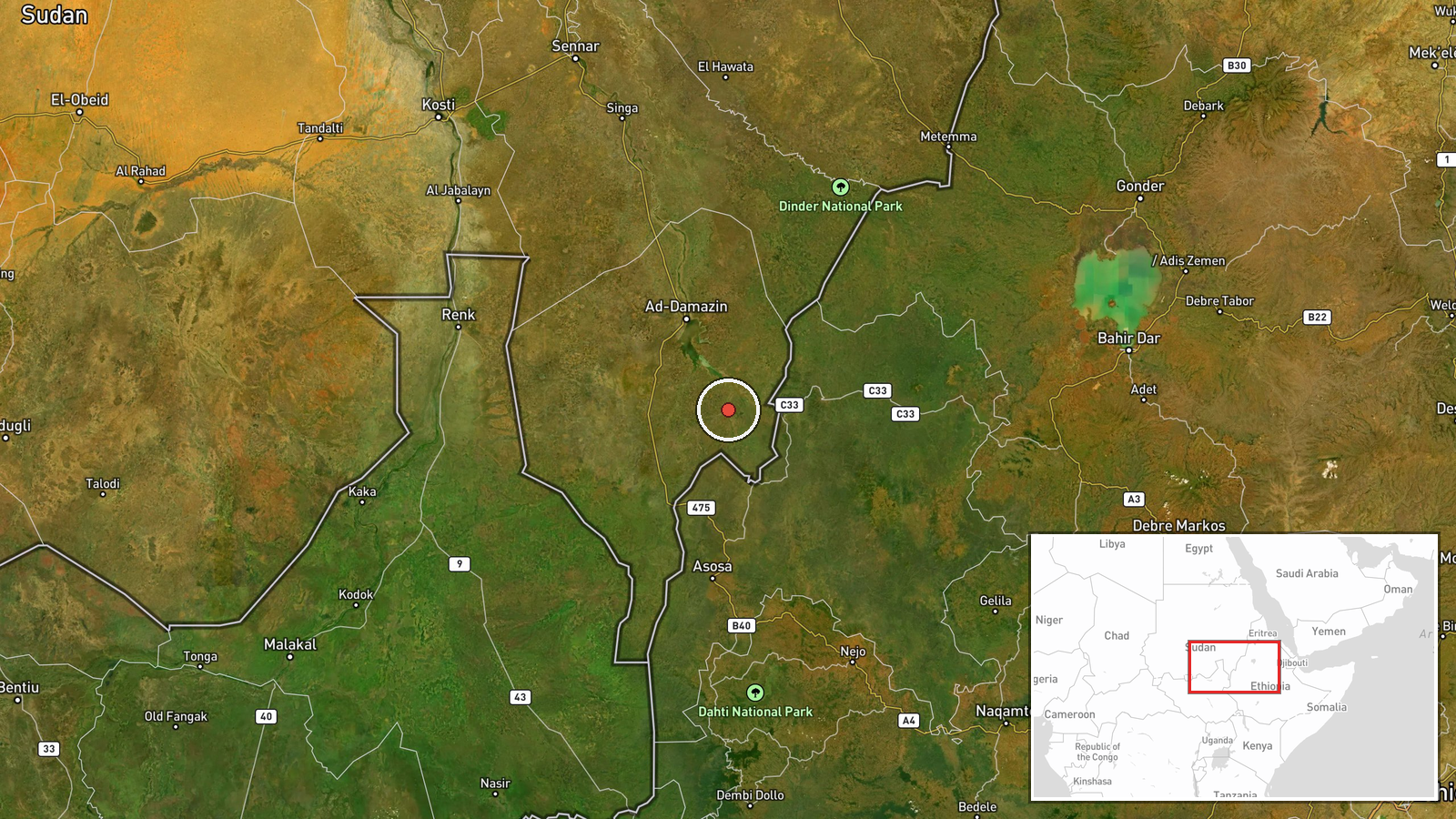
A Telegram channel, @arabicafrica, reported that Sudanese air defense units shot down an unidentified drone near Bakuri in Blue Nile State on the morning of 22 October 2026. The post, in Russian, attributes the account to a representative of the Sudanese army, Asim Awad, and states that the drone had crossed into Sudan's territory from Ethiopia. The wording says the operator of the aircraft is not reported, so who flew it and for what purpose remain unknown. The report gives no details on the drone's type, the number of aircraft involved, or any damage or casualties on the ground. The event is logged at 18:50 UTC on the same date. No independent footage or statement from another party has been identified in the data supplied for this event.
Context and assessment
Bakuri sits in Blue Nile State, a southeastern front that has drawn growing attention in Sudan's war between the Sudanese Armed Forces (SAF) and the Rapid Support Forces (RSF). A related event logged one minute earlier, at 18:49 UTC, reportedly describes the army regaining control of Bakuri and Akleili and pursuing RSF fighters after inflicting heavy losses. If accurate, the drone shootdown falls during or immediately after a contested ground movement in the same area, which may be why air defenses were active. Blue Nile's border with Ethiopia gives any aircraft crossing from that direction a short path into Sudanese airspace, and the report's account of a drone entering from Ethiopia suggests that frontier is now part of the aerial picture. Operationally, the event may indicate that SAF units are concerned about unmanned surveillance or strike activity in the sector, and that air defense is being used against small aerial targets as well as conventional aircraft. Nothing in the available data identifies the drone's owner, so it would be speculative to link it to either side or to any foreign backer. The single-source nature of the report also means the wider significance remains uncertain.
Sources and confidence
The event rests on a single Telegram channel, @arabicafrica, with no cross-confirmation from a second outlet, official SAF publication, or Ethiopian authority in the data provided. The channel's post attributes the claim to an army representative, but the attribution is secondhand and no statement is quoted independently. The confidence score of 5.5 is low, reflecting the single source, the absence of imagery, and the unknown operator. The score would rise with a direct SAF statement, wreckage or launch imagery, geolocated video, or reporting from Ethiopian or regional outlets. It would fall if the channel retracted the claim or if later reporting found the incident could not be verified.
Location
The location is recorded at settlement precision, with coordinates of about 11.2 N, 34.65 E, placing the point at the village of Bakuri rather than a specific facility. Blue Nile State lies in southeastern Sudan along the border with Ethiopia. The terrain is largely savanna and low hills, with the Blue Nile river system to the west, though the exact distance from the border is approximate. The coordinates should be treated as the settlement centre rather than the precise point where the drone was engaged.
Related events nearby
- Sudanese army reportedly regained control of Bakuri and Akleili in southeastern Blue Nile state, inflicting he2026-10-22 18:49 UTC · Capture · Bakuri, Blue Nile State, Sudan
- RSF claims its Tasis Forces seized tanks and heavy weapons from SAF (the 'Muslim Brotherhood Army') in Blue Ni2026-10-22 19:56 UTC · Report · Blue Nile State, Sudan
▶ View this event on the live map

Intel Mapper aggregates open-source reports from monitored Telegram and X channels, geolocates them, cross-checks duplicates across sources and assigns a confidence score. Entries are updated as new confirmations arrive. Read how we verify events.