Two Myanmar junta soldiers reportedly killed in clash near Sun Lan village, Tamu Township
What happened
A Telegram report from BNI Online, a Burmese-language news outlet, states that a clash took place near Sun Lan village in Tamu Township, Sagaing Region, Myanmar, leaving two soldiers of the military junta dead. The report is written in Burmese and links to a full article on the outlet's website. The event data does not describe the size of the forces involved, the weapons used, or the specific unit affected. The attacking side is recorded as resistance forces, a broad label covering the anti-junta groups active in the area. The event is logged for 16 October 2026 at 14:35 UTC. No second source was attached when the event was recorded.
Context and assessment
Tamu is a border town in northwestern Sagaing Region, facing the Indian town of Moreh, and it sits on a main land route between Myanmar and India. Control of the Tamu area matters to both junta forces and their opponents because it shapes access to cross-border trade, a source of revenue and supplies. Two related items from the same period point toward that economic dimension. A Burmese-language Telegram report says a bombing-hit Indian market in the Myanmar-India border trade zone has closed, leaving regional trade flow nearly halted. It is logged about eight hours after the clash. A separate DVB survivor account, logged the following morning, describes residents who knew an aircraft was approaching and then lost consciousness from fear as it neared. That account gives no location or casualty figures, and the record's suggestion that it was likely a junta aircraft should be treated as provisional. Taken together, the items suggest fighting along the border belt may be overlapping with trade disruption and air activity. The sources do not, however, establish a direct operational link between the Sun Lan clash and either the market incident or the airstrike.
Sources and confidence
The clash rests on a single channel, the Telegram account of BNI Online, which links to its own article. No second outlet, monitoring group or official statement is listed, so cross-confirmation is absent. The confidence score of 6.6 out of 10 reflects a single-source report with a specific casualty figure but no named unit, no independent verification, and a location recorded only at region level. Confidence would rise if another Burmese outlet, a local media group or a monitoring organisation reported the same deaths, or if a resistance group or local administration confirmed the clash. It would fall if the outlet amended or withdrew the report, or if no further mention appeared.
Location
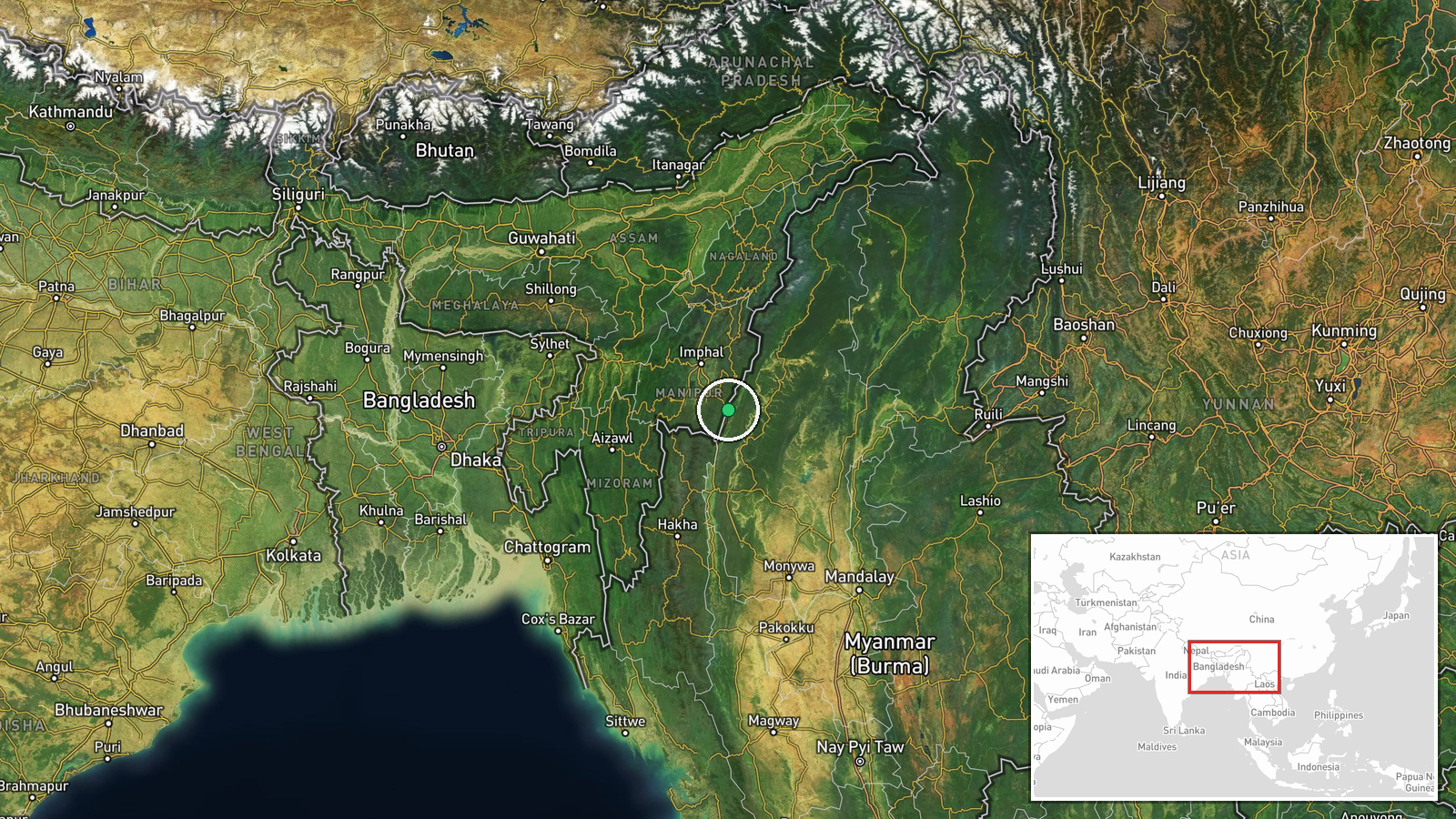
The location is recorded only at region level, with coordinates of 24.23 N, 94.30 E. These place the point within Tamu Township rather than at the village itself, and the location confidence is rated low. Sun Lan village has no verified position in the data, so the map marker should be read as approximate. Tamu lies in northwestern Sagaing Region, in hilly, forested terrain along the Indo-Myanmar frontier, near the Kabaw Valley and the Moreh crossing on the Indian side. The border road and trade corridor are the most notable nearby features.
Related events nearby
- Bombing-hit Indian market closed, leaving regional trade flow nearly halted, per Burmese-language Telegram rep2026-10-16 22:25 UTC · Report · Myanmar-India border trade zone, Myanmar
- DVB survivor account: residents knew an aircraft was approaching, then lost consciousness from fear as it near2026-10-17 08:33 UTC · Airstrike · Myanmar (location not reported)
▶ View this event on the live map

Intel Mapper aggregates open-source reports from monitored Telegram and X channels, geolocates them, cross-checks duplicates across sources and assigns a confidence score. Entries are updated as new confirmations arrive. Read how we verify events.