Myanmar survivor account describes air attack; location and casualties unconfirmed
What happened
A single Telegram channel, DVB Digital (@dvbtvnews), published a survivor account on 17 October 2026, reported as 3 p.m. local time, which corresponds to 08:33 UTC in the event record. The post, written in Burmese, quotes a resident saying people knew an aircraft was approaching and that, as it came close, they lost consciousness out of fear. The text does not name the village or town, the number of people affected, or the type of aircraft. No casualties are stated. The event is categorized as an airstrike and attributed to the Myanmar junta, but that attribution rests on the framing of the account and on the broader pattern of air operations in the country rather than on a named aircraft or a military statement. The account describes the moments before impact but offers no direct description of damage or injury.
Context and assessment
Myanmar's conflict since the 2021 military takeover has included frequent air attacks on towns and villages in areas contested by People's Defence Forces and ethnic armed organisations, and the Sagaing Region has been one of the most affected zones. Several related events from the same period point to activity in the northwest. On 16 October, a clash near Sun Lan village in Tamu Township, Sagaing Region, reportedly left two junta soldiers dead, according to a Telegram report from BNI Online. Tamu sits on a key trade corridor to India, and a separate Telegram report from the Myanmar-India border trade zone said a bombing-hit Indian market had closed, leaving regional trade nearly halted. A police arrest reportedly involving the founder of the Pyo Hap movement was reported the following day. These events are not confirmed as connected to the airstrike, and their locations differ. Operationally, the pattern may suggest that air power is being used where ground control is contested, and that border commerce is becoming a secondary casualty of fighting along trade routes. Such a reading remains tentative and should be treated as a hypothesis rather than an established trend.
Sources and confidence
This event rests on one source, a DVB Digital post on Telegram, which is a Burmese-language channel tied to an established exile broadcaster with a record of covering the conflict. No second outlet has independently reported the same incident in the available data, and the account contains no named place, casualty figure, or visual evidence. The confidence score of 6.5 reflects a credible outlet with a plausible account, offset by the absence of corroboration and specifics. Confidence would rise with a second independent report, a named settlement, local or medical reporting of casualties, or imagery. It would fall if other outlets dispute the event or if no further reporting emerges.
Location
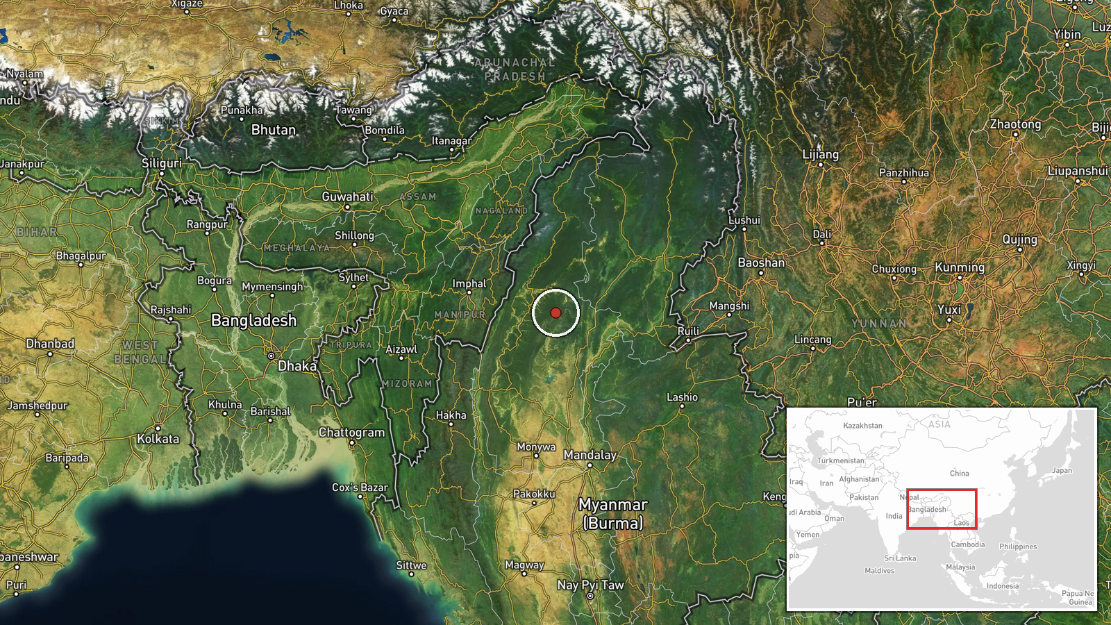
The source does not report a location. The coordinates are a regional-level approximation with low confidence, not a verified settlement or facility, and should not be read as the strike site. The point falls in northwestern Myanmar, in the broader Sagaing Region belt near the Indian border, an area of hill ranges and river valleys, including the Chindwin basin. Because the placement is approximate, nearby features are context only.
Related events nearby
- Founder of the 'Pyo Hap' (ပိုးဟပ်) movement reportedly arrested by Myanmar security forces; location and detai2026-10-17 12:10 UTC · Police Operation · Myanmar (location not reported)
- Bombing-hit Indian market closed, leaving regional trade flow nearly halted, per Burmese-language Telegram rep2026-10-16 22:25 UTC · Report · Myanmar-India border trade zone, Myanmar
- Clash near Sun Lan village in Tamu Township left two Myanmar junta soldiers dead, per Telegram report from BNI2026-10-16 14:35 UTC · Combat · Sun Lan village, Tamu Township, Sagaing Region, My
▶ View this event on the live map

Intel Mapper aggregates open-source reports from monitored Telegram and X channels, geolocates them, cross-checks duplicates across sources and assigns a confidence score. Entries are updated as new confirmations arrive. Read how we verify events.