KIA-led joint forces reportedly seize two SNA camps in Myanmar as heavy fighting continues
What happened
A Telegram channel, @bnionline, which publishes under the name BNI, reported on 20 October 2026 at 14:01 UTC that joint forces of the Kachin Independence Army (KIA) had seized two camps belonging to the SNA. The report says heavy fighting is ongoing. The original post is in Burmese, and the English summary is a translation of its headline. The post does not name the camps, identify the settlements where they stand, give the size of the forces involved, or report any casualty figures. The location is recorded only as Myanmar, so the event is mapped at regional precision.
Context and assessment
Myanmar has been in armed conflict since the military seized power in February 2021, and the KIA is one of the most capable ethnic armed organizations fighting the junta, with strongholds in Kachin State and influence along the northern Shan border. Control of camps in this area would matter for supply routes, border crossings and the wider contest over northern Shan State. Several related reports from the same day point to a busy operational picture. A separate report describes an anti-junta ambush that killed one Tatmadaw soldier, with a fighter reportedly using a domestic MA-3 MK II carbine. Other reports describe arrests of drug users by Pa-O resistance forces and an armed robbery in Lashio, a northern Shan town. A BNI analysis from the previous day describes expanding military movements, but its body text was not accessible and its details remain unverified. If the camp seizures are confirmed, they could indicate sustained pressure on junta-aligned positions, though the data alone does not show whether this is a planned offensive or a local engagement.
Sources and confidence
All information comes from a single Telegram channel, @bnionline, and no independent outlet in the data reports the seizures. The post is in Burmese and contains no imagery or named locations that could be checked. The confidence score of 6.6 reflects these factors: the channel is a known regional outlet, but the event is single-sourced and unverified, so the score is moderate to low. Confidence would rise with independent reporting from other Myanmar outlets, KIA or junta statements, geolocated imagery, or named camps. It would fall if other sources contradict the account or if later reporting does not confirm the seizures.
Location
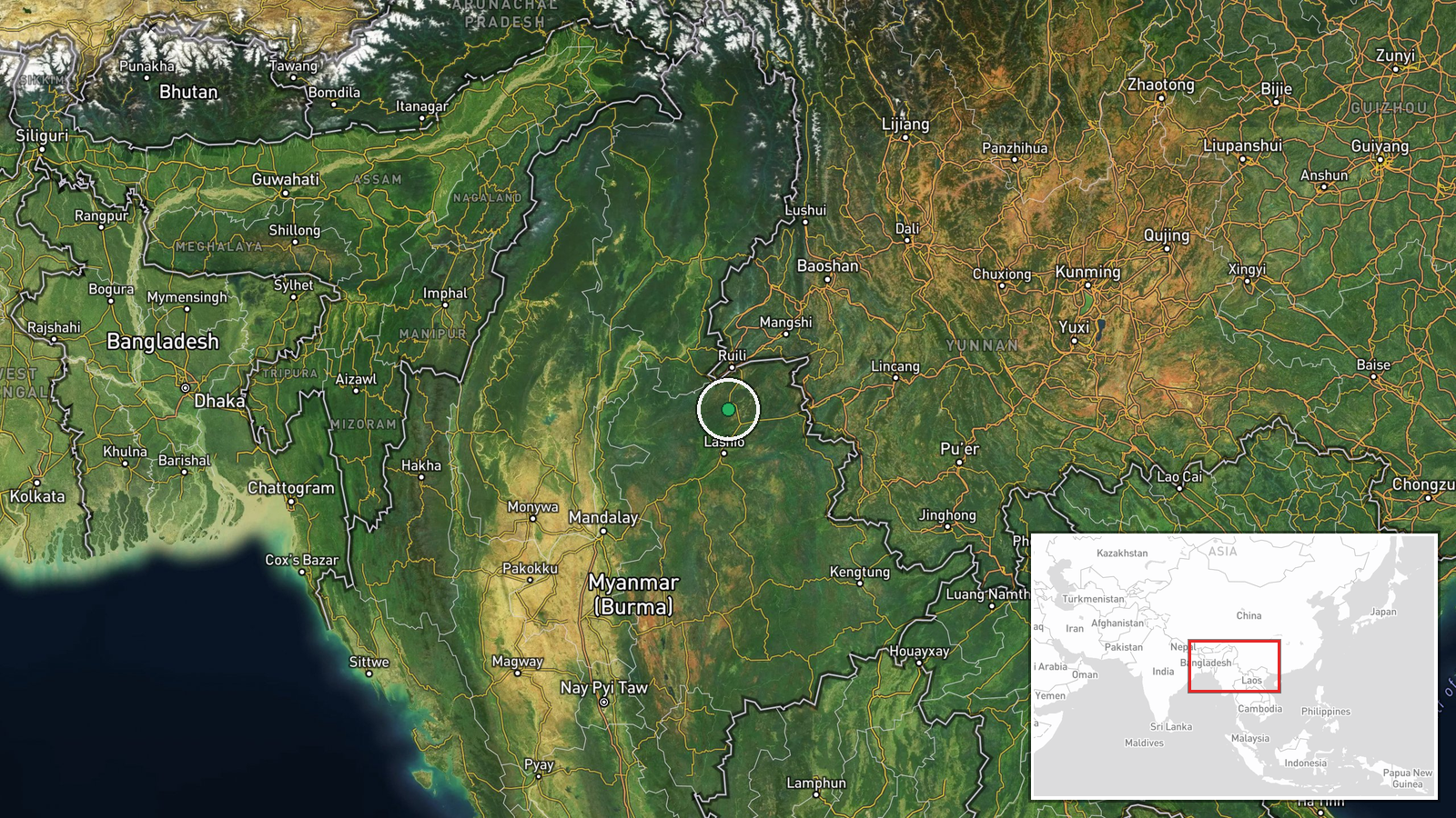
The coordinates, 23.5 north and 97.8 east, are an approximate regional centre rather than a settlement or camp, and the location confidence is recorded as low. The point sits in northern Shan State near the Kachin border, an area of hills, forest and narrow road corridors. The town of Lashio, a related event site, lies to the south and is a major point on regional transport links. Users should treat the marker as indicating the general area of reported fighting only.
Related events nearby
- Reports say 18 journalists remain detained in junta prisons, continuing a campaign of arrests against the pres2026-10-20 10:07 UTC · Police Operation · Myanmar (location not reported)
- Anti-junta rebels ambushed a vehicle carrying Burmese soldiers, killing one Tatmadaw soldier. A fighter report2026-10-20 09:42 UTC · Combat · Myanmar (location not reported)
- Pa-O resistance forces reportedly arrested drug users at a tea shop in junta-controlled area and extorted mone2026-10-20 07:11 UTC · Police Operation · Myanmar (location not reported)
- Armed robbers seized about 90 million kyat from people returning to gold shops in Lashio, Shan State.2026-10-20 09:44 UTC · Security · Lashio, Shan State, Myanmar
- Kachin Independence Army (KIA) attacked Myanmar military forces in Bhamo Township after troops burned a monast2026-10-20 01:55 UTC · Combat · Bhamo Township, Kachin State, Myanmar
▶ View this event on the live map

Intel Mapper aggregates open-source reports from monitored Telegram and X channels, geolocates them, cross-checks duplicates across sources and assigns a confidence score. Entries are updated as new confirmations arrive. Read how we verify events.