Fighting in Wuntho Township, Upper Sagaing, reportedly displaces local residents
What happened
A Telegram post from the Burma News International channel (@bnionline) reports that fighting continues intensely in Wuntho Township in upper Sagaing Region, Myanmar, and that local residents have been forced to flee their homes. The post was published on 20 October 2026 at 14:16 UTC and links to a Burmese-language article on the outlet's website. The original text is brief. It does not identify the parties involved, the specific sites of the clashes, the number of people displaced, or any casualties. The event is classified as displacement rather than a discrete armed attack, reflecting the report's focus on civilians leaving their homes. Because the account comes from a single channel and describes conditions in general terms, the details should be treated as reported rather than independently verified.
Context and assessment
Wuntho lies in northern Sagaing, close to the frontier with Kachin State, and is part of a broader belt where the military and armed resistance groups have contested towns, roads and rural areas since the 2021 coup. Control of such corridors matters because it links Sagaing with Kachin and the Bhamo area, and displacement often follows sustained ground fighting, artillery or airstrikes rather than isolated incidents. The related events suggest a wider pattern of clustered violence in the north on the same day. In Bhamo Township, Kachin Independence Army forces reportedly attacked military units after troops burned a monastery, an episode that points to retaliation cycles affecting civilian sites. Separately, anti-junta fighters reportedly ambushed a vehicle carrying soldiers, killing one, with a domestic carbine reportedly used. Taken together, these reports may indicate active movement or resupply contests across northern Myanmar, though the location of the ambush is not given and no link to Wuntho is established. Operationally, sustained fighting that drives residents out of a township is often a sign of contested territory, and the scale of displacement would be the key indicator of how serious the situation is.
Sources and confidence
The report rests on one Telegram channel, Burma News International, which regularly publishes Burmese-language reporting from conflict areas but is not an independent verification body. No second outlet in the dataset corroborates the fighting or the displacement, and the source count is one. The confidence score of 6.6 reflects this single-channel basis, the absence of casualty or location detail, and the general wording. Confidence would rise if local media, humanitarian agencies or satellite imagery confirmed clashes or displacement in Wuntho, or if the outlet published named locations and dates. It would fall if the claim were not repeated, if the channel corrected or retracted the post, or if local officials disputed it.
Location
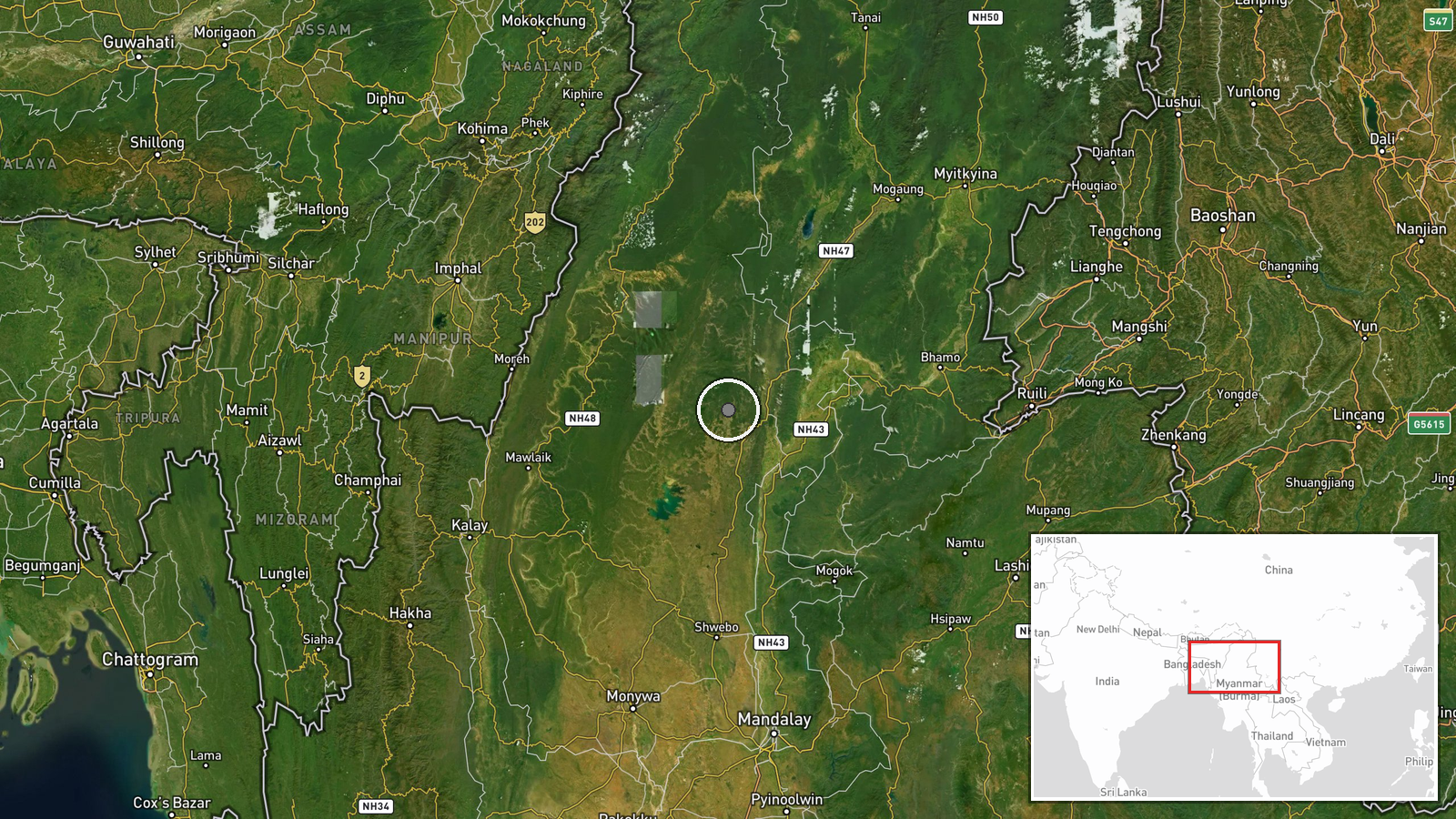
The coordinates are approximate and set at region level for Wuntho Township, not at a specific village or facility, so the pin marks the wider township rather than any fighting site. The area is hilly and forested in parts, with river valleys and roads linking towns toward Kachin State and the Bhamo area to the north. Those routes and terrain features often shape where fighting occurs and where displaced people move, but the report does not name any particular settlement or landmark.
Related events nearby
- Anti-junta rebels ambushed a vehicle carrying Burmese soldiers, killing one Tatmadaw soldier. A fighter report2026-10-20 09:42 UTC · Combat · Myanmar (location not reported)
- Kachin Independence Army (KIA) attacked Myanmar military forces in Bhamo Township after troops burned a monast2026-10-20 01:55 UTC · Combat · Bhamo Township, Kachin State, Myanmar
▶ View this event on the live map

Intel Mapper aggregates open-source reports from monitored Telegram and X channels, geolocates them, cross-checks duplicates across sources and assigns a confidence score. Entries are updated as new confirmations arrive. Read how we verify events.