Myanmar junta aircraft reportedly bomb areas near Kyaukphyu, Rakhine State
What happened
A Burmese-language report carried by the Telegram channel BNI (Burma News International) says Myanmar military aircraft, flying in a group, carried out airstrikes near Kyaukphyu and the Oo Zin Taung hill area in Rakhine State. The post, timed 21 October 2026 at 04:15 UTC, is brief and links to the outlet's website. It gives no details on casualties, damage, or the aircraft types involved. The text uses the Burmese term for bombing and attributes the strikes to junta forces. No second outlet had been identified as carrying the same account when this event was logged, so the report rests on a single source.
Context and assessment
Kyaukphyu sits on Rakhine's western coast and is strategically significant because of its deep-sea port and its role as a terminus for China-backed oil and gas pipelines, which gives the town economic and military weight beyond its size. Rakhine has been a major theatre of fighting between the junta and ethnic armed groups for several years, and airstrikes there have been a recurring feature of that conflict. The related events logged the same day point to a wider pattern of pressure rather than a single incident. A Pauktaw report describes military abuse of residents who lack household registration or identity cards, while other reports describe ongoing combat elsewhere in the country, the continued detention of journalists, and arrests by resistance forces in junta-held areas. Operationally, a group sortie aimed at hill terrain near a coastal town could indicate an attempt to strike suspected resistance positions or movement routes, but the report does not name a target, so this remains an inference rather than a confirmed purpose.
Sources and confidence
All evidence comes from one Telegram channel, BNI, which publishes Burmese-language reporting and is a known outlet in this coverage area. No independent confirmation, imagery, or statement from another party has been found, and the source count is one. The confidence score of 6.6 reflects a credible outlet with an identifiable publication link, offset by the absence of casualty details, visual evidence, and cross-checking. Confidence would rise with corroboration from local media, verifiable photographs or video, satellite imagery of impact sites, or follow-up reporting naming the locations. It would fall if the outlet corrected or withdrew the post, or if no further reporting appeared.
Location
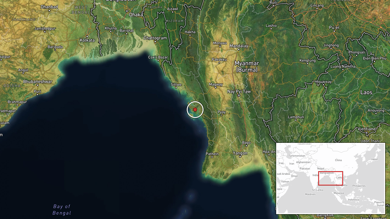
The coordinates are region-level rather than a precise settlement or facility point, and location confidence is recorded as low. The position was derived from the named places in the original text, Kyaukphyu and the Oo Zin Taung hill area, and placed in the broader Kyaukphyu area. The setting is a coastal township on the Bay of Bengal, with inland hill ranges and the town's port facilities as the main notable features nearby.
Related events nearby
- Over 400 Rakhine returnees from Malaysia remain held by junta forces, not yet allowed to return home; no retur2026-10-21 04:40 UTC · Displacement · Myanmar (location not reported)
- Myanmar military reportedly beating and extorting money from residents in Pauktaw who lack household registrat2026-10-21 03:31 UTC · Security · Myanmar (location not reported)
- KIA joint forces seized two SNA camps in Myanmar; heavy fighting continues, per BNI report.2026-10-20 14:01 UTC · Combat · Myanmar (location not reported)
- Reports say 18 journalists remain detained in junta prisons, continuing a campaign of arrests against the pres2026-10-20 10:07 UTC · Police Operation · Myanmar (location not reported)
- Anti-junta rebels ambushed a vehicle carrying Burmese soldiers, killing one Tatmadaw soldier. A fighter report2026-10-20 09:42 UTC · Combat · Myanmar (location not reported)
▶ View this event on the live map

Intel Mapper aggregates open-source reports from monitored Telegram and X channels, geolocates them, cross-checks duplicates across sources and assigns a confidence score. Entries are updated as new confirmations arrive. Read how we verify events.