Airstrikes on two Yesagyo villages reportedly kill 12 civilians, including two children
What happened
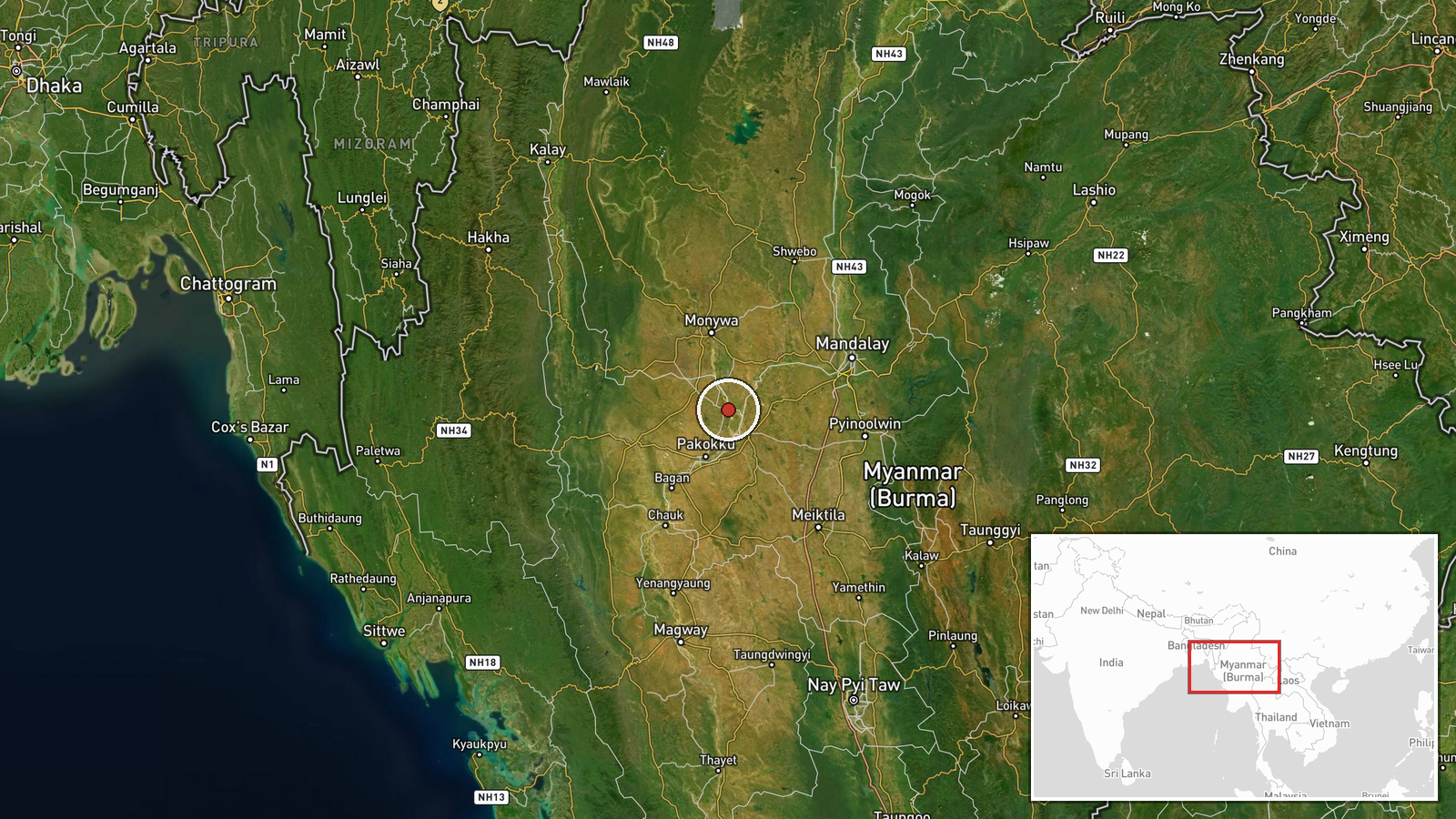
The National Unity Government reportedly said on Sunday that Burma Air Force airstrikes in Yesagyo Township, Magway Region, on Friday killed at least 12 civilians, including two children, and injured two others. The report, as relayed through a Telegram channel run by DVB, says the strikes hit two locations in two villages where residents were using a Starlink satellite internet terminal to get online. The NUG further said an unknown number of residents from four villages have left their homes out of fear of further airstrikes. Yesagyo lies about 130 miles north of Magway city and is partially administered by the NUG. The casualty figures and the claim that the internet users were the targets come from the NUG and have not been independently confirmed in the available reporting.
Context and assessment
Yesagyo sits in the dry zone of central Myanmar, an area where the military and armed resistance forces have fought for control of towns and transport routes since the 2021 coup. Partial NUG administration there makes the township a contested political and military space rather than a rear area. Two related events from the previous day fit a wider pattern. DVB reported that Myanmar military airstrikes on three villages in the Mattara area killed three civilians on October 18, suggesting that aerial attacks on village clusters in the region were occurring in close succession. Separately, junta forces closed a road in Mandalay as military trucks withdrew toward the city, stranding cargo traffic on the Mandalay to Myitkyina route. Road closures and troop or vehicle movements can indicate a shift in force posture, though the reporting does not establish a direct link to the Yesagyo strikes. The targeting of Starlink terminals, if accurate, would be consistent with the military's longer-running efforts to restrict satellite connectivity that resistance groups and local communities use to communicate and share information. Because the reporting is thin, these links should be read as possible rather than established.
Sources and confidence
This event rests on a single channel, a Telegram post from DVB's news account, which relays a NUG statement. No second outlet, local monitor, or independent witness is identified in the data. The confidence score of 6.5 reflects a credible outlet and a specific, detailed claim, offset by the absence of cross-confirmation and the fact that the casualty figures originate with a party to the conflict. Confidence would rise with corroboration from Myanmar-based media with local reporters, hospital or township administration statements, photographs or video geolocated to the villages, or confirmation from the military. It would fall if local sources disputed the toll, if the strikes were attributed to a different incident, or if the Starlink targeting claim were contradicted.
Location
The location is given at settlement level, with Yesagyo Township as the anchor point and coordinates placed on the township settlement rather than on the two specific village sites named in the reporting. Location confidence is rated high because the township is clearly identified. The area is part of Magway Region in central Myanmar, on relatively flat dry-zone terrain. The Ayeyarwady River corridor lies to the west, and the regional capital Magway is about 130 miles south.
Related events nearby
- Junta forces closed Kasaw Ward No. 3 road to traffic as military trucks withdraw toward Mandalay, stranding th2026-10-18 14:00 UTC · Security · Mandalay, Mandalay Region, Myanmar
- Myanmar military airstrikes on three villages in Mattara area killed three civilians, per DVB report.2026-10-18 04:30 UTC · Airstrike · Mattara, Myanmar
▶ View this event on the live map

Intel Mapper aggregates open-source reports from monitored Telegram and X channels, geolocates them, cross-checks duplicates across sources and assigns a confidence score. Entries are updated as new confirmations arrive. Read how we verify events.