Residents report junta reinforcing trapped column at Taw Kyi, near Kyaukphyu, Rakhine State
What happened
A Telegram channel associated with DVB, the Democratic Voice of Burma, reports that the Myanmar junta is sending reinforcements to a military column reportedly trapped at Taw Kyi village in Kyaukphyu Township, Rakhine State, near the Kyaukphyu oil wells. The post, published on 22 October 2026 at about 14:40 UTC, is attributed to local residents, who are quoted as saying roughly 800 soldiers are being used to control the Mying area. The original Burmese wording describes the column as blocked in place and reinforcements as being dispatched to it, but it does not give troop movements, unit identities, or the state of the column beyond that description. No casualty figures are included.
Context and assessment
Kyaukphyu sits on Rakhine's coast and is strategically important for several reasons. It hosts a deep-sea port and the terminus of oil and gas pipelines that carry energy from the Bay of Bengal toward southwestern China, which gives the area economic weight well beyond its local population. Rakhine has also been a central front in the conflict between the junta and the Arakan Army, which has pressed for control of much of the state since late 2023. The related reports from the same day suggest a wider pattern. An airstrike reportedly hit the Pi Chaung confluence, a trade hub on the Lemro river route, with local sources citing damage and a near halt to trade. A separate report describes junta forces reportedly targeting commercial hubs across Rakhine, and a third notes clashes between the military and the Arakan Army in unnamed townships. If the reinforcement account is accurate, it may indicate that the junta is prioritizing the defense of an isolated position near energy infrastructure, while also contesting commercial routes. Such a reading remains provisional, since it rests on a single channel and the same day's linked reports are also unconfirmed.
Sources and confidence
The event rests on one source, a Telegram channel attributed to DVB, and its source count is one. The report is also the only one in the data set that describes this specific reinforcement. Related events from the same day carry separate channel attributions, but they do not independently confirm the column's situation at Taw Kyi. The confidence score of 5.9 reflects that single-channel basis, the use of residents' testimony without named witnesses, and the absence of imagery, official statements, or independent reporting. Confidence would rise with corroboration from additional outlets, geolocated footage, or statements from the Arakan Army or junta. It would fall if imagery or local contacts contradicted the account of a trapped column.
Location
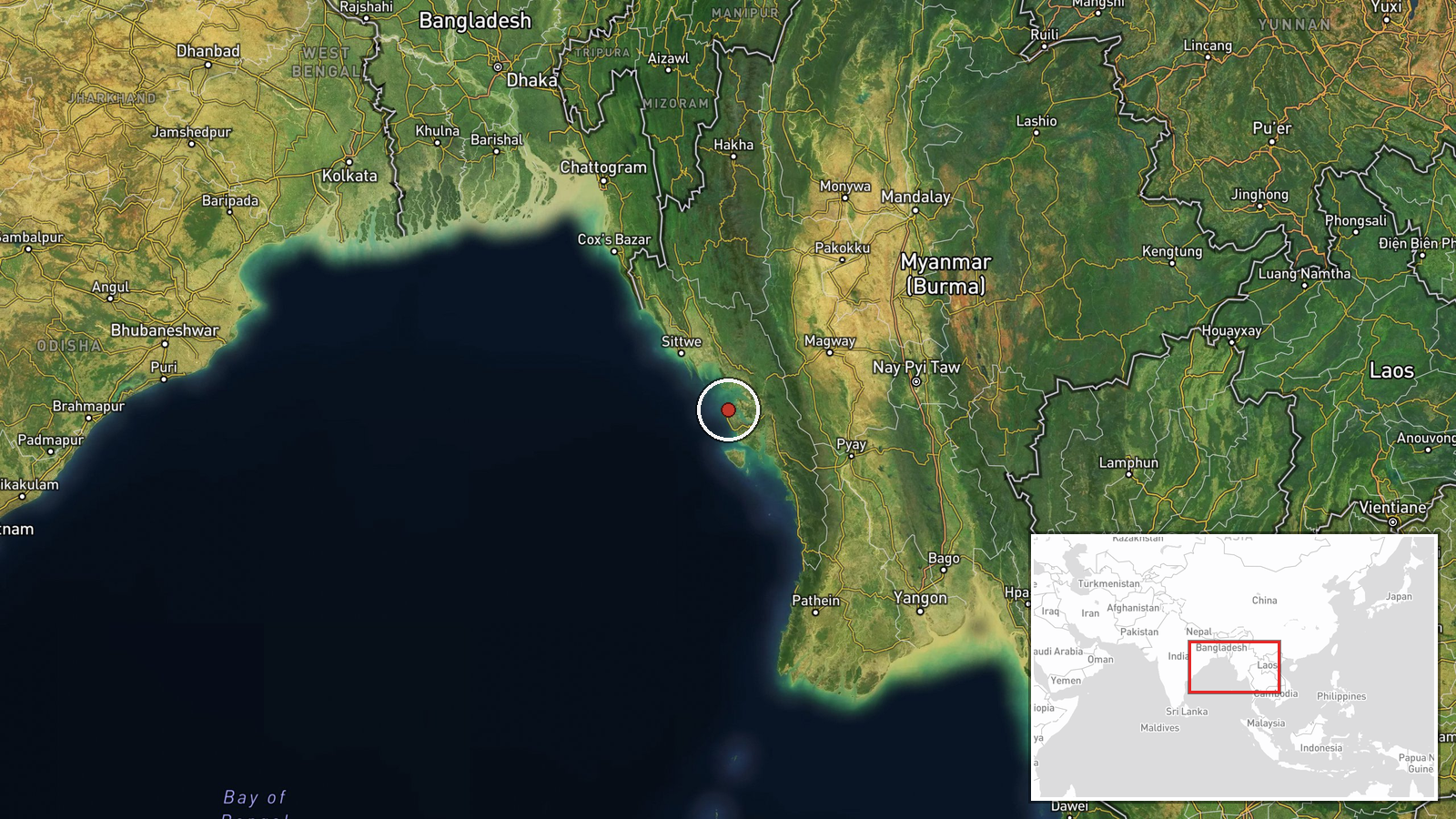
The coordinates are placed at regional precision and carry low location confidence, so they indicate the broader Kyaukphyu area rather than a precise point in Taw Kyi village. The settlement lies in Kyaukphyu Township on the western coast of Rakhine State, in a low-lying coastal and hilly landscape near the Bay of Bengal. Nearby features include the oil wells and pipeline infrastructure, the port area of Kyaukphyu, and the Mying area that the report names as the focus of military control.
Related events nearby
- Myanmar junta bombed the Pi Chaung confluence, a key trade hub on the Lemro river route into Rakhine; trade re2026-10-22 03:01 UTC · Airstrike · Pi Chaung confluence, Rakhine State, Myanmar
- Myanmar junta forces reportedly deliberately attacking strategic trade and commercial hubs in Rakhine State, p2026-10-22 13:46 UTC · Combat · Rakhine State, Myanmar
- Myanmar military and Arakan Army clashed in three unnamed townships in Rakhine State; specific locations not i2026-10-22 03:02 UTC · Combat · Sittwe Township, Rakhine State, Myanmar
▶ View this event on the live map

Intel Mapper aggregates open-source reports from monitored Telegram and X channels, geolocates them, cross-checks duplicates across sources and assigns a confidence score. Entries are updated as new confirmations arrive. Read how we verify events.