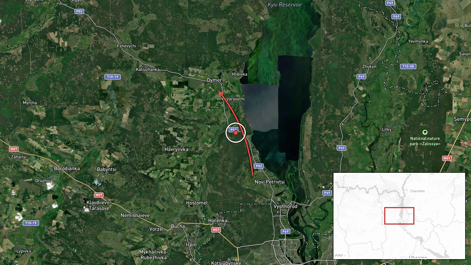
Russian jet-powered Shahed drone tracked toward Dymer, Kyiv Oblast
What happened
Ukrainian air monitoring reported a single Russian jet-powered Shahed (Geran-3) drone transiting toward Dymer in Kyiv Oblast on October 13 at 13:26 UTC. The drone was detected during an apparent broader strike operation, with at least two other Shahed drones simultaneously tracked toward Hostomel and over Slavutych in the same oblast within minutes. The report was published by the Kyiv Post Strategic Communications Service via Telegram.
Context and assessment
Dymer lies roughly 50 kilometers north of central Kyiv and sits near critical infrastructure corridors serving the capital. The coordinated detection of multiple Shahed drones heading toward separate targets in Kyiv Oblast on October 13 aligns with Ukrainian reports of a major Russian attack overnight October 12–13, which reportedly employed novel jamming techniques that delayed air raid alerts. Shahed drones, particularly the jet-powered variant, are precision-capable systems typically aimed at military or infrastructure targets. The pattern of simultaneous multi-vector drone transit toward populated and strategic areas may indicate sustained Russian efforts to degrade Ukrainian air defense integration or strike dispersed military assets.
Sources and confidence
Single source: Telegram channel @kpszsu (Kyiv Post Strategic Communications Service), an official Ukrainian military communication outlet. No independent cross-confirmation reported. Confidence score of 8.0 reflects the official status and real-time tracking role of the source, but single-channel reporting limits certainty. Confirmation via Ukrainian or allied radar data, or follow-up damage reports from Dymer, would strengthen confidence.
Location
Dymer is a settlement approximately 50 km north-northwest of Kyiv city center in Kyiv Oblast, positioned along transport and utility corridors serving the capital region. It lies near the Irpin River valley. Geo-precision is set to settlement level with high confidence based on Ukrainian air monitoring nomenclature.
Related events nearby
- Ukrainian air monitoring: 1 Russian jet-powered Shahed (Geran-3) drone passing Chornobyl, heading toward Dymer2026-10-13 13:47 UTC · Drone Transit · Dymer, Ukraine
- Ukrainian air monitoring: 1 Russian jet-powered Shahed (Geran-3) drone from Kyiv Oblast toward Hostomel.2026-10-13 13:27 UTC · Drone Transit · Hostomel, Ukraine
- Russian forces destroyed four Ukrainian locomotives. Equipment losses documented; specific location and timest2026-10-12 22:41 UTC · Report · Kyiv, Ukraine
- Ukrainian air monitoring: 1 Russian jet-powered Shahed (Geran-3) drone heading toward Kyiv.2026-10-13 14:26 UTC · Drone Transit · Kyiv, Ukraine
- Ukrainian air monitoring: 2+ Russian jet-powered Shahed (Geran-3) drones passing Liubech, heading toward Kyiv 2026-10-13 14:16 UTC · Drone Transit · Kyiv Oblast, Ukraine
▶ View this event on the live map

Intel Mapper aggregates open-source reports from monitored Telegram and X channels, geolocates them, cross-checks duplicates across sources and assigns a confidence score. Entries are updated as new confirmations arrive. Read how we verify events.