Russian Shahed drone tracked approaching Kyiv; multiple airframes detected across oblast
What happened
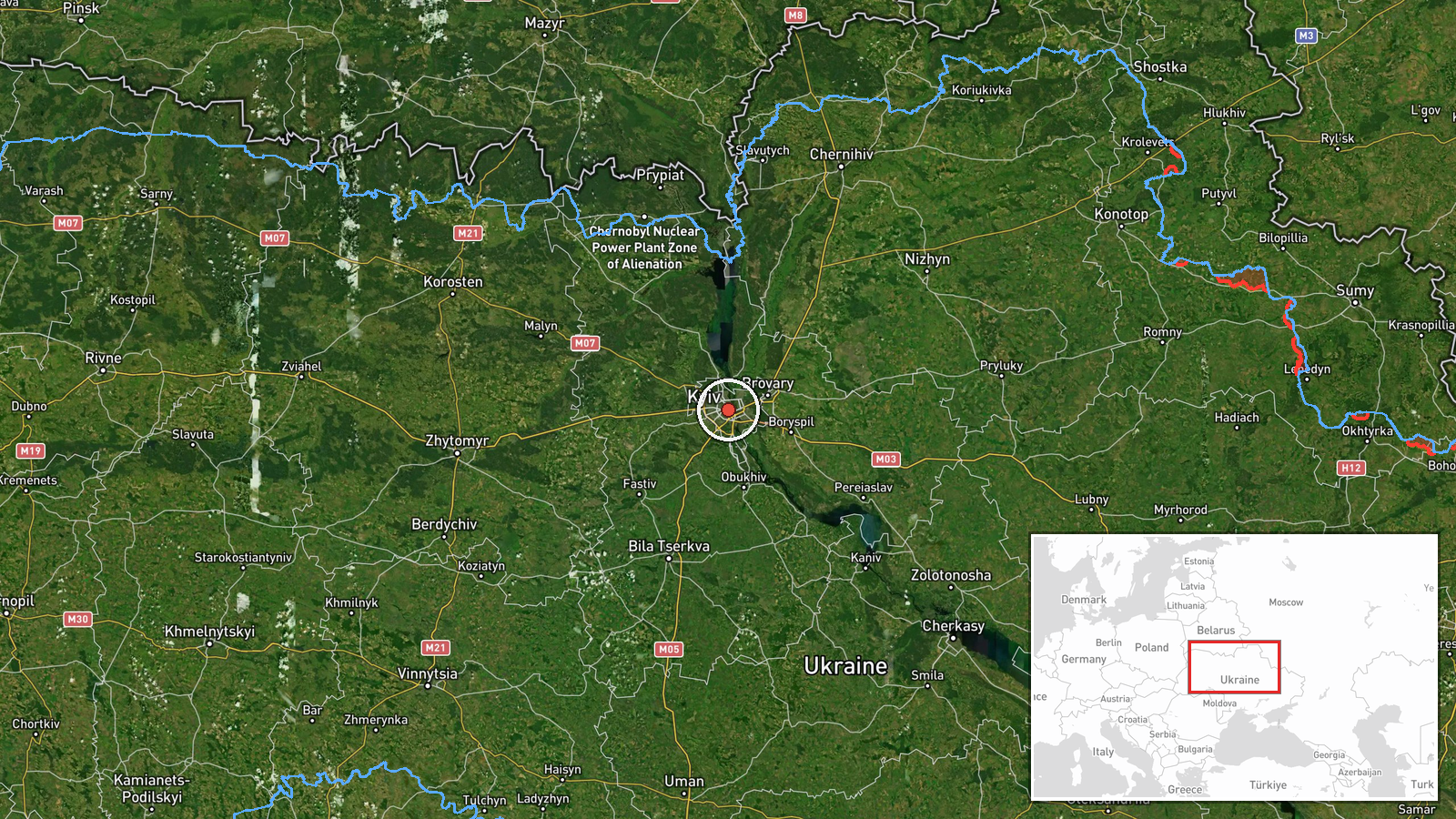
Ukrainian air monitoring reported one Russian jet-powered Shahed (Geran-3) drone near Kaniv Reservoir on course toward Kyiv at 14:26 UTC on 13 October 2026. This sighting followed four other detections of Shahed drones transiting Kyiv Oblast in the preceding hours, with at least two airframes previously tracked passing through Liubech, Vyshneve, and Slavutych. The report was issued by Ukraine's air force communication channel.
Context and assessment
The Kaniv Reservoir observation reflects an ongoing Russian campaign targeting Kyiv using precision-strike Shahed drones, which are subsonic jet-powered airframes optimized for sustained flight over long distances. The clustering of six confirmed sightings within three hours suggests a coordinated multi-wave attack pattern. This follows recent Ukrainian reports of Russian use of novel drone tactics, possibly designed to evade air defenses or complicate early warning systems. Such concentrated drone activity toward the capital typically precedes strikes on infrastructure, government facilities, or residential areas. The sequential tracking from Cherkasy Oblast through northern approaches indicates either a coordinated launch or wave-based deployment strategy.
Sources and confidence
Single source: Telegram channel @kpszsu (Ukrainian air force communication). No cross-confirmation from independent observers or allied intelligence channels is noted. Confidence rated 8.0 (high) reflects the established reliability of official Ukrainian air monitoring channels and corroboration by five related sightings within the same timeframe and geographic corridor. Confirmation from air defense engagement reports or damage assessments would strengthen confidence further.
Location
Kaniv Reservoir, located approximately 100 kilometers south of Kyiv in central Ukraine. The reservoir straddles the Dnieper River in Cherkasy Oblast. The drone's position places it on a direct approach vector to Kyiv, consistent with established Russian air attack routes from the south and southwest.
Related events nearby
- Ukrainian air monitoring: 1 Russian jet-powered Shahed (Geran-3) drone over Kyiv Oblast.2026-10-13 14:57 UTC · Drone Transit · Kyiv Oblast, Ukraine
- Ukrainian air monitoring: 2+ Russian jet-powered Shahed (Geran-3) drones passing Liubech, heading toward Kyiv 2026-10-13 14:16 UTC · Drone Transit · Kyiv Oblast, Ukraine
- Ukrainian air monitoring: 1 Russian jet-powered Shahed (Geran-3) drone passing Vyshneve, heading toward Kyiv.2026-10-13 14:05 UTC · Drone Transit · Kyiv, Ukraine
- Ukrainian air monitoring: 2+ Russian jet-powered Shahed (Geran-3) drones from Cherkasy Oblast toward Kyiv Obla2026-10-13 13:30 UTC · Drone Transit · Kyiv Oblast, Ukraine
- Ukrainian air monitoring: 1 Russian jet-powered Shahed (Geran-3) drone passing Slavutych, heading toward Kyiv 2026-10-13 13:29 UTC · Drone Transit · Kyiv Oblast, Ukraine
▶ View this event on the live map

Intel Mapper aggregates open-source reports from monitored Telegram and X channels, geolocates them, cross-checks duplicates across sources and assigns a confidence score. Entries are updated as new confirmations arrive. Read how we verify events.