Russian Geran-3 drone reported heading toward Mykolaiv from the east
What happened
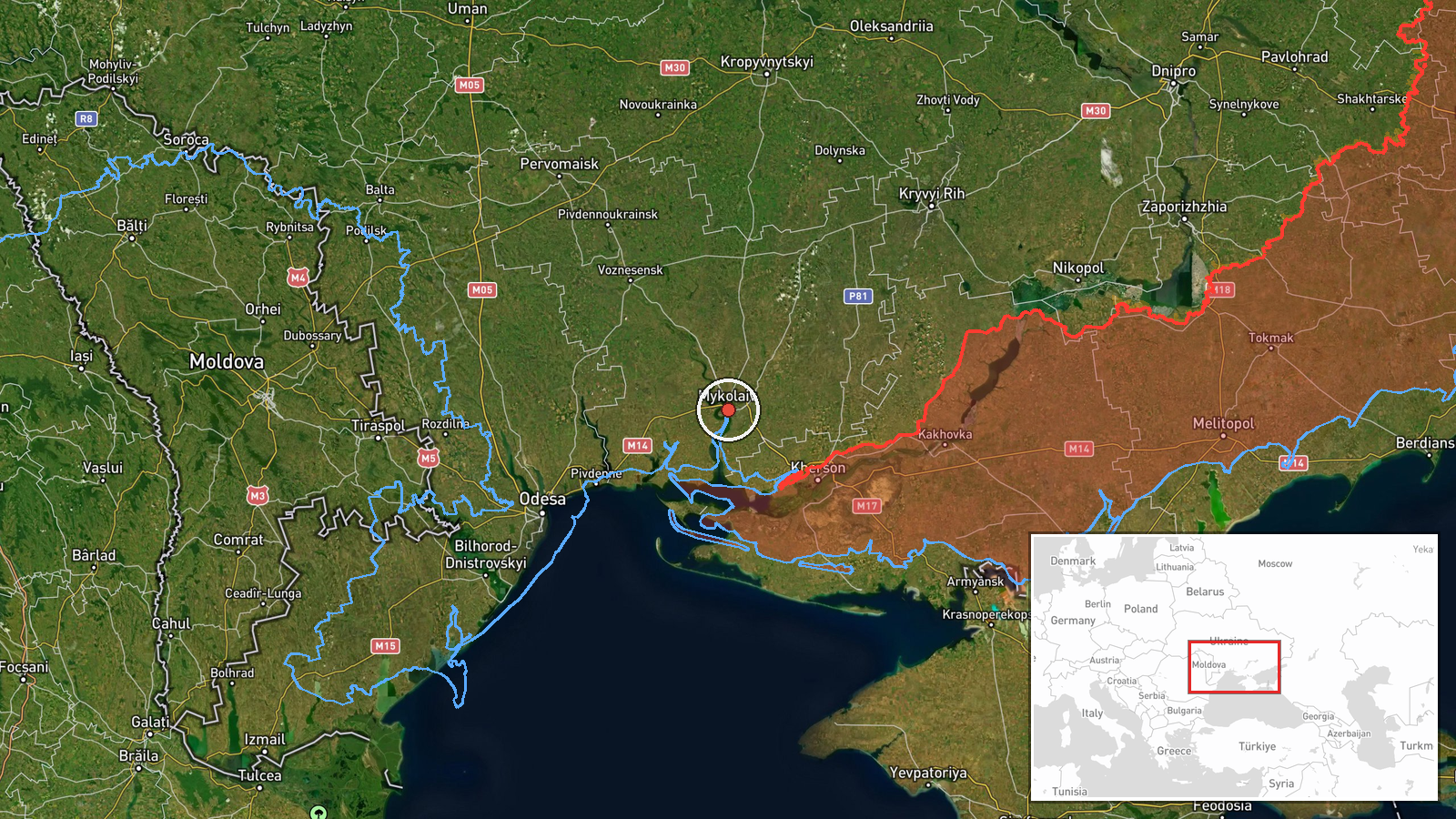
Ukrainian air monitoring detected one Russian jet-powered Shahed-type drone, designated as a Geran-3, moving toward Mykolaiv from an easterly direction on 13 October at 13:28 UTC. The sighting was reported by the Telegram channel of Ukraine's Air Force Command (@kpszsu). The report indicates an ongoing transit rather than a confirmed strike or interception at the time of posting.
Context and assessment
Mykolaiv, a major southern Ukrainian city and administrative hub in Mykolaiv Oblast, has remained under sustained Russian pressure since early in the full-scale conflict. The reported drone activity occurred on the same day Ukrainian forces claimed destruction of Russian special forces attempting to cross the Dnipro River near Kherson to conduct sabotage operations, suggesting elevated tempo across southern Ukraine. A related detection of another Geran-3 over nearby Odesa Oblast at the same timestamp indicates a potential coordinated wave of incoming strike drones targeting the Black Sea region and hinterland. Such operations typically aim at civilian infrastructure, military facilities, or transport nodes.
Sources and confidence
Single source: Ukraine Air Force Command Telegram channel (@kpszsu). No cross-confirmation from independent or Russian sources reported. Confidence score of 8.0 reflects the authoritative Ukrainian source and consistent pattern of air monitoring reports, though the absence of corroboration and open-source verification typical of daytime sightings prevents higher confidence. Confirmation of impact or interception would strengthen assessment.
Location
Mykolaiv city proper (46.97°N, 32.0°E), a regional capital in southern Ukraine situated on the Southern Bug river estuary approximately 75 km inland from the Black Sea coast. The detection indicates approach from the east, likely across Russian-held or contested territory in Zaporizhzhia and Donetsk Oblasts. Mykolaiv serves as a key logistics and administrative node for Ukrainian operations in the south.
Related events nearby
- Ukrainian drone forces destroyed a large group of Russian Spetsnaz special forces attempting to cross the Dnip2026-10-13 09:15 UTC · UAS Strike · Kherson, Kherson Oblast, Ukraine
- Ukrainian air monitoring: 1 Russian jet-powered Shahed (Geran-3) drone over Odesa Oblast.2026-10-13 13:28 UTC · Drone Transit · Odesa Oblast, Ukraine
▶ View this event on the live map

Intel Mapper aggregates open-source reports from monitored Telegram and X channels, geolocates them, cross-checks duplicates across sources and assigns a confidence score. Entries are updated as new confirmations arrive. Read how we verify events.